


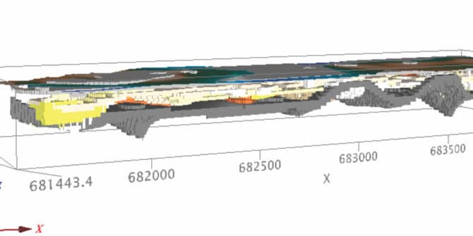
Subsurface modeling identifies risks ahead of Rio subway build
A new subway line that opened in Rio de Janeiro just before the 2016 summer Olympics relied on a detailed analysis of the subsurface to
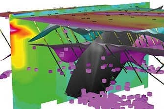
Constrained inversion models identify new resources at Ivanhoe’s Platreef deposit
Certain minerals, such as magnetite, are valued for their role as magnetic time capsules, locking-in the direction and intensity of the Earth’s magnetism at the
Magnetization Vector Inversion helps identify structures in Brazilian gold district
Magnetization Vector Inversion (MVI) helped identify structures in the Pontes e Lacerda area of southwestern Brazil, a gold district at -12° latitude where magnetic anomalies
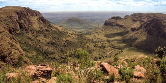
Targeting Exploration Mapping Needs
Industry usage of drillhole and mapping software is growing day-by-day. This is largely due to speed and efficiency advantages when dealing with greater volumes and
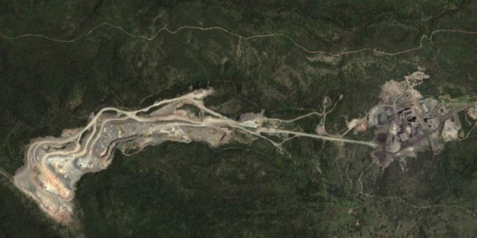
3D model improves cement mine planning at Doña Amalia
A new 3D geological model for InterCement’s Doña Amalia mine in Argentina is improving day-to-day operational decisions and assisting the company with long-term mine planning.
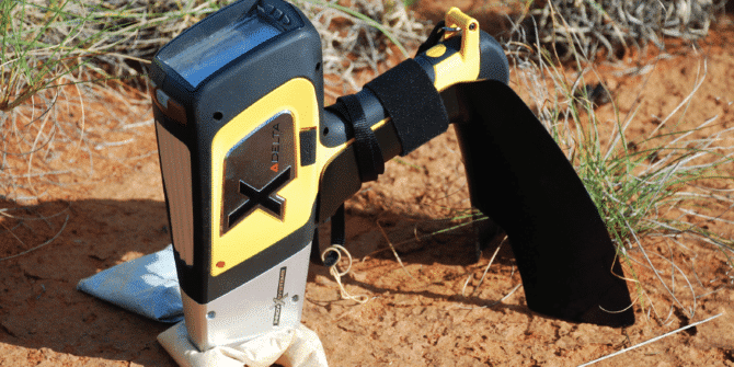
Integration of REFLEX ioGAS and an Olympus PXRF analyzer with Leapfrog Geo for advanced dynamic modelling and better decision making
The Project The sulphide nickel and copper deposit at Kevitsa was first discovered in 1987 and is one of the largest mineral discoveries in Finland.
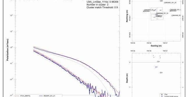
Identification and Classification of Unexploded Ordnance using Advanced Electromagnetics – A Practical Reality
SummaryIn the past differentiating between unexploded ordnance (UXO) and clutter using shape information derived from conventional electromagnetic induction (EMI) data has proven challenging. Digital geophysical
Solving Complex 4D Problems on Canada’s West Coast
Ocean scientists work in not just three but four dimensions, including time, so presenting data in a way that others can understand can be challenging.