


Magnetization Vector Inversion (MVI) helped identify structures in the Pontes e Lacerda area of southwestern Brazil, a gold district at -12° latitude where magnetic anomalies with inverted polarity are poorly understood, in a study presented by Geosoft at SIMEXMIN 2016.
Pontes e Lacerda has been in the spotlight recently. A gold discovery attracted prospectors to the area and motivated the Geosoft team to test the effectiveness of MVI methods with airborne geophysical data provided by CPRM, Brazil’s geological survey.
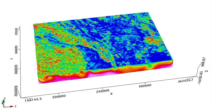
Using MVI, the team was able to invert the study area in high resolution (150m x 150m x 75m), resulting in a voxel composed of 1083 x 750 x 44 cells. The model successfully identified the main geological features at surface and at depth, outlined magnetic anomalies along a shear zone, and indicated the depth of basement rocks beneath a thick Holocene cover in the western part of the study area.
“Low latitudes tend to have bipolar anomalies, so you introduce errors if you assume the magnetization runs only in the direction of the geomagnetic field”, says Telma Aisengart, the project lead. “MVI is more representative of the real situation in this case because it includes the magnitude and direction of the magnetization vector.”
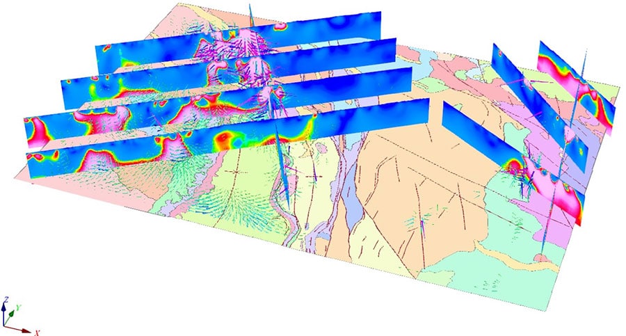
The airborne magnetic data was acquired at an elevation of 100 m above ground at 500 m line spacings. To avoid the artifacts this height to width ratio would create, the team sampled the grid using 10 m cells upward continued to 150 m to generate one sample per cell before running the model.
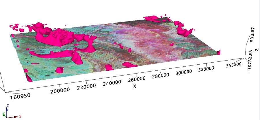
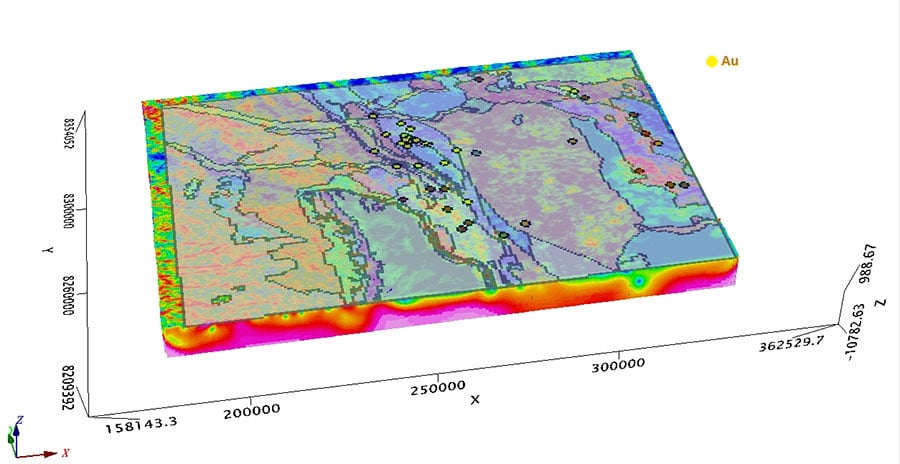
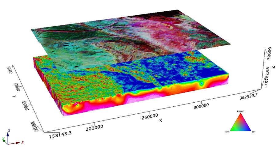
Pontes e Lacerda is located in the southwestern Amazonian Craton at the junction of Paleo-to-Mesoproterozoic terrains. The Jauru and Rio Alegre tectonic domains predominate. Further east lie granodiorites and metavolcanic-sedimentary rocks where magnetic anomalies with inverted polarity that are poorly described in the literature show clearly in the MVI model.
Gold mineralization is associated with the Aguapeí Mobile Belt, a set of NNW – SSE trending structures. There are at least 20 gold occurrences along the belt, including the São Francisco mine, a shear hosted lode gold deposit composed of narrow quartz veins containing free gold.
The study suggests exploration in the low latitude region could benefit from MVI’s more accurate representation of the structures that control mineralization. “You would need to use other data to corroborate the findings,” says Aisengart. “But the results of our study demonstrate the effectiveness of this type of 3D inversion in the area, and may be useful to companies exploring there.”