


Reduce your costs and steel use in offshore wind farms

Lower the steel, fabrication, transportation and installation costs of your monopile foundation project with PLAXIS Monopile Designer. Enhance your projects with design methods developed to reduce your steel requirements, lowering the overall costs of offshore wind farms and giving you an edge in a highly competitive industry.


KEY BENEFITS
Improve design and development with PLAXIS
Reduce costs
Using smart design, you could reduce the embedded length of piles by up to 35% and overall steel, fabrication, transportation, and installation costs.

Improve accurately
Use the PISA design method as a powerful way to make your designs more efficient and effective.

Simplify your workflow
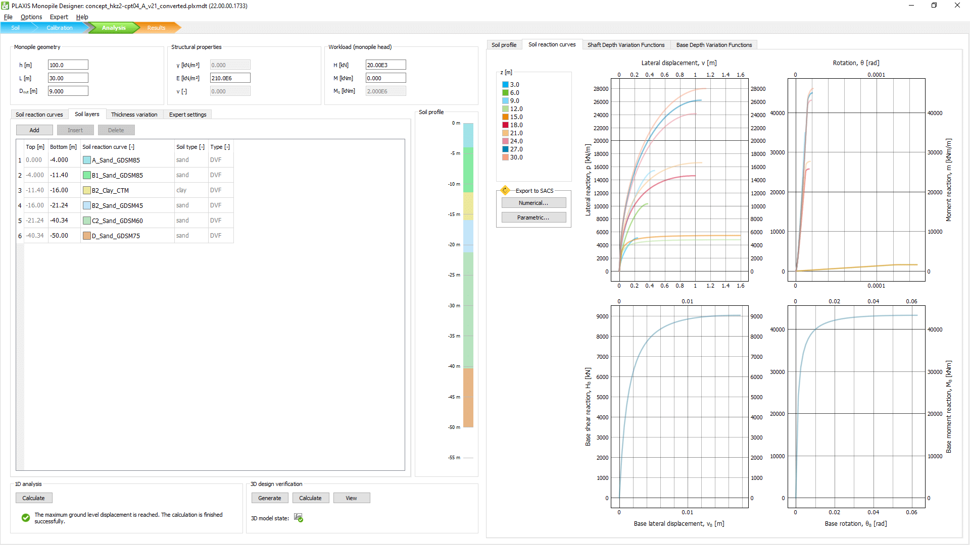
Use Monopile Designer with PLAXIS 3D to automate generating and calculating 3D models or to calibrate your 1D model.

Analyse layered soils
Conduct 1D analyses of monopiles in layered soil by combining multiple sets of soil reaction curves from homogeneous profiles.

Validate your designs
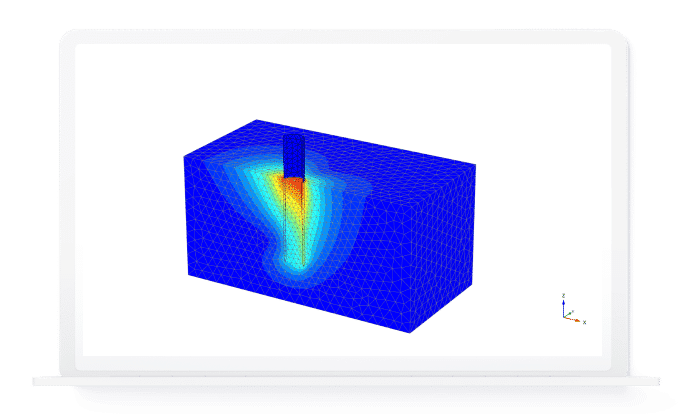
Automate the generation and calculation of a FEM model to verify monopile geometry and validate your 1D design or homogenous and layered profiles.
Automate everything
All functionality is available through a Python scripting interface, enabling you to fully automate and integrate your design process.

PRODUCT PLANS
An integrated workflow addition
PLAXIS Monopile Designer
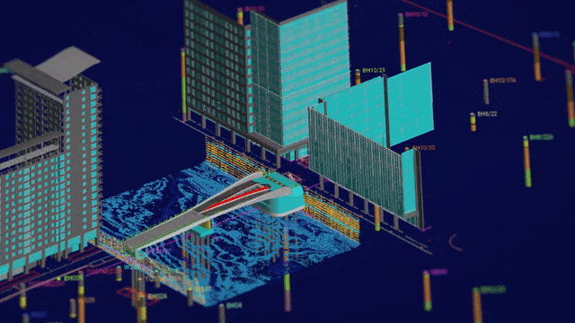
PLAXIS Monopile Designer is a finite element software for monopile foundations. It transfers the results of the PISA Joint Industry Research Project to your daily engineering practice, reducing the amount of steel – and overall costs – of your monopiles. It can be used as a stand-alone tool or in connection with PLAXIS 3D.
Buy now
Proceed to cart
Seequent products can be purchased securely through Bentley's eStore. Seequent is the Bentley subsurface company.
Prices shown on Bentley's eStore will be displayed in your local currency excluding tax.
PLAXIS Monopile Designer includes the following:
PLAXIS 3D Interoperability
PLAXIS Monopile Designer is fully interoperable with PLAXIS 3D. You can use it as a stand-alone application with predefined soil reaction curves (rule-based design) or with the most advanced and widely used geotechnical software solution when extracting them numerically from 3D FEM models (numerical-based design). Together, PLAXIS Monopile Designer and PLAXIS 3D, automate the entire process of generating and calculating 3D models, deriving, normalising, and parameterising soil reaction curves, and extracting them to your 1D model. Interoperability with PLAXIS 3D requires Geotechnical SELECT Entitlements.
PRICING
Start using PLAXIS today
PLAXIS Monopile Designer
USD $12,165.00 (excl. tax)
Includes-
 PLAXIS 3D Interoperability

Only 12 month named licences are available to purchase online. For shared and enterprise licences, please contact us.
Named license - allows unlimited use of the software for a single dedicated user during the subscription period.
Shared license - allows any number of users to access the software over the subscription period, limited to one user per seat at any given time.
Proceed to cart
Seequent products can be purchased securely through Bentley's eStore. Seequent is the Bentley subsurface company.
Prices shown on Bentley's eStore will be displayed in your local currency excluding tax.
For information on enterprise and other PLAXIS licenses, talk to us
Contact sales
Proceed to cart
Seequent products can be purchased securely through Bentley's eStore. Seequent is the Bentley subsurface company.
Prices shown on Bentley's eStore will be displayed in your local currency excluding tax.


CUSTOMER STORIES
PLAXIS at work
See the uses and impact of PLAXIS in research and industry

We’re the leading software provider for clarity and cost reduction in monopile design
RESOURCES
Free training and support
Accelerate your PLAXIS usage with training courses, on-demand webinars, or support from our team of geotechnical experts
PLAXIS Training
Get access to tokens that can be redeemed for the expert services and training your project needs with your purchase.
PLAXIS Webinars
Explore our on-demand webinars for general tips, tricks, and workflows to unlock more value from PLAXIS.
PLAXIS Support
Get expert support from our global team of geo-engineering professionals when you submit a ticket on the customer portal.