


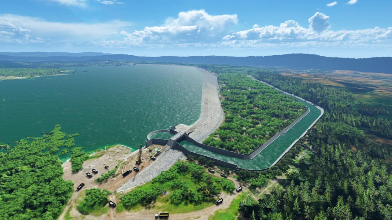
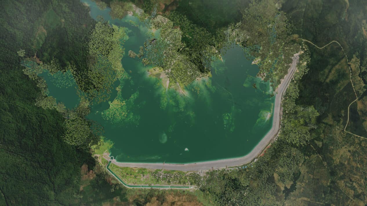
With a capacity of 33 million cubic metres of water and stretching a vast 3.1 kilometres, Indonesia’s Semantok Dam is a vital asset for controlling flooding and irrigation for East Java’s prosperous agricultural sector.
PT Hutama Karya (Persero) tackled the project’s unique geotechnical design challenges – including incorporating sandy soil as fill material, reducing excavation, and improving safety – with Bentley and Seequent 3D modelling and analysis software.

Amy R. Widyastuti, BIM Manager, Hutama Karya and Akhyaarul Umam Azzaqy, Project Manager, Hutama Karya
Improving living standards with a new dam
The Nganjuk District in East Java, Indonesia, experiences heavy annual rainfall, resulting in frequent flooding due to poor rainwater infiltration in the Semantok River upstream. To alleviate the problem, the Coordinating Ministry for Economic Affairs of Indonesia initiated the development of the USD 87.9 million Semantok Dam.
The dam, now operational, reduces flood discharge from 822 cubic metres (per second) to 574 cubic metres and ensures water availability in both rainy and dry seasons. Additionally, the dam irrigates 1,900 hectares of agricultural land, significantly boosting rice production, which is the primary source of income for the district.
“The presence of this dam will reduce floods, increase raw water supply, enhance irrigation capability, improve planting, and develop tourism as a new economic centre in East Java,”
said Amy Rachmadhani Widyastuti,BIM Development Manager for PT Hutama Karya (Persero).
Hutama Karya, a state-owned infrastructure developer, has a portfolio that includes several dams across Indonesia, with the Semantok Dam being one of the largest they have developed. At a length of 3.1 kilometers and a height of 31.56 meters, this dam is the longest in Southeast Asia. Designing and building the large structure within the 1,800-day deadline posed a significant challenge.
Fast metrics:
Slope design adjustments saved an estimated USD 1.8M in rework and ensured safety.
Geotechnical analysis saved USD 2M on grouting foundation, secant pile reconstruction.
Slope safety requirements of 1:3 (left) and 1:2.75 (right) were evaluated with GeoStudio.
Working with brittle, loose soil
As the Hutama Karya team began to design Semantok Dam, they quickly discovered the unusual terrain presented various problems. A grouting system was initially developed as the foundation for the main part of the dam, however, the brittle and loose sandy soil layer caused persistent water leaks above the maximum amount permitted.
As a result, the team needed to undertake soil analysis to determine alternative design methods and ensure the dam would be strong enough to contain water from intensive rains, without flooding. They had planned to use rock fills as the primary material for the dam. Though innovative, this was tough to accomplish, as the nearby quarry could not produce enough rock for the long dam without deep, damaging excavation.
Since creating a quarry off-site would be cost-prohibitive, Hutama Karya opted to use random soil in the area as fill material, which required redesigning the dam slope (as the soil would perform differently than rock fills). They also wanted to employ real-time, remote monitoring to gain a holistic overview of the project and improve decision-making and safety.
“As a national strategic project, the Semantok Dam’s stakeholders were concerned with output and outcomes across all project phases. We were constantly reminded that building a dam is also building the risk of disaster, so all possible innovation to mitigate the risks should be considered,”
said Akhyaarul Azzaqy,Construction Manager at Hutama Karya.
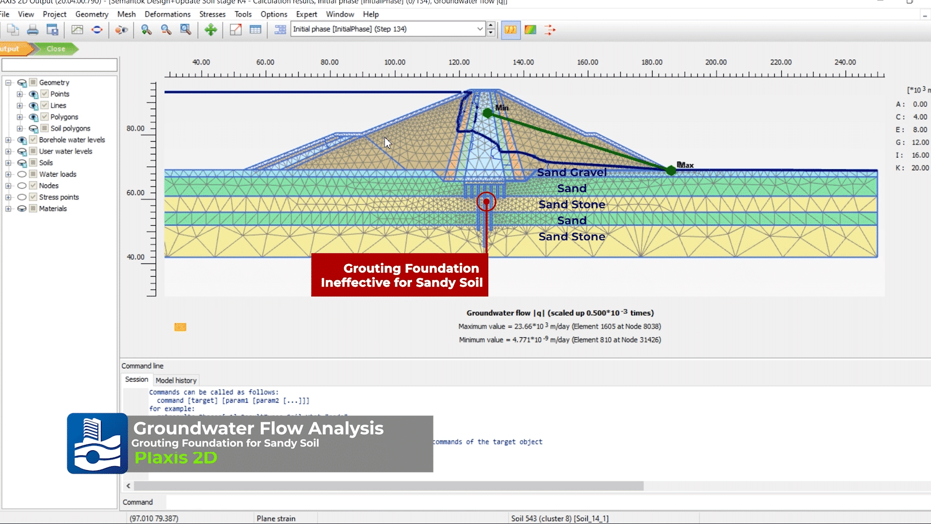
PLAXIS enabled the team to model soil fill within the proposed dam design and test its performance within the area’s terrain. (Image: PT Hutama Karya, Persero).
Going digital to optimise design
Hutama Karya determined that they could solve their design issues and optimise the dam by using reality modelling and geotechnical design software from Bentley and Seequent, including GeoStudio, iTwin Capture, PLAXIS and SYNCHRO. They first undertook a laser scan of the project area, created point clouds, and moulded them into a digital replica of the site with iTwin Capture.
The digital replica helped the project team understand the existing condition of the field and plan local quarry locations, minimising the excavation depth to limit the impact on the environment. The team then imported reality modelling data into their bespoke project management information system, giving the project manager insight into real-time conditions.
Next, the reality model was augmented with geotechnical analysis via PLAXIS, enabling them to simulate foundation options and test the groundwater flow. PLAXIS enabled the team to model soil fill within the proposed dam design and test its performance within the area’s terrain.
Though the initial slope design did not meet safety requirements, they used GeoStudio to evaluate other slope designs, eventually realising that a greater slope on the left side of 1:3 combined with a lesser slope of 1:2.75 on the right side would meet safety requirements for both construction and operations while incorporating the sandy soil as fill.
“It is true that the main dam body design is wider than the initial design, but we did not need to excavate the substructure as deep as the initial design, since the foundation bearing capacity is adequate enough,”
said Azzaqy.
Lastly, to ensure the changes to the design would not impact the tight deadline, Hutama Karya simulated the construction with SYNCHRO. In addition to testing the construction feasibility of the new design, the application helped them plan the construction process.
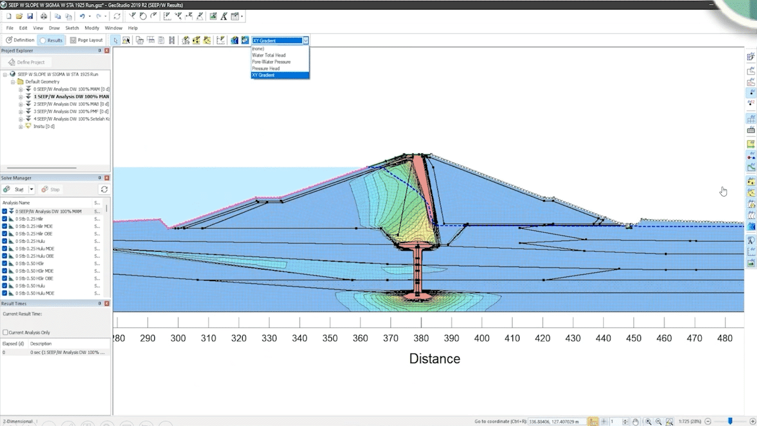
The team used GeoStudio to evaluate various designs to meet the slope safety requirements for construction and operations. (Image: PT Hutama Karya, Persero).
Improving decision-making saves time and money
Creating a reality model of the project area helped the design team understand the terrain and plan the quarry. They produced the model with point cloud data in three days, almost three times faster than the eight days conventional methods would require for design validation.
Real-time data produced by the combined reality model and Hutama Karya’s planning system enabled the project manager to improve construction planning and decision-making. The organisation regularly updated the survey data and combined it with geospatial data and the BIM, creating a true digital twin during construction.
Harnessing that data to help define each step of construction and gain a holistic view of the overall project improved efficiency by 183 days, saving USD 646,000 while improving the quality of the dam.
Using geotechnical analysis to determine how to safely construct the dam by using soil as the fill material significantly improved construction efficiency. The analysis also helped them develop alternative methods for safely strengthening the dam’s substructure, including deepening the dam trench, cutting off the wall systems with a secant pile, and applying support blankets and liners of clay.
As a result, Hutama Karya eliminated the need to construct a grouting foundation and reconstruct the secant pile, saving USD 2 million. Additionally, adjusting the slope design to ensure strength and safety helped the organisation avoid an estimated USD 1.8 million in rework, while ensuring continued safety.
“Our digital construction innovation using Bentley and Seequent software on the Semantok Dam has not only assisted us in solving the engineering problems with high-accuracy data, but also created a more sustainable infrastructure towards a healthier environment, improved well-being, and boosted economic growth,”
said Rachmadhani Widyastuti.
Adjusting the slope design to ensure strength and safety helped the organisation avoid an estimated USD 1.8 million in rework while ensuring continued safety. (Image: PT Hutama Karya, Persero).