


A new subway line that opened in Rio de Janeiro just before the 2016 summer Olympics relied on a detailed analysis of the subsurface to identify risks and avoid surprises during excavation.
Detailed analysis and 3D modeling of the subsurface helped the engineering team to identify risks and avoid surprises during excavation of a new subway line that opened in Rio de Janeiro just before the 2016 summer Olympics.
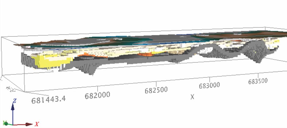
Geologist Camila Nascimento Alves used data from the city’s Geotechnical Institute (GE0-RIO) to construct a 3D model of the subsoil in the Ipanema and Leblon neighbourhoods along the 16-km Line 4 subway. The model, created with Geosoft Target, used the consistency and density of the sediments and assisted the team in preparation for engineering work.
“We were able to identify low resistance soils that required support during the excavation, “ says Alves, who completed her master’s thesis on the topic. “By injecting cement columns to improve resistance (jet grouting), the engineers were able to secure the way for the tunnel boring machine.”
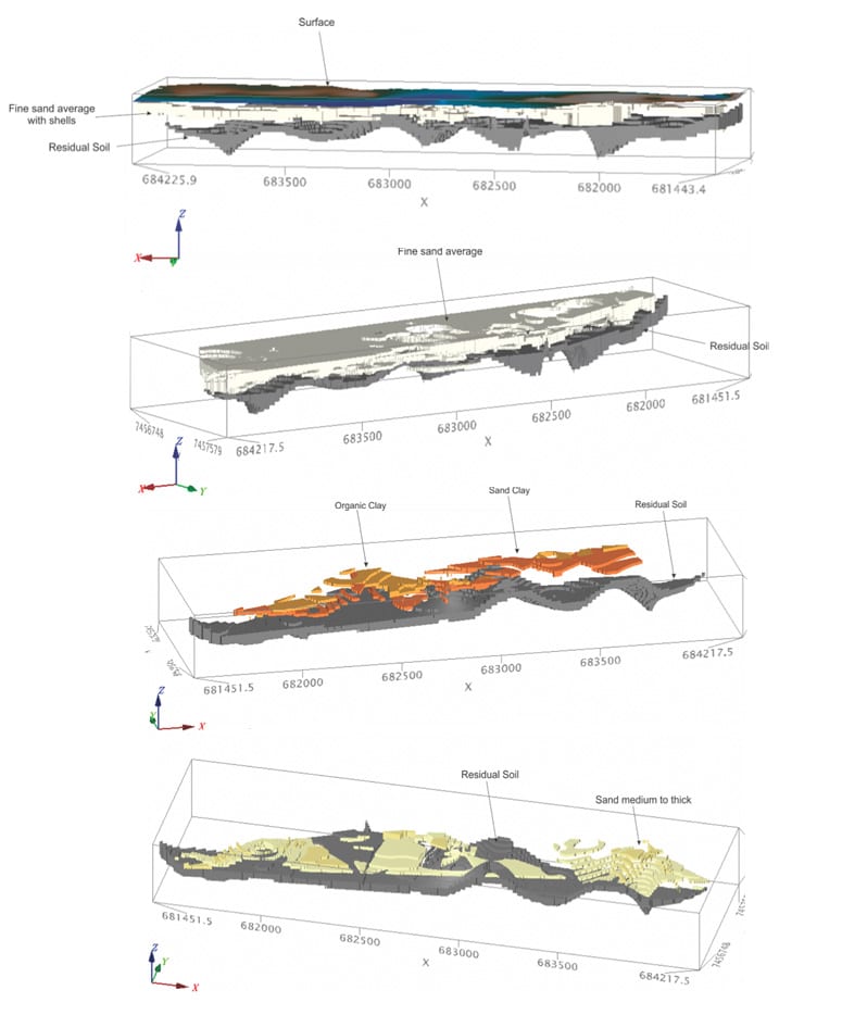
To determine the geotechnical properties of the soil, the team drilled 275 percussion holes over a two square kilometre area and conducted SPT (standard penetration) tests. The resulting data was catalogued and georeferenced so that the resistance index could be interpolated in Target using voxels.
“We found soft clays that can cause instability in central-northern Leblon and in Ipanema at depths of 10-20 metres,” says Alves.
The first 15 metres of soil is characterized by fine sand with shell fragments that ranges from soft to very compact. Just below are 2-3 metres of soft floodplain clays containing organic material. The deepest two layers consist of sandy clay representing alluvial fans followed by sand on top of the residual soil at a depth of 25-30 m (insert graphic).
The team was able to provide a highly accurate 3D interpretation of the geological and geotechnical characteristics of the subsurface area because of the close spacing of the drill holes and the resistance index readings at every metre downhole. As a result, engineers were able to work around existing foundations with confidence and mitigate risks associated with excavation.
“This knowledge can contribute to economic planning and risk mitigation in regions with a similar geological setting,” says Alves.
The new subway line, opened just four days before the Olympics, features five new stations running east-west along the oceanfront. The line is expected to carry three hundred thousand people a day by the end of 2016.