


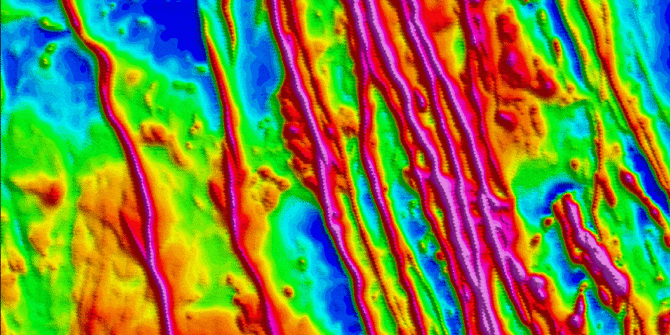
The Multi-trend gridding tool unlocks enhanced gridding capabilities when working with data containing linear trends
The Multi-trend gridding tool unlocks enhanced gridding capabilities when working with data containing linear trends. The Multi-trend gridding tool is now a part of the
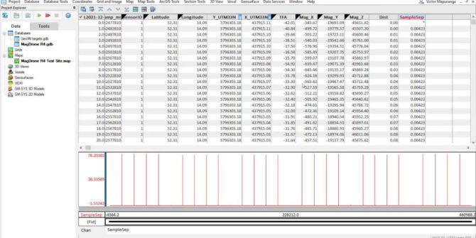
Drone survey planning and data processing using UgCS and Oasis montaj
During the video you will learn the basic workflows, concepts, and tools necessary to plan a drone survey using UgCS software and process data in
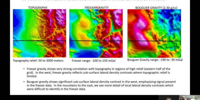
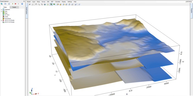
Webinar: Computing the 3D Bouguer correction using GM-SYS 3D in both onshore and offshore settings
Gravity surveys allow geoscientists to estimate lateral density contrasts of the earth’s surface and subsurface, however, the raw gravity data we collect must undergo extensive
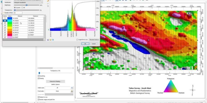
What’s new in Oasis montaj 2022.1
In this video, we discuss: Seequent Central integration Multi-trend Gridding improvements New GM-SYS 3D workflow UXO Marine improvements Presented by Geoff Plastow, Senior Geophysicist /
What’s new in Oasis montaj 2021.2
In this video we will have a look at: • the new interactive gridding tool • all new image colour tool • enhancements to working
A new level of workflow control with the Gravity & Terrain Correction Extension in Oasis montaj 2021.2
Improvements to the Gravity & Terrain Correction Extension allow for a more intuitive user interface that brings a new level of control to your workflow.
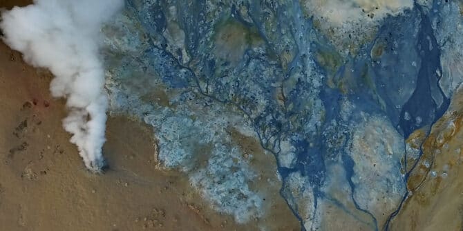
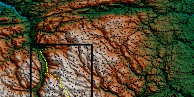
How one university uses Oasis montaj to find geothermal energy for Africa
Calistus Ramotoroko explores geothermal potential deep beneath the Kasane hot springs in Botswana, Africa. Geothermal exploration is on the rise in Africa as the continent
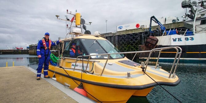
How SEP Hydrographic uses Oasis montaj to protect offshore wind farms from UXO threats
Offshore UXO can be an unpleasant surprise and a major headache for UK wind farm construction. SEP Hydrographic have been using Oasis montaj and UXO