


The Multi-trend gridding tool unlocks enhanced gridding capabilities when working with data containing linear trends.
The Multi-trend gridding tool is now a part of the Interactive Gridding tool, allowing a new level of control to gridding workflows for your geophysical data. Moreover, we have significantly improved gridding performance speed by 30%, meaning you can test your gridding parameters faster and more efficiently. In this article, we explore recent improvements to the tool and our favourite tips on how to best select the correct parameters for data interpolation when using Multi-trend gridding.
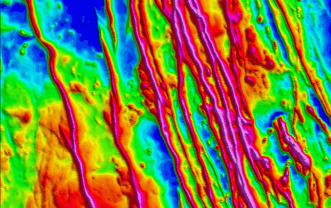
Developed by Tomas Naprstek and Richard Smith at The Mineral Exploration, Laurentian University, and now a mainstay component of the Oasis montaj gridding workflow, the Multi-trend tool is a gridding algorithm designed with the focus of enhancing linear features in gridded geophysical data such as magnetic or gravity data. Anyone who has worked with magnetic or gravity datasets knows that it is not uncommon to observe “string of beads” or “boudinage” style artifacts in interpolated geophysical gridded data, especially if the data consists of thin linear features. These linear features are ubiquitous in most magnetic geophysical surveys and can be related to geological features such as dykes, dyke swarms, or faults. The choice of gridding tool and relevant interpolation parameters play critical roles in ensuring these artifacts are avoided and that the resultant geophysical grid is geologically plausible for further interpretation.
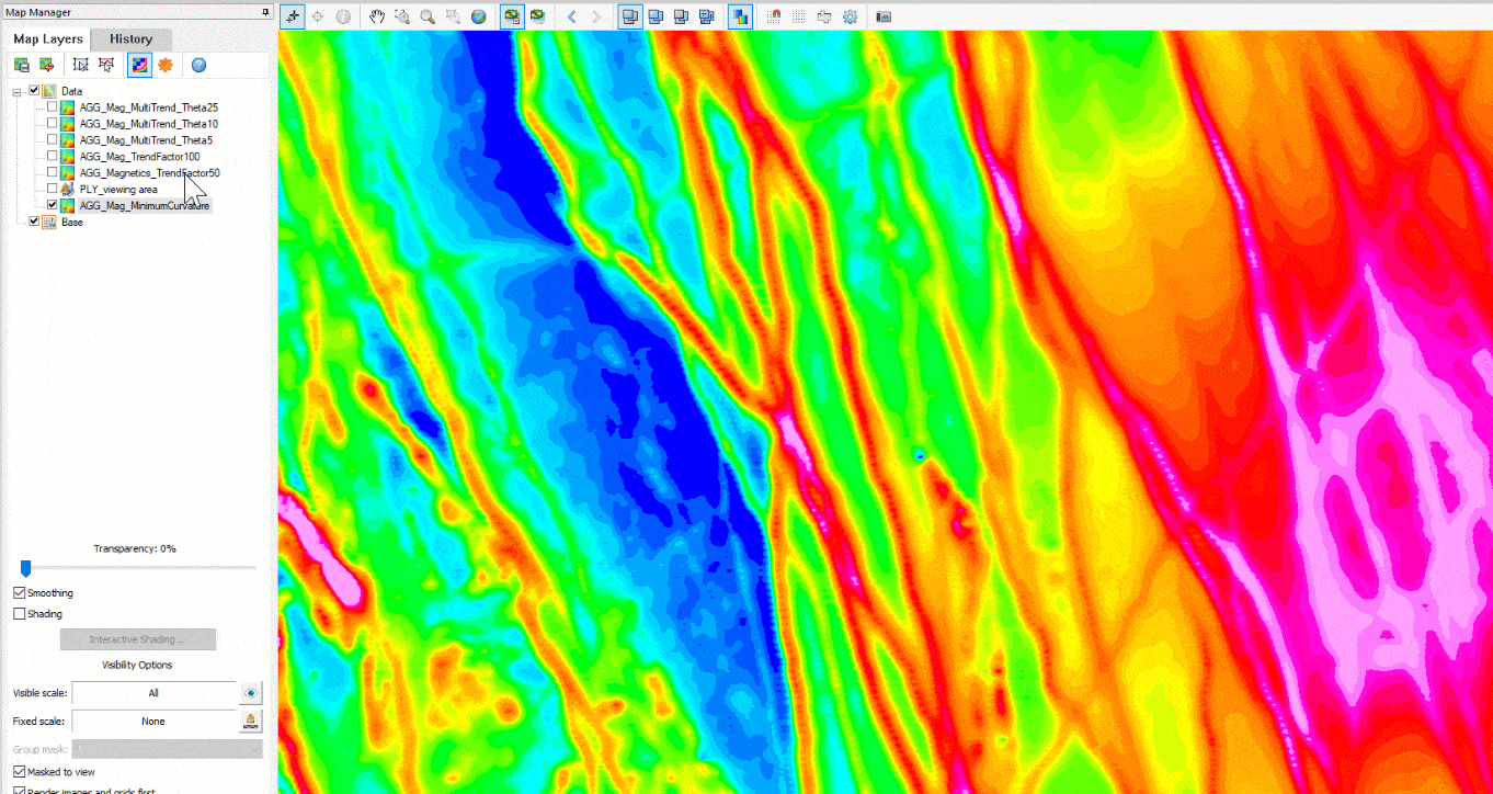
Boudinage effects associated with linear features
Compared to other gridding methods, the Multi-trend gridding tool effectively circumvents these issues by implementing a robust routine that accounts for multi-directional features trending at various angles, avoiding undesirable boudinage effects associated with linear features as seen above.
New and accessible menu location.
You can conveniently access the Multi-trend gridding tool directly from within the Interactive Gridding Tool menu. The tool sits alongside the rest of the gridding methods available to Oasis montaj: Minimum curvature, Bi-Directional, Kriging, Inverse Distance Weighted, Direct, and Multi-trend.
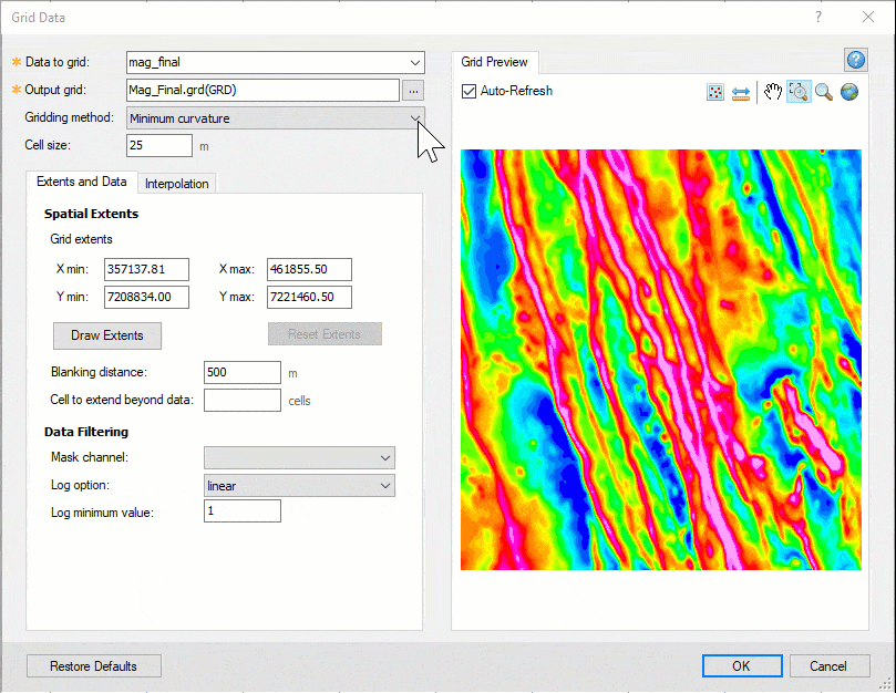
Accessing multi-trend gridding from the Interactive Gridding Tool
Faster than ever before.
We know how important it is to be able to quickly grid your data, especially when iterating through various gridding parameters to assess the most suitable ones. On average, the multi-trend gridding algorithm has gained a 30% increase in speed and performance. On certain datasets, we observed an improvement of up to 100%!
A more streamlined experience when selecting interpolation parameters.
We have updated the tool’s user interface and parameter naming conventions to be consistent with gridding parameters you may already be familiar with within Oasis montaj. Common gridding parameters such as the Cell size (previously Final cell size) and Blanking distance (previously Interpolation Distance) can be selected based on pre-existing guidelines.
The Cell size, previously Final cell size, should be set to ¼ to ½ of the line separation or the nominal data sample interval. The Cell size will determine the final cell size of the resultant grid and should be a larger value than the Starting cell size used for the initial interpolation. The Starting cell size parameter may be advantageous in preserving linear features in the resultant grid and should be chosen based on features present in the dataset. A small cell size should be selected with attentiveness, as it can remove weaker linear features because they will now have “farther” to trend when connecting trends.
The Blanking distance parameter, previously Interpolation distance, can be selected based on the previous guideline of at least 4 to 5 times the Cell size and thus, should be chosen in conjunction with the Cell size. The Blanking distance should preferably exceed the survey line spacing. Grid cells farther than the Blanking distance value from a valid point will be set to dummies in the resultant grid. Additionally, the Blanking distance serves a dual function in influencing a searching distance to find and connect linear trends.
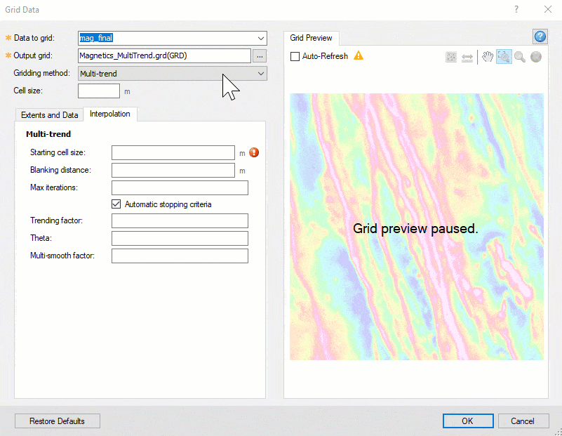
Changing the cell size and blanking distance
The Maximum iterations parameter determines the total number of iterations at each level of grid refinement, after which the gridding process terminates. A higher number of iterations will yield a grid honoring the survey data more closely in exchange for a longer gridding time. The Stopping criteria are based on whether convergence is achieved after successive iterations. It is advised to leave the automatic stopping criteria checked ‘on’ to ensure maximum efficiency.
The Trending factor parameter determines the smoothness of the lineaments. You can use a value between 0 and 100 to determine the appropriate trending factor for your dataset. Setting the trending factor too high could yield a grid that contains undesirable ‘terraced’ artifacts.
Smoothing the lineaments with the Trending factor
The Theta is the increment in degrees to rotate the trend direction. The theta will determine whether there is an adequate number of survey points within the search radius to locate and connect trends. Generally, the smaller the relative value of the theta, the better chance there is to remain within the general trend direction of a real geologic structure. On the other hand, it is also important to consider that a very small theta value will result in a longer gridding time. A theta value set too large may connect features that are separate and create trends that do not belong together.
Finally, the Multi-smooth factor allows you to locate unique trending directions or azimuths. The lower this factor, the more unique trends are located and connected. And as such, this value is set to 0 by default, allowing the routine to search for trends in any given azimuth direction, making it a truly ‘Multi-trend’ tool! On the other hand, increasing this value will force the routine to focus on predominant trends.
As with all geophysical gridding workflows, one must pay close attention to the features present in the dataset and iteratively test the gridding algorithms and parameters to find the ones that best suit the project needs. With the Multi-trend gridding method, you have yet another powerful tool in your kit, allowing you to run speedier gridding workflows and produce geologically sound data products. And ultimately, good data creates the foundation for good exploration.
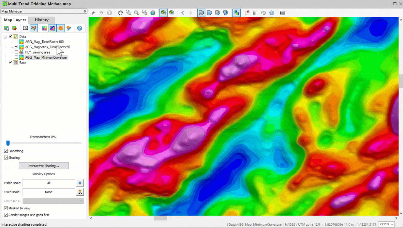
Linear feature grid improvement with multi-trend gridding