This webinar reviews the theory of Bouguer corrections and demonstrates how to construct and apply a model of the correction to Free-Air Gravity data to obtain the Bouguer anomaly map, using public data.
Gravity surveys allow geoscientists to estimate lateral density contrasts of the earth’s surface and subsurface, however, the raw gravity data we collect must undergo extensive processing before we arrive at an interpretable product. This includes (but is not limited to) the Drift, Tide, Latitude, Free-Air, and Bouguer corrections.
Dr. Michal Ruder will be taking us through the why and how of applying 3D Bouguer corrections to onshore and offshore Free-Air Gravity data.
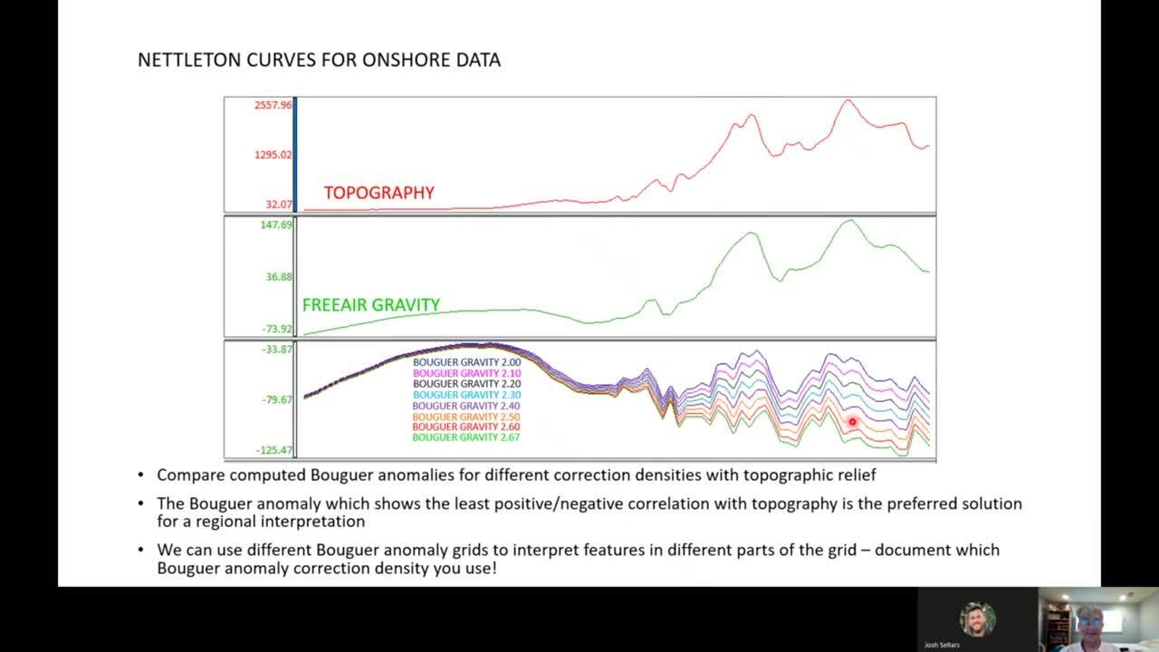
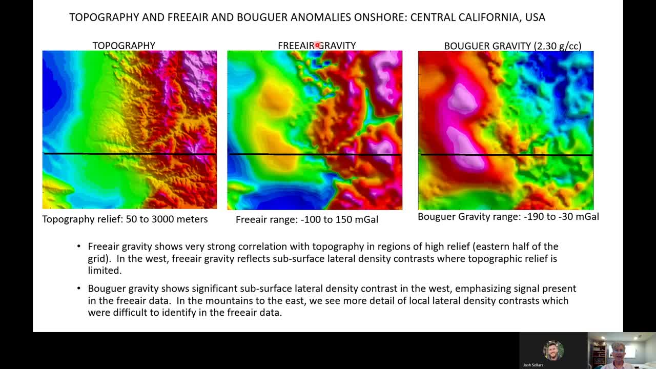
Free-Air Gravity can be dominated by signals associated with topographic and bathymetric relief due to the large density contrasts at the air/earth & water/mud interface, and their relative proximity to the gravimeter. This is particularly relevant in areas of high topographic relief like the onshore and offshore regions of the state of California.
The Bouguer correction minimizes the gravity anomaly associated with these large density contrasts, producing a map of gravity anomalies that focuses on lateral density contrasts below the topographic/bathymetric surface.
GM-SYS 3D enables the interpreter to easily apply these 3D Bouguer corrections to focus their interpretations on areas within the geologic column for exploration, environmental, and engineering purposes.
Overview
Speakers
Dr. Michal Ruder
President, Wintermoon Geotechnologies
Josh Sellers
Project Geologist, Seequent
Duration
1 hour