


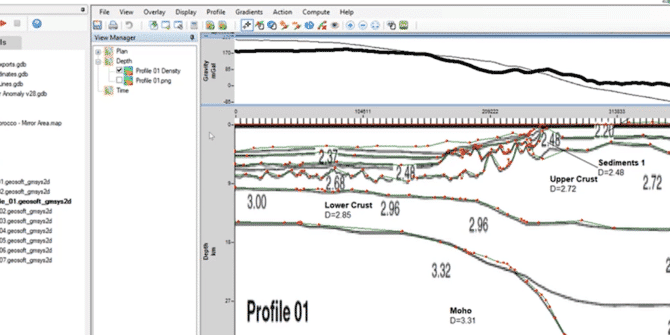
Oasis montaj: Building and Managing 2D Models in GM-SYS
The GM-SYS extensions are trusted by international government surveys and the exploration programs of the world’s most successful energy companies. The webinar covers:• Methods for building
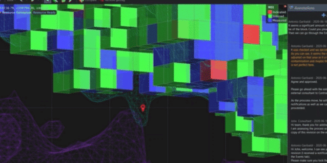
Technical Tuesday: Branch out your Collaboration with Central
During this technical session, you will be taken through the full breadth of functionality available with Seequent Central. Learn best practice in Central's use of:

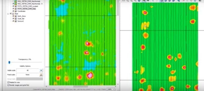
UAV MagArrows surveys to improve geologic mapping
His experience with UAVs in the mineral exploration industry The benefits of UAV surveys The limitations and restrictions of conducting drone surveys UAV sensors for
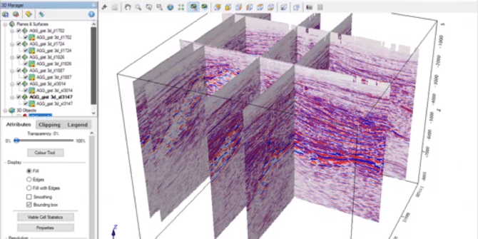
SEG-Y Importer in Oasis montaj
Overview Speakers Sean Goodman Technical Analyst - Seequent Duration 9 min JTNDJTIxLS0lMjBUaGUlMjBzY3JpcHQlMjB0YWclMjBzaG91bGQlMjBsaXZlJTIwaW4lMjB0aGUlMjBoZWFkJTIwb2YlMjB5b3VyJTIwcGFnZSUyMGlmJTIwYXQlMjBhbGwlMjBwb3NzaWJsZSUyMC0tJTNFJTBBJTNDc2NyaXB0JTIwdHlwZSUzRCUyMnRleHQlMkZqYXZhc2NyaXB0JTIyJTIwYXN5bmMlMjBzcmMlM0QlMjJodHRwcyUzQSUyRiUyRnBsYXkudmlkeWFyZC5jb20lMkZlbWJlZCUyRnY0LmpzJTIyJTNFJTNDJTJGc2NyaXB0JTNFJTBBJTBBJTNDJTIxLS0lMjBQdXQlMjB0aGlzJTIwd2hlcmV2ZXIlMjB5b3UlMjB3b3VsZCUyMGxpa2UlMjB5b3VyJTIwcGxheWVyJTIwdG8lMjBhcHBlYXIlMjAtLSUzRSUwQSUzQ2ltZyUwQSUyMCUyMHN0eWxlJTNEJTIyd2lkdGglM0ElMjAxMDAlMjUlM0IlMjBtYXJnaW4lM0ElMjBhdXRvJTNCJTIwZGlzcGxheSUzQSUyMGJsb2NrJTNCJTIyJTBBJTIwJTIwY2xhc3MlM0QlMjJ2aWR5YXJkLXBsYXllci1lbWJlZCUyMiUwQSUyMCUyMHNyYyUzRCUyMmh0dHBzJTNBJTJGJTJGcGxheS52aWR5YXJkLmNvbSUyRnUxSnVYcEo0ZTdaMXVMZE0ybVR6YVcuanBnJTIyJTBBJTIwJTIwZGF0YS11dWlkJTNEJTIydTFKdVhwSjRlN1oxdUxkTTJtVHphVyUyMiUwQSUyMCUyMGRhdGEtdiUzRCUyMjQlMjIlMEElMjAlMjBkYXRhLXR5cGUlM0QlMjJpbmxpbmUlMjIlMEElMkYlM0U= Video Transcript [00:00:00.720] (lighthearted music) [00:00:11.990] <v ->Hi everyone.</v> [00:00:12.823] My name is
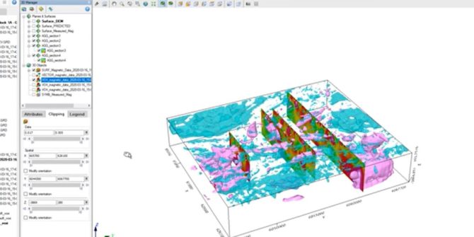
What’s New in the Geosoft May 2020 Release
allowing you to gain new 3D insights and interpretations from TDEM data. You can also experience significant performance improvements when viewing 3D data; usability improvements
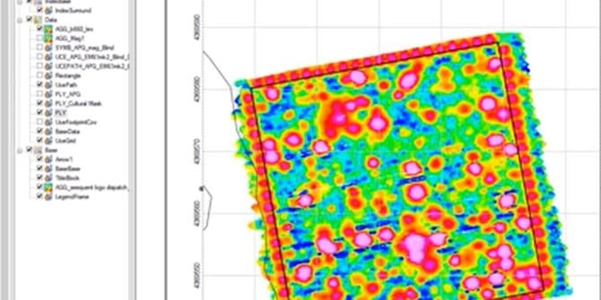
Industry Best Practices for Advanced Geophysical Classification of UXO Survey Data
to process advanced electromagnetic sensor data to classify unexploded ordnance targets. An overview of UX-Analyze, along with practical tips for experienced users to help improve
Industry Best Practices for Processing Onshore UXO Geophysical Data
New and experienced users alike will walk away with practical tips to improve their use of UXO Land. Presenter InformationLaura Quigley, Technical Analyst, Seequent Laura
Industry Best Practices for Processing Offshore UXO Geophysical Data
This online training seminar includes industry best practices for using UXO Marine to process and interpret offshore geophysical survey data to locate and analyse unexploded