


What’s new in AGS Workbench 6.7
The latest release of AGS Workbench provides improved interoperability between Oasis montaj and AGS Workbench. With support for the Oasis montaj GBD file format, now
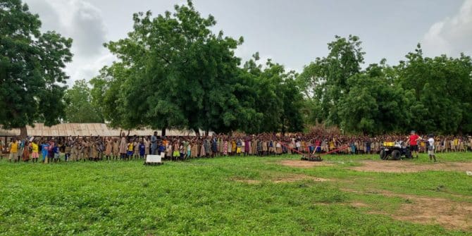
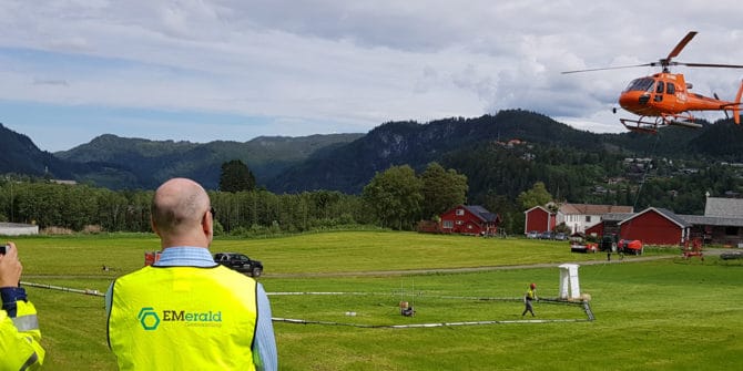
Towed Transient Electromagnetic Technology (tTEM) Improves Water Access in Developing Countries
The Aarhus University HydroGeophysics Group are dedicated to improving water access in developing countries. We are excited to share their story about their recent project
Introduction to the Hydro-Structural Modelling (HSM) module in Aarhus Workbench 6.6
With the latest release of Aarhus Workbench, we have introduced a new module that enables you to create groundwater models faster and with less uncertainty
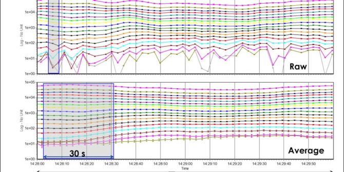
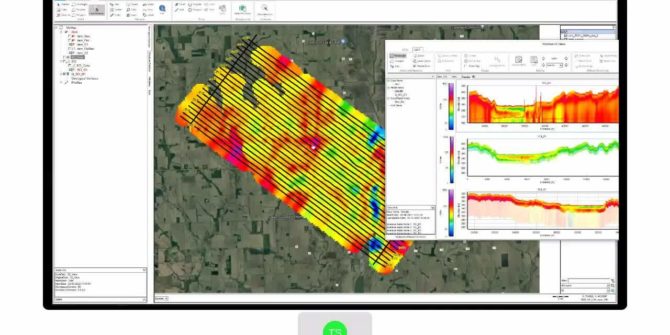
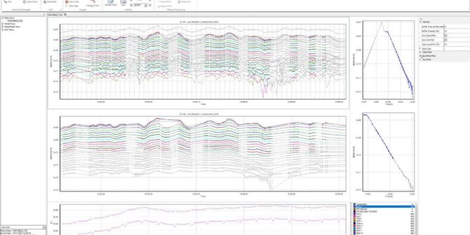
Aarhus Workbench 6.6: Redesigned TEM Auto Processing Tool
Suppress couplings and background noise and reduce model uncertainty with the TEM auto processing tool. Overview SpeakersToke Højbjerg Søltoft Aarhus GeoSoftware DirectorDuration13 minJTNDJTIxLS0lMjBUaGUlMjBzY3JpcHQlMjB0YWclMjBzaG91bGQlMjBsaXZlJTIwaW4lMjB0aGUlMjBoZWFkJTIwb2YlMjB5b3VyJTIwcGFnZSUyMGlmJTIwYXQlMjBhbGwlMjBwb3NzaWJsZSUyMC0tJTNFJTBBJTNDc2NyaXB0JTIwdHlwZSUzRCUyMnRleHQlMkZqYXZhc2NyaXB0JTIyJTIwYXN5bmMlMjBzcmMlM0QlMjJodHRwcyUzQSUyRiUyRnBsYXkudmlkeWFyZC5jb20lMkZlbWJlZCUyRnY0LmpzJTIyJTNFJTNDJTJGc2NyaXB0JTNFJTBBJTBBJTNDJTIxLS0lMjBQdXQlMjB0aGlzJTIwd2hlcmV2ZXIlMjB5b3UlMjB3b3VsZCUyMGxpa2UlMjB5b3VyJTIwcGxheWVyJTIwdG8lMjBhcHBlYXIlMjAtLSUzRSUwQSUzQ2ltZyUwQSUyMCUyMHN0eWxlJTNEJTIyd2lkdGglM0ElMjAxMDAlMjUlM0IlMjBtYXJnaW4lM0ElMjBhdXRvJTNCJTIwZGlzcGxheSUzQSUyMGJsb2NrJTNCJTIyJTBBJTIwJTIwY2xhc3MlM0QlMjJ2aWR5YXJkLXBsYXllci1lbWJlZCUyMiUwQSUyMCUyMHNyYyUzRCUyMmh0dHBzJTNBJTJGJTJGcGxheS52aWR5YXJkLmNvbSUyRjFmV0h5a2l1VVN4dmVSZHA5NkNnWVIuanBnJTIyJTBBJTIwJTIwZGF0YS11dWlkJTNEJTIyMWZXSHlraXVVU3h2ZVJkcDk2Q2dZUiUyMiUwQSUyMCUyMGRhdGEtdiUzRCUyMjQlMjIlMEElMjAlMjBkYXRhLXR5cGUlM0QlMjJpbmxpbmUlMjIlMEElMkYlM0UlMEE= Video
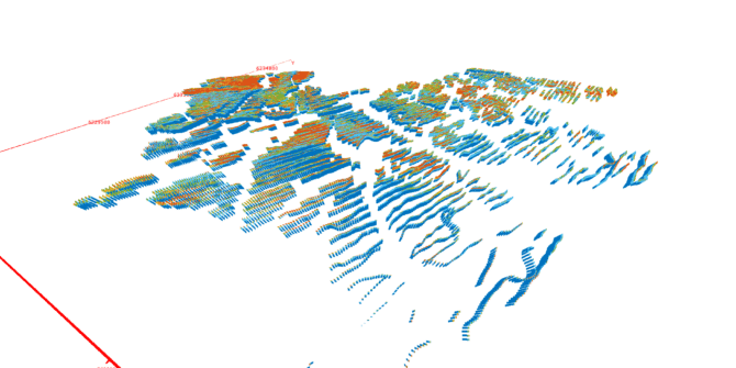
Aarhus Workbench 6.6: New data visualisation capabilities with “Views”
Views is a flexible, visual tool for processing and visualization of all EM and streamed ERT data in Workbench. Depending on your workflow and what
Filling the gaps: Why geotech and geophysics are better together
Clouds roll over Austria’s highest peak revealing it part by part. Andi A. Pfaffhuber has made a career piecing together a more complete view of
How a Nordic highway reduced drilling by 30% with AEM, Workbench, and machine learning
They estimated it would require around 600 boreholes for the project, and EMerald Geomodelling reduced that by 30%. That's around 200 less boreholes to do
5 ways mining projects use resistivity models to reduce risks
Mining is high risk at every stage: you must find the minerals, safely and efficiently extract them, and ensure minimal environmental impact. Mining and exploration