


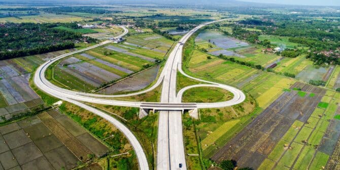
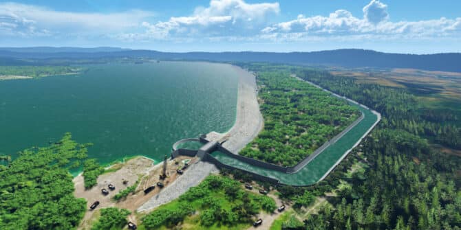
Technology saves Sumatran expressway project 120 days, avoids $180m in losses
The adoption of advanced digital tools on the $3.5bn Trans-Sumatra Toll Road project played a “pivotal role” in meeting the expressway’s engineering challenges.
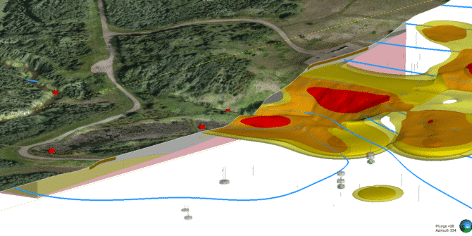
Put the data to work: Leverage 3D modelling tools to maximise the value of your subsurface data
Leverage Seequent's 3D modelling tools to maximise your subsurface data.
PLAXIS 2024.2 What’s New
This latest PLAXIS release includes two new user defined material models, one that helps improving the process of designing tailings dams and the other for
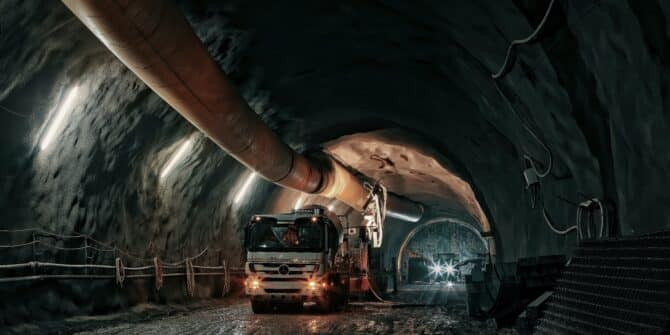
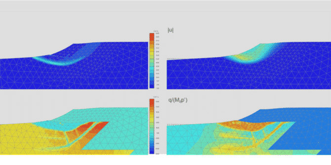
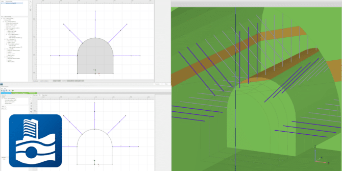
The high stakes of soft soil tunnelling. From choosing the right TBM, to picking a confident path beneath the feet of a city.
This article was first published in the August 2024 edition of Geomechanics and Tunneling Journal. As cities grow, and infrastructure projects within them become ever
Solving complex geotechnical design challenges for the longest Dam in South-East Asia.
With a capacity of 33 million cubic metres of water and stretching a vast 3.1 kilometres, Indonesia’s Semantok Dam is a vital asset for controlling
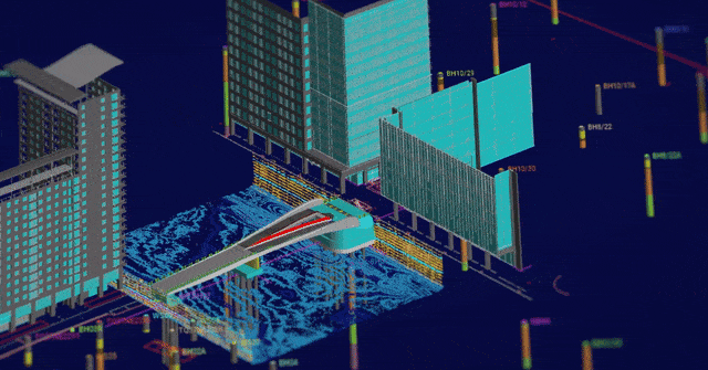
Arcadis utilise digital modelling & analysis for: Iconic lifting footbridge in London’s Canary Wharf
Through groundbreaking digital modeling and analysis, Arcadis, achieved unprecedented efficiencies, reducing ground investigation costs by 30% and design costs by 12%. Hear from Andrea Gillarduzzi,
PLAXIS 2024.1 – What’s New
With PLAXIS 2024.1 users benefit from enhancements for designing and reinforcing underground excavations, improvement in the connected geotechnical workflow and modal analysis for offshore foundation

A Connected Geotechnical Workflow: The Key to Safe and Sustainable Infrastructure Projects
Gain knowledge of: Integrating and visualising available subsurface data Interpreting subsurface data to aid geotechnical analysis Managing geoscience data and collaborating to refine project design