


See what’s new in GeoStudio 2023.1
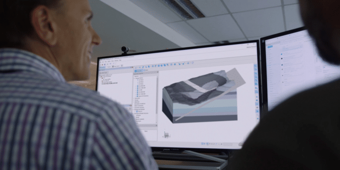
This release includes the newest product in the GeoStudio portfolio, SLOPE3D, empowering you to conduct enhanced 3D slope stability analysis. SLOPE3D’s advanced solving methods, integrated
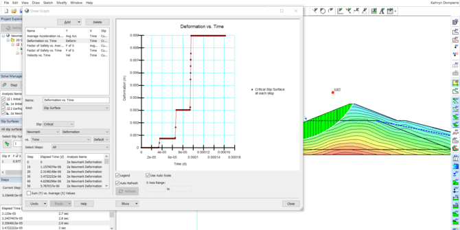
Mastering SLOPE/W: Dynamic Stability with the Newmark Method
This webinar includes a demonstration of the following: • The fundamentals of the Newmark method; • How to combine multiple analyses in a single GeoStudio
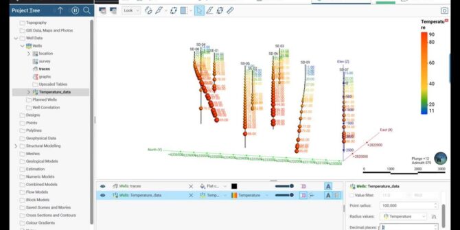
Importing and Visualizing Temperature Data
In this video, learn how to import temperature data, visualize this data in 3D, and ultimately use it to produce a numeric model. Overview SpeakersVaiva

Fugro supports the future of sustainable energy infrastructure with new resistivity survey technology
Fugro’s latest innovation in geophysical technology, WAGEO, together with Seequent’s AGS Res2DInv software can unlock crucial geo-data insights for more sustainable energy infrastructure. What does
PLAXIS Enables Streamlined Infrastructure Projects with Leapfrog Interoperability
Building infrastructure such as roads and tunnels is a complex process, but PLAXIS 2023.1 makes it easier and more efficient by incorporating geological data to
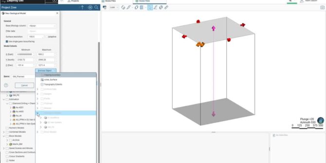
How to use your mining data in Leapfrog Geo
In this webinar we will focus on the existing as well as more recent tools in Leapfrog Geo and Edge that you can use to
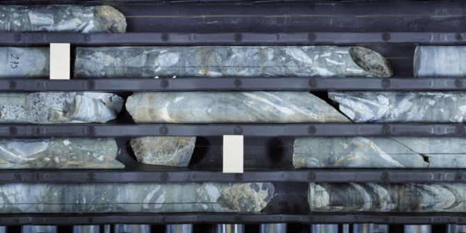
Imago Demo Guide
This is a short guide to exploring the Imago image viewing tools in a web browser. There are no obligations or costs involved in using
What Imaging Station Shall I Build?
The following information will help you decide what is the optimal imaging station to build. Your imaging requirements will be differ depending on whether you