


Watch: Leapfrog Edge explained
Watch: Leapfrog Edge Explained - The intuitive geostatistical software designed to integrate resource estimation directly with your geological model. Seamlessly transforming raw data into confident,

Enable true ground-informed design in Civil 3D
Our understanding of ground conditions evolves with the project, so geotechnical design teams need a reliable way to work with the latest information.
Faster geological modelling powers smarter decisions at Rana Gruber
Seequent’s connected workflow helps Rana Gruber manage geological data, update models faster, and support more informed mine planning decisions.
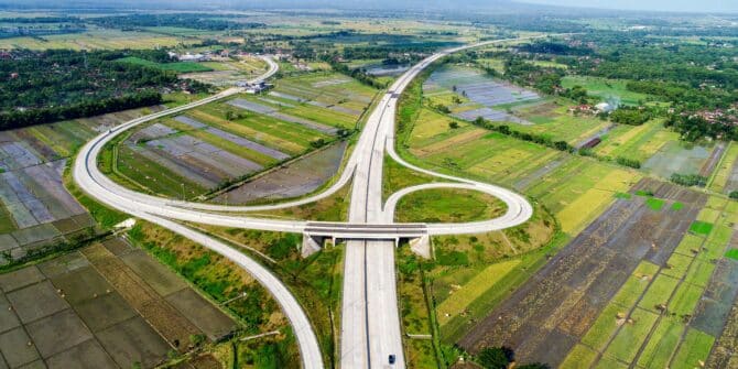
Technology saves Sumatran expressway project 120 days, avoids $180m in losses
The adoption of advanced digital tools on the $3.5bn Trans-Sumatra Toll Road project played a “pivotal role” in meeting the expressway’s engineering challenges.

IAEG-Seequent partnership builds engineering knowledge, capability
Seequent is supporting the International Association for Engineering Geology by sponsoring workshops incorporating Leapfrog.

World Geothermal Congress – building confidence to power the future
Energy security, increased power demands, and the need for reliable, constant renewable energy have placed global interest in geothermal energy at an all-time high.

World Geothermal Congress: geothermal’s next frontier will be ‘unlocked by confidence’, Seequent CEO says
Seequent Chief Executive Graham Grant told the World Geothermal Congress the future of geothermal energy will be unlocked not just by ambition, but by confidence.
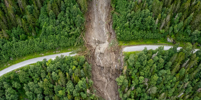
Co-operation essential for tackling landslide dangers
Landslides kill thousands of people globally each year, despite efforts to better manage this hazard. Pat McLarin, Seequent Segment Director, Civil, writes.