


Landslides kill thousands of people across the globe each year, despite the efforts of engineers and scientists to better understand and manage this natural hazard. Pat McLarin, Seequent Segment Director, Civil, writes.
Our knowledge of landslides is improving at a rapid rate, along with the rollout of often expensive mitigation measures. But population pressures and changes to rainfall intensity and duration are outpacing that adoption, and the number of deaths each year continues to rise.
Some studies calculate there are more than 4,000 deaths a year on average from mass land movement, with fatalities concentrated in highland areas of Asia, East Africa, and parts of Central and South America.
Severe weather can cause enormous spikes in the number of landslides and of those killed by them. It is no wonder the World Bank and the Global Facility for Disaster Reduction and Recovery list landslides among the top 11 hazards affecting global development and life and mark them as key risks which planners need to focus on when building climate resilience.
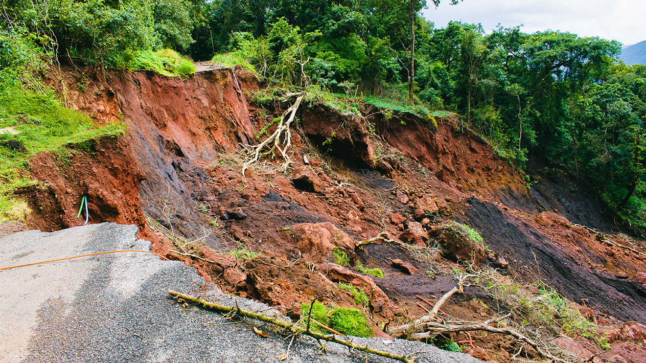
Landslides kill thousands of people globally each year.
Source: Adobe
Closing this gap between research advances and delivering the practical solutions made possible by engineering and government investment was the focus of a large, world-leading landslide conference featuring representatives from four international societies in Queenstown, New Zealand, at the end of April.
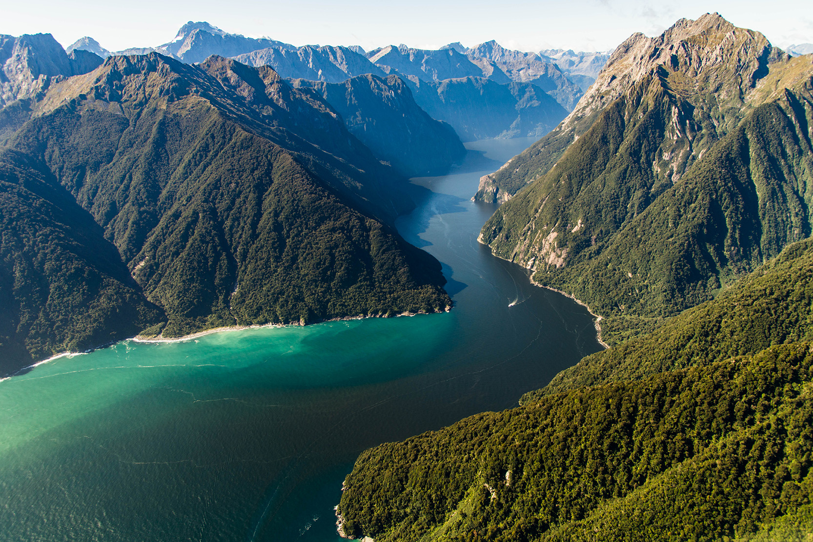
More than 400 engineers, geologists, scientists, social scientists and communicators spent the best part of a week together at a crucial time, hearing the latest research on landslides, learning more about potential solutions, and visiting the landslide-prone locations of Milford Sound and the schist landscapes of Central Otago.
As well as keynote presentations, a series of workshops addressed the issues head-on for geotechnical engineers and engineering geologists, looking at different types of modelling, slope-stability guidance efforts, and appropriate land-use planning to reduce the risk to communities and individuals.
Hot on the heels of the conference, New Zealand’s Natural Hazards Commission stated it had now received more landslide-damage claims, mostly caused by storm rainfalls in parts of the North Island and the top of the South Island, than for any other hazard, saying the problem is accelerating. In the last five years, the commission received almost 13,000 claims for landslide damage,10,000 more than over the previous five-year period.
At the conference, it was clear that while there is a great deal of work going on in this area, it is an issue which society needs to properly understand.
Engineers can come up with all sorts of measures for adaptation and mitigation, but responsibility for life and livelihoods starts with government, local councils, planners, and the communities themselves, who determine land use and what level of risk they are prepared to accept.
How do we ensure those who should be leading this work are doing so? And what can engineers and companies such as Seequent do to best support a society-led approach?
Community resiliency is a combination of adaption, smart land use, and engineering solutions, but also education and preparedness. Remote communities can be quite resilient and aware of the risks, but the social mix of communities is also changing, as we experienced at the conference on field trips to places where tourists make up at least as much of the population on any one day as locals.
A consistent approach to mitigation is vital. As the Convenor of the Landslide Risk & Geo-education (LaRGE) 2026 event, Ross Roberts, said, it is no easy task for policymakers to be consistent, particularly when neighbouring regions of a country might have different approaches to land-use controls.
In his keynote address to the conference, earth scientist and Vice-Chancellor of Nottingham Trent University, Professor Dave Petley, said the communication of this explosion in the amount of research being done was not actually leading to a reduction in global fatalities.

Seequent Segment Director, Civil, Pat McLarin discusses importance of knowing what is happening under the surface for the resilience of structures above ground.
Source: Bentley
In an ideal world, he said, better understanding of a landslide would lead to better planning and practice, ‘but something is not working as well as it should do’. And at a global level, better planning and practice were not directly leading to fewer deaths, though there were some notable exceptions, such as in Hong Kong, with a slope safety programme costing about US$170 million annually that is believed to have so far saved hundreds of lives.
Clearly, there are wide and worrying gaps to fill. If ignored, fatalities from landslides will continue to increase.
At the conference, delegates talked about where the leadership in landslide mitigation should come from. There was a general view that it is less the responsibility of one central agency and more about how universities, employers, and practitioners behave, including through professional-practice groups.
For example, every landslide study should start with gaining knowledge of the slope, its materials, groundwater, and other potential triggers. Three-dimensional modelling should then be used to test and refine that model.
Combining mapping, borehole and lab data, monitoring and adding meteorological inputs to inform results, and being explicit about data gaps and uncertainties, will then present us with multiple plausible scenarios, which are more useful than a simple single answer.
Beca Associate Engineering Geologist Christoph Kraus supports this collaborative approach to landslide mitigation, particularly in the face of climate change.
‘It needs to be an all-in approach. Clearly there’s going to be regulations set, from councils, from government. As consultants, researchers, regulators, and stakeholders, we all need to plan ahead, work together and adapt as things change.’
Christoph says the New Zealand Geotechnical Society and Australian Geomechanics Society are working on several landslide guidance documents, including an update of the existing landslide risk management guidelines, as well as new slope-stability guidance documents.
These guidelines incorporate research and experience from New Zealand, Australia, and various parts of the world to provide well-researched, up-to-date guidance. In New Zealand we have a Landslide Database, a searchable resource for individuals and those planning and engineering new settlements and subdivisions, looking after key infrastructural assets, and assessing emergency management planning.
Earth Sciences New Zealand is upgrading its database, increasing the number of landslides it has classified from 23,000 to more than 500,000. Details such as the trigger for movement, their size, and damage are also being added.
In Aotearoa New Zealand, Cyclone Gabrielle and the magnitude 7.8 Kaikōura earthquake generated many tens of thousands of landslides. There have also been more recent landslides, one which killed six people at a camping ground in the beachside town of Mount Maunganui and another which killed two people at home not far away.
Related content:
* New Caledonian roadway avoids difficult realignment following landslide
* Why do unforeseen site conditions continue to impact civil projects?
* 2026: the outlook for civil infrastructure
Seequent, The Bentley Subsurface Company, has an important role to play in helping protect lives around the world through its modelling and analysis of potentially unstable slopes.
New Zealand’s largest active urban landslide is in the Nelson suburb of Tāhunanui. It is a 27-hectare complex rotational slump which gets triggered by heavy rain and has been modelled using Seequent Leapfrog to relate the behaviour of the slide to how it connects with the underlying geology.
Pacific island nations are also highly vulnerable to landslides due to their geology and frequent torrential rainfall. One example comes from New Caledonia, where a 2.2km critical access road through steep terrain was badly damaged by a deep-seated landslide containing about 15,000 cubic metres of material.
Engineering and construction manager Hatch used several pieces of Seequent software – OpenGround, Leapfrog Works, and GeoStudio and PLAXIS – in its remediation work to ensure that in future the route is as robust as it can possibly be.
Seequent also sponsors IAEG engineering geological modelling workshops which teach engineering geology best practice and how it can be applied in digital 3D models to cut risk for civil and environmental projects.
When it comes to landslides, the importance of co-operation, education, and strong, clear communication between researchers and potentially affected communities cannot be overestimated.
* Pat McLarin is the Segment Director for Civil at Seequent, The Bentley Subsurface Company.