


Unlocking the power of SEG-Y with Leapfrog
The launch of Leapfrog 2021.1 introduces a powerful new capability supporting the import of SEG-Y data. This new workflow enables ...
Visualise seismic data in 3D with Leapfrog Energy 2021.1
Seismic data is a crucial geophysical method across multiple industries, but in particular is a mainstay in hydrocarbon exploration and ...
Import multiple drillhole, borehole and well data sets into your Leapfrog project
Drillhole, borehole or well data (collectively termed drill data for this blog) is at the core of every Leapfrog project ...
Why drill hole data needs a new hero
When we were young, we grew up with our favourite superheroes believing them to be invincible. No task too big, ...
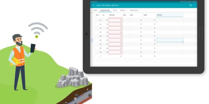
Take a Tour of MX Deposit
Let's find the next world-class deposit together. Affordable, flexible, mobile and hosted, MX Deposit gives you full control over all ...
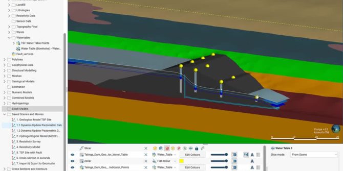
Tailings Storage Facilities Management: From data acquisition to an integrated 3D model in Leapfrog
The workflow solution that is helping safeguard operations with digital twin technology. Environmental, socio-economic and political risks along with a need to ...
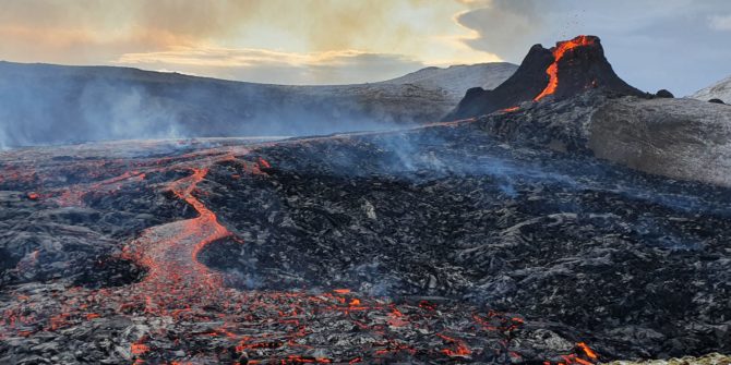
Watch Iceland’s new volcano form in Leapfrog
Videos of red lava flowing from Iceland’s Fagradalsfjall volcano are awe inspiring. Geothermal geologist Bastien Poux used Seequent’s Leapfrog Geothermal ...
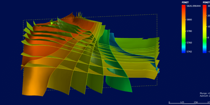
The role of the 3D Geological Model in Geotechnical BIM
Building Information Modelling/Management (BIM) is defined as ‘Use of a shared digital representation of a built asset to facilitate design, ...