


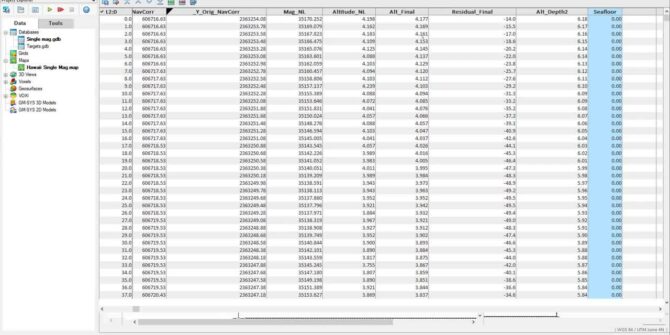
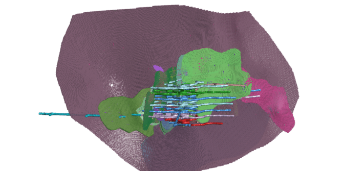
Survey Coverage tool in the UXO marine extension
Using the sensor footprint at the seafloor, and the sensor altitude, easily determine what percent of the survey area has ...

How to add users to a Central server and assign permissions for projects
Objective: I want to add users to the Central server and then assign them permission to view specific projects. Resolution: ...
How to update a video card driver
Objective: I would like to update my video card driver to the most recent release version possible. Resolution: Windows 7 & 10 ...
Significant processing and storage improvements for more powerful modelling
With the amount of data that is now available to all geoscience professionals, the stress we are placing on our ...
How Meager Creek Development Corp uses Leapfrog to source green hydrogen from geothermal
"Opening that topography to show the reservoir below, we've seen a number of community folks, key stakeholders, that went: ‘Oh, ...

Eric Bugeja, buildingSMART Discusses IFC Interoperability with Pat McLarin, Seequent
In this interview, Pat McLarin, Civil Segment Director at Seequent interviews Eric Bugeja, Chairman, Australasia at buildingSMART to discuss the ...
How to configure Leapfrog to connect to a Proxy
Objective: I want to configure Leapfrog to work with my network's proxy. Resolution: To configure Leapfrog, you can access the ...
How to create grids (*.grd) from contour lines in Oasis montaj and Target
Objective: I have a Geosoft map that contains a contour group. I would like to use this contour group to ...