


Objective:
I have a Geosoft map that contains a contour group. I would like to use this contour group to create a Geosoft grid. (*.grd).
Resolution:
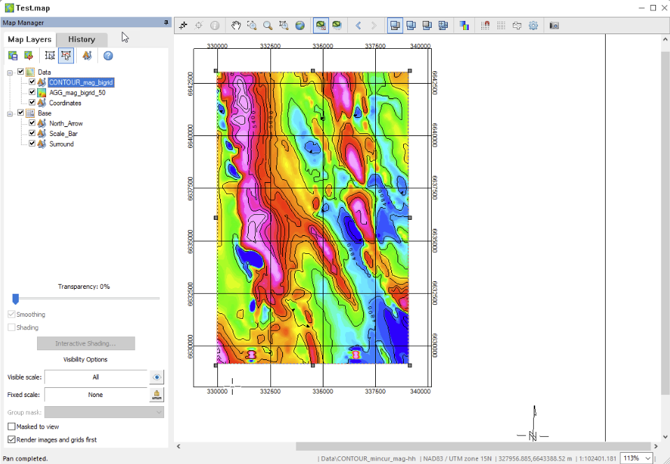
It is not uncommon for Geosoft maps (*.map) to include a geophysical grid overlayed with topographical contours as shown below:
It is possible to extract the contour data from the map to create DTM grid for better visualization.
Step 1: Sample the contour layer to a GDB
- Open your map and locate the contour layer in the Map Manager Tree. In the example above the contour layer is called CONTOUR_mag_bigrid
- Right-click the contour layer and select Export to GDB.
- You will be prompted to enter a database name followed by the New Database popup window. Be sure there are at least the same amount of lines/groups as the levels of contours in you map.
You should now have a database with X and Y coordinates in the projection of your map and a data channel. The data channel is the contour values. The contour levels are split into lines in the database.
Step 2: Grid the contour GDB
- You can now grid the data channel using anyone of the avaiable gridding methods by going to Grid and Image > Gridding > Grid Data.
- Refine the resolution of the grid using the Cell Size parameter.
Alternative method using an ESRI Shapefile
Some ESRI shapefiles (*.shp) may also be gridded depending on how the data is stored in the file.
- You can check if useful information is stored in the shp files by importing the shp to a database by going to Map > Import > Import > ArcView Shape File(s)
- Select your *.shp file and set the “Import data to:” field to New database. NOTE: if you also wish to display the *.shp to your map, also select the “Plot map to:” to new or current map. If not, set to Do not import. Click “OK”.
- Give the input database a name and click “OK”
Once the shapefile has been imported into a Geosoft database (*.gdb), the imported database should have a single line with all the stored data from the shp file. You can now grid the appropriate data channel using the steps outlined above in Step 2: Grid the contour GDB.