


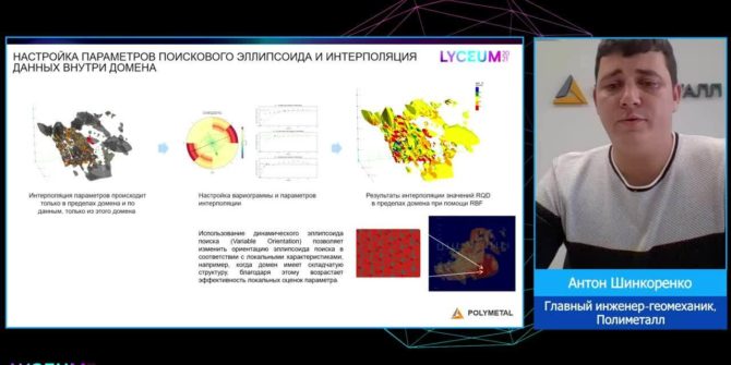
Geomechanical modelling as part of a digital mine
The geomechanical model can and should become the main tool of geomechanical engineers for identifying potentially dangerous areas and 3D calculations of different rock mass
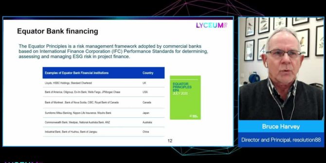
Trust, but verify: Remote sensing for ESG assurance in resource sector financing
Environmental, social and governance (ESG) is increasingly referenced in corporate boardrooms and the financial sector, and verification of ESG metrics is a new condition of
How drones are evolving the way we explore the Earth
As drones and survey instruments become lighter and batteries become stronger, innovative ways to apply drone technology is evolving rapidly.
Solving the groundwater challenge
Access to safe water and sanitation is the pivotal point that turn problems into potential by empowering people with time for school and work and
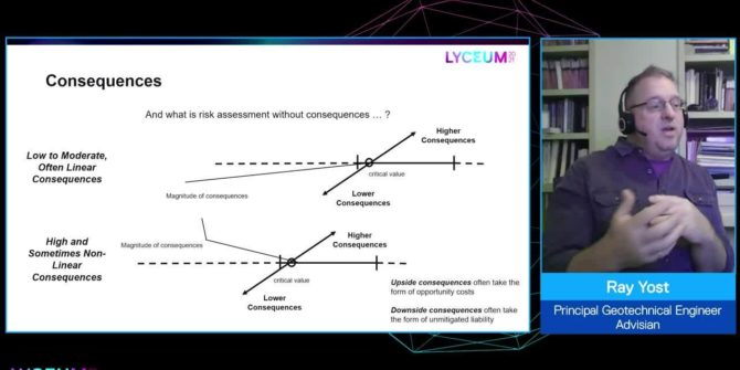
Understanding geotechnical risk: A structure for uncertainty
This session presents a means to characterize risk as a function of the relationship between uncertainty - provides divisions to the continuum of tools available

Where the uncertain subsurface meets surface infrastructure
Recent engineering accidents and natural disasters have highlighted across many industries the need for better interaction between subsurface and surface information to create more resilient
Water: A shared responsibility
Water use is growing globally at more than twice the rate of population increase in the last century, and an increasing number of regions are
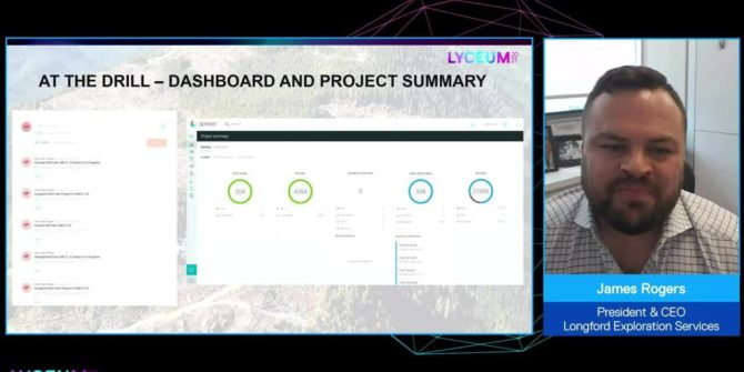
Implementation of streamlined data collection and viewing in early-stage exploration projects
This session will showcase an implementation of MX deposit, Imago, Leapfrog Geo and Central on a 50,000m historic drilling data set, implementing data capture and