


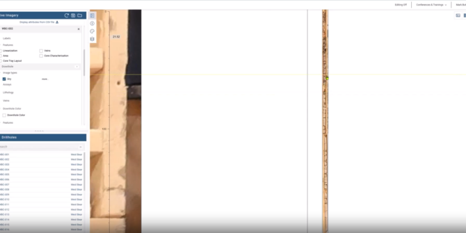
Managing a ‘Digital Coreshed’ for your Cobalt-Nickel Deposit
Join Seequent's product specialists to understand how our market leading software suite can enable data collection, management, and modelling of a Cobalt-Nickel Deposit. Overview SpeakersMark
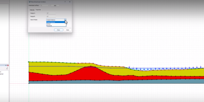
Defining Anisotropic Surfaces in 2D Stability Analyses
This video describes the theory behind anisotropic surfaces, demonstrates how to implement anisotropic surfaces, and evaluates the results of a stability analysis that uses and
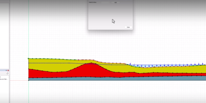
Defining Weak Surfaces in 2D Stability Analyses
This video deomonstrates the workflow for setting up weaksurfaces in GeoStudio SLOPE/W. Overview SpeakersTrevor Kent – Seequent LimitedDuration3:55 minsJTNDJTIxLS0lMjBUaGUlMjBzY3JpcHQlMjB0YWclMjBzaG91bGQlMjBsaXZlJTIwaW4lMjB0aGUlMjBoZWFkJTIwb2YlMjB5b3VyJTIwcGFnZSUyMGlmJTIwYXQlMjBhbGwlMjBwb3NzaWJsZSUyMC0tJTNFJTBBJTNDc2NyaXB0JTIwdHlwZSUzRCUyMnRleHQlMkZqYXZhc2NyaXB0JTIyJTIwYXN5bmMlMjBzcmMlM0QlMjJodHRwcyUzQSUyRiUyRnBsYXkudmlkeWFyZC5jb20lMkZlbWJlZCUyRnY0LmpzJTIyJTNFJTNDJTJGc2NyaXB0JTNFJTBBJTBBJTNDJTIxLS0lMjBQdXQlMjB0aGlzJTIwd2hlcmV2ZXIlMjB5b3UlMjB3b3VsZCUyMGxpa2UlMjB5b3VyJTIwcGxheWVyJTIwdG8lMjBhcHBlYXIlMjAtLSUzRSUwQSUzQ2ltZyUwQSUyMCUyMHN0eWxlJTNEJTIyd2lkdGglM0ElMjAxMDAlMjUlM0IlMjBtYXJnaW4lM0ElMjBhdXRvJTNCJTIwZGlzcGxheSUzQSUyMGJsb2NrJTNCJTIyJTBBJTIwJTIwY2xhc3MlM0QlMjJ2aWR5YXJkLXBsYXllci1lbWJlZCUyMiUwQSUyMCUyMHNyYyUzRCUyMmh0dHBzJTNBJTJGJTJGcGxheS52aWR5YXJkLmNvbSUyRkxUclRlQzJhZ3E5dmpBOUw5dW04Nm0uanBnJTIyJTBBJTIwJTIwZGF0YS11dWlkJTNEJTIyTFRyVGVDMmFncTl2akE5TDl1bTg2bSUyMiUwQSUyMCUyMGRhdGEtdiUzRCUyMjQlMjIlMEElMjAlMjBkYXRhLXR5cGUlM0QlMjJpbmxpbmUlMjIlMEElMkYlM0UlMEE=
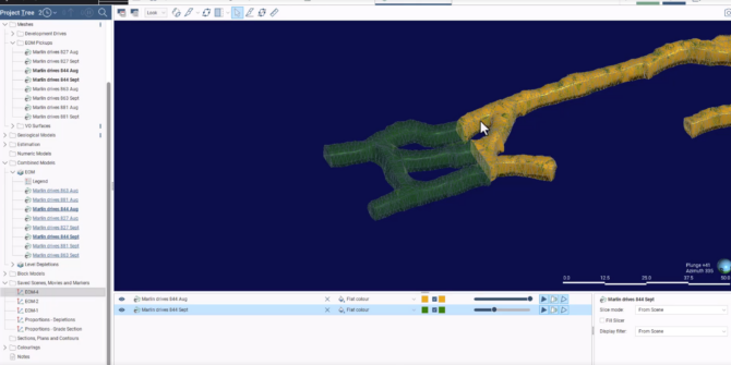
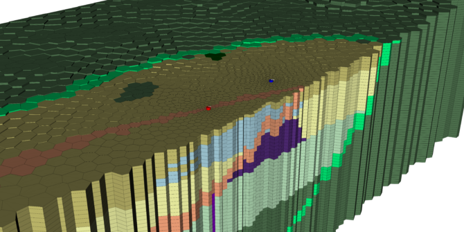
Real-time resource estimation: Boosting production efficiency with Leapfrog Edge
Leapfrog Edge is a module that extends Leapfrog's dynamic workflow, offering built-in tools for comprehensive resource estimation and validation directly within the software. Join Lee
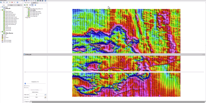
Explore the new Oasis montaj geophysical acquisition extension
Join Senior Geophysicist Jack in this webinar exploring key modules in Oasis montaj, including airborne quality control, UAV geophysics, and geophysical levelling, showcasing examples of
Volsung 2024.3 What’s New
Join Clare Baxter as she demonstrates the efficiency improvements in the latest release of Volsung. This update introduces better interoperability, enhanced data plotting capabilities, and

Advanced technology benefits Melbourne commuters, cuts project costs by $16m
Better cross-functional working and a digital strategy optimised delivery of this $11bn mega project which will cut travel times and reduce pollution.
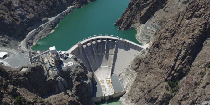
Transforming ground modelling: Designing the world’s third tallest arch dam in 3D
This webinar explores how 3D ground modelling is changing geotechnical engineering practices, focusing on the Yusufeli Dam in Turkey, which is the world’s third-tallest arch