


The high-tech earth modelling we love today started with a little gold (a filament to be exact) and the spirit of exploration.
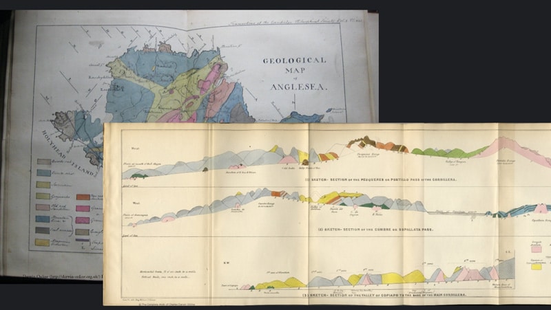
In the early 1800s, continental explorers like Charles Darwin sketched maps of land that included geological observations. These could be considered the earliest examples of geological modelling – as well as mapping.
“Then, in 1833, the scientist Carl Gauss published a paper that became famous because it talked about the Earth’s magnetic field,” says Lorraine Godwin, Director, Segment Business Development at Seequent.
“This would be the moment that most geophysicists would tie to the advent of modern geophysics.”
Gauss noticed that a fine filament of gold hanging on a string seemed to always point in the same direction – North. He’d discovered the Earth’s magnetic field and invented a simple compass, the building block of today’s magnetometers.
Lorraine herself has had an evolving career in geoscience technology, including 23 years with Seequent companies. She worked in the field as a geophysicist before moving into software. She’s watched the industry change rapidly as new geophysical equipment, industries, and needs emerged.
With her colleague Darren Mortimer, Lorraine presented “The evolution of earth modelling” at the virtual Symposium on the Application of Geophysics to Engineering and Environmental Problems (SAGEEP) conference.
Here, she’ll share how – from compasses, to war submarines, to punchcards – the world at large has shaped the geo-software that we use today.
1930s Scanning for metal with magnets
A century after Gauss, scientist Victor Vacquier discovered a new use for compass technology: mineral exploration.
“Victor at the time was working on fluxgate magnetometers for ore deposits,” explains Lorraine.
“When you have a magnetic ore deposit, then the Earth’s magnetic field plus the signal strength of the deposit would add up to a higher signal. You could measure that and see that in data.”
The early mining industry had relied mostly on luck and surface observations to find metals. Now, magnetics gave them a better idea of what was hiding below.
To solve a similar problem during World War II, the military found a new use for Vacquier’s device at sea: detecting submarines.
Vacquier also used this new marine application of his technology after the war to map the magnetic patterns on the ocean floor.
“This led to the theory of seafloor spreading and was a major impetus behind what we now know as plate tectonics: the idea that the plates are moving and colliding, resulting in earthquakes and mountains ranges forming, and even changing the underlying geology,” says Lorraine.
1970s Rise of the machine
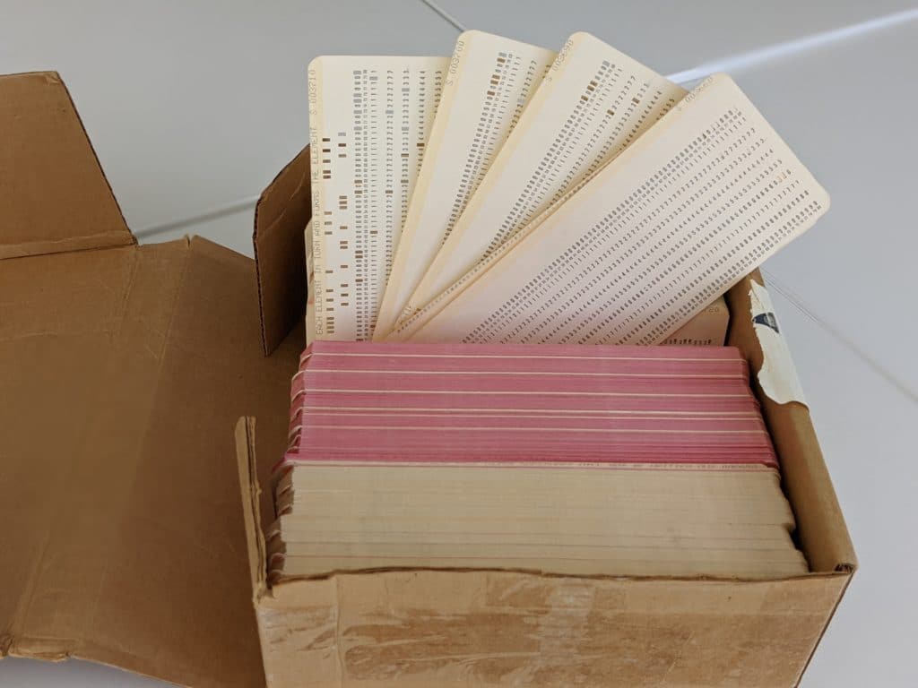
Fast forward a few decades and these early discoveries in magnetics have transformed into calculators and basic computers.
“Around this time, a geologist had a hammer and a map, and a geophysicist had a calculator and a computer with a stack of floppy disks – and they had to be software developers to get the job done.”
Geo-professionals had to do more than collect and analyse the data – they had to create the computer programs they needed to analyse and process it. They had to become early programmers.
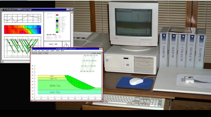
Geoslope (now part of Seequent) was founded by two siblings in Saskatchewan, Canada in 1977. One was an engineer and the other was a computer programmer. They saw an opportunity for computers to make faster, more accurate predictions about slope stability by analysing more data than a person could.
“Geoslope has a long history of the engineering software business. They’re arguably the first company worldwide to commercialize software targeted at geotechnical engineers,” says Lorraine.
Their first two products were PC-SLOPE and PC-SEEP, which were made to run on a personal computer (thus the “PC” names).
“And that was unique in the industry, as it represented a move away from mainframe computing.”
Personal computers allowed more people to run programs and analyse data, without waiting their turn on a single, shared mainframe.
“These were the days of digitisers and huge plotters, and you’d have big, printed manuals that would help guide you through the software.”
1980s Computers do the drawing
Meanwhile in Toronto, Canada, two geophysicists were tired of hand drawing or “contouring” their geophysical data.
“They believed microcomputers would change the world of geophysics and they were right,” says Lorraine.
Many early geo-measurement systems were analogue, which meant that they just had gauges and paper recording charts.
“Geoscientists then had to take that data and manually enter it or plot it by hand and hand contour it, which if anyone’s done it – and I did this in my early geophysical field days – it’s really painful and time-consuming,” explains Lorraine.
The Toronto duo wrote specialised programs on floppy disks to do their geophysical analysis. They realised that software could be used to visualise and interpret geophysical data and move away from hand contoured maps.
They founded Geosoft (now part of Seequent) and created Oasis montaj geophysics software, supposedly named as an “oasis for your montage of geophysics data.” Geophysicists rejoiced at no longer having to hand contour data or hire artists to draw renditions of the subsurface.
Software provided a place to bring together a “montaj” of all their geophysical data and tie it together with other geo-data such as drillholes, geochemical, etc. for a better understanding of the subsurface.
1995 The Earth in digital 3D
Applied Research Associates in New Zealand (ARANZ, now Seequent) started in 1995 in Christchurch, New Zealand. They originally created 3D medical imaging software to model inside the human body using data.
It became clear this could be applied to see inside the Earth as well and solve a big program in geological modelling.
“They were the developers of the fast RBF technology that we know and love today in Leapfrog. The software made the modelling process not only dramatically faster, but highly visual and dynamic.”
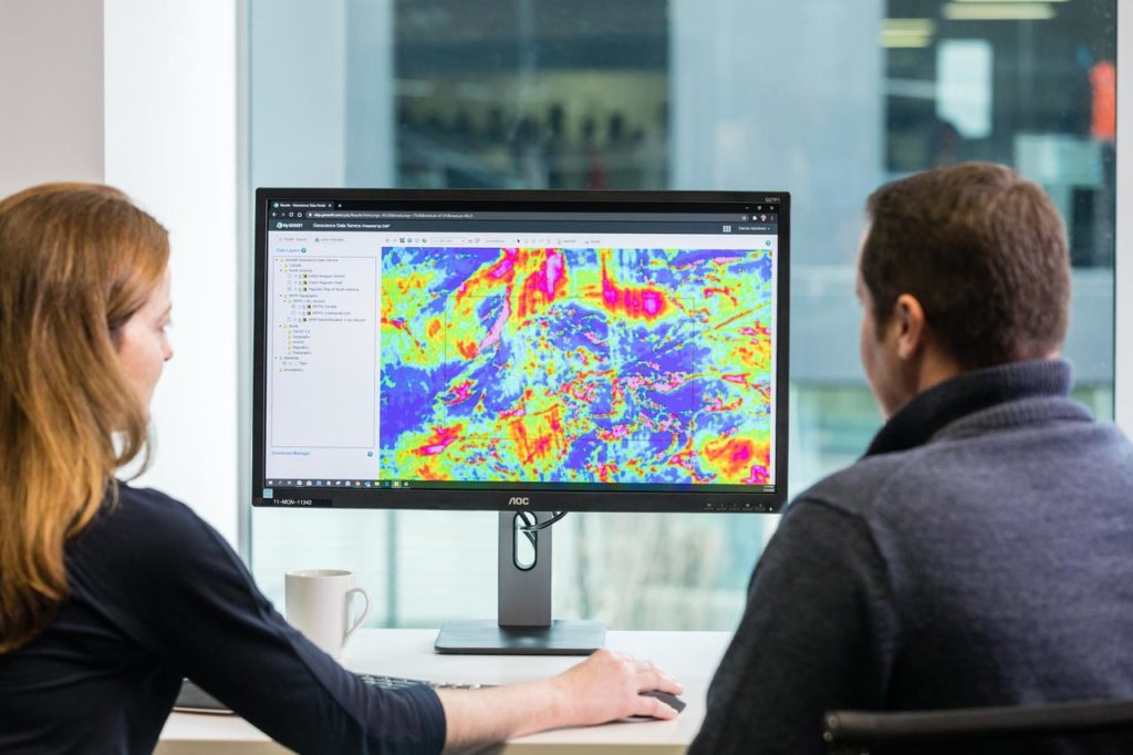
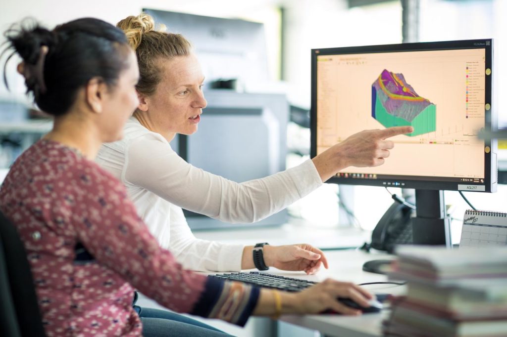
Geo-professionals wanted to bring all their data together, quickly, and make it 3D to clearly communicate insights with non-technical stakeholders. Much software at the time was designed to be understood by experts only.
“At the same time, we’re seeing collaboration across multiple levels of stakeholders: from very technical to non-technical people, like investors, the environmental protection agency, and stakeholders that are looking at the projects from a different perspective.”
Non-technical stakeholders didn’t need to know the nitty-gritty of the data, but they needed to know the outcomes of it. Leapfrog’s 3D visualisation made it much easier to communicate expert insights so everyone could make informed decisions.
Leapfrog’s pioneering implicit modelling also helped predict the geology between drillhole or point data, guided by the geologist’s knowledge. 3D and implicit modelling tools were quickly adopted across industries to help better map the subsurface.
“This was a paradigm shift in the depth of understanding of the earth subsurface,” says Lorraine.
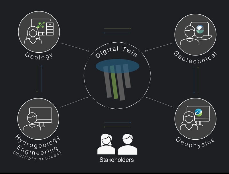
“It’s really allowed the integration of disparate data sets together. Bringing our geology, our geotechnical, hydrogeology, geochemistry, or geophysics together, and gave us deeper insight into the subsurface.”
The future of earth modelling
In 2017, Seequent was founded to bring together geo-data of all types, to help everyone gain a better understanding of the Earth.
“The real power is not just in the data. It’s in connecting that data together with the knowledge and insights that we get by connecting different, disparate data types together,” says Lorraine.
Teams began growing and diversifying, and there was a need to find a way to make better decisions together – no matter their expertise or location.
“Today, geoscientific software is allowing teams to work collaboratively from a single source of truth, to create more than just 3D models but what we call digital twins, a term originally from the civil industry.”
Cloud-based Seequent Central came from this need for teams to collaborate on geo-data and models in near real time, from anywhere. Which mirrored the global shift to more remote work.
Data itself keeps growing and growing, along with new sensor types and ways to collect it.
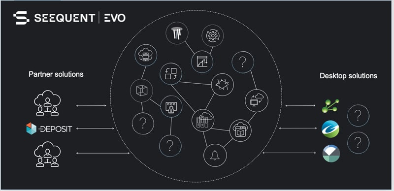
“So, how do we make sense of it all? That’s what our vision is for Seequent Evo, which is an easy flow of information across all solutions,” explains Lorraine.
“It shouldn’t matter which software solution you’re using. We want the Evo data translation tool to be accessible to all. That’s why we’re going to make it accessible via a secure API to any third party – even if they’re a competitor or not.”
Seequent Evo is the connector between geo-data, software, and tools to reduce time, risk, and project costs. It allows multidisciplinary teams to collaborate seamlessly on models, and track their data and files.
“We’ve seen the evolution from hand-drawn maps to 3D models and digital twins that are more than just geoscience, but incorporate other types of data, like flow models and building information management data,” says Lorraine.
The future of geo-modelling is connection between teams and data, still driven by the human spirit to explore the Earth.