


Denmark’s groundwater is so clean, you can almost drink it straight out of the ground. To protect it, the government launched an ambitious project to map all aquifers in the country.
Most groundwater mapping happens after there is water scarcity or pollution. But in 1999, the Danish government decided to protect their abundance of buried freshwater.
They launched a massive publicly-funded project to map all of Denmark’s aquifers. They sponsored programs to develop techniques, software, and technology to expand groundwater knowledge.
“In many places around the world, you don’t have management of how much water you use until it it’s too late, whereas we monitor all of that in Denmark now,” says Toke Søltoft director of Aarhus GeoSoftware at Seequent.
“We have so much water. It’s very clean. We don’t want to start treating surface water or desalinating sea water. It was very proactive, to go in and figure out how to do more to protect our water.”
Denmark has strict standards for its water quality.
“The law is that you cannot treat groundwater in Denmark except oxidate it and put it through a sand filter to remove iron. If there is more treatment needed, it has to go through review or we actually close the wells,” says Toke.
“That’s how clean it has to be – you almost should be able to drink it directly from the ground.”
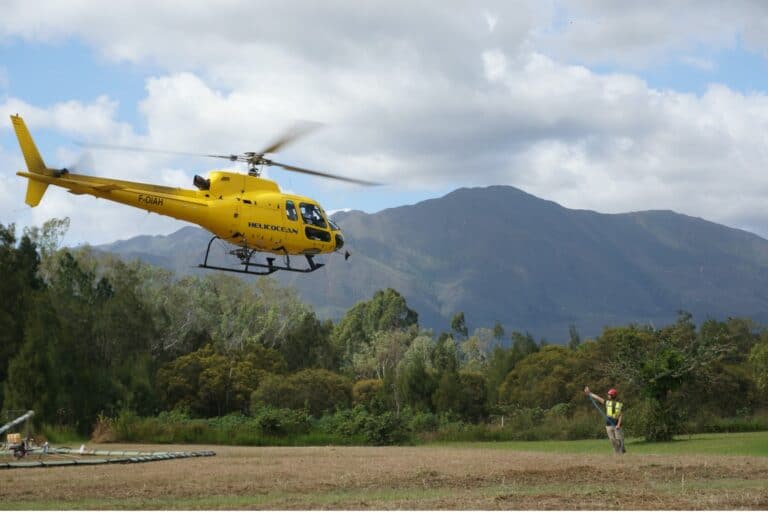
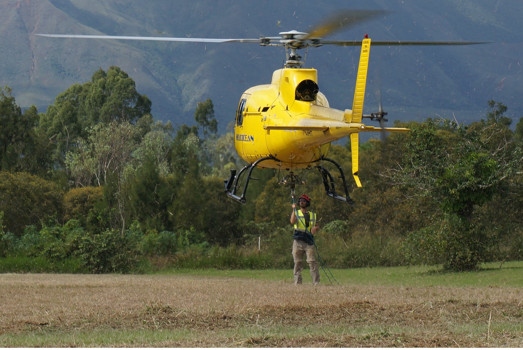
An airborne geophysical survey lifts off (credit: Aarhus GeoSoftware).
How to map hidden water
Unlike lakes and rivers that we can see, buried groundwater is hard to map. Techniques like airborne geophysical EM surveys measure variations in the Earth’s conductivity, helping reveal what materials lay below the surface.
“I guess many people have the idea that an aquifer is like a blob of water underground,” says Toke.
“Of course, it’s not like that. When you go to the coastline and dig a hole in wet sand: water will come out of that hole. That’s what it looks like in Denmark, and in many places.”
Groundwater typically soaks into sandstones and fractured rocks underground. Only in few places does groundwater exist in underground cave formations, like Mexico’s cenotes.
Geophysical surveys that use drones or helicopter-mounted devices can fly over areas and scan them for signals that indicate fractured rocks or specific geology related to groundwater.
“In Denmark, the geology is made mostly sand and clay due to the ice age. So, most of the groundwater in Denmark is below a clay layer.”
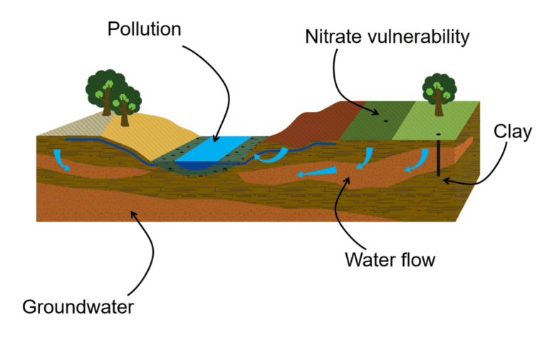
Most of Denmark’s groundwater is protected by a clay layer but that still leaves some areas vulnerable where that layer is thinner (credit: Aarhus GeoSoftware).
This clay has protected their water from nitrates, pesticides, and other contaminants. However, this protection varies across the country depending on the thickness of the clay layer.
“The mapping project built up methods and tools to map the extent of the aquifers, the depth to them, and saw how well they were protected,” he says.
Toke was a researcher at the world-renown Aarhus University hydrogeophysics department that was a part of the groundwater mapping project.
Teams in the department developed the knowledge, instruments, software, and guidelines on how to map groundwater based on their learnings since 2001.
“We have now mapped around 40% of Denmark and we have a good idea where all the water is,” Toke says.
Many spinoff companies launched from the mapping project, including airborne survey instruments developer SkyTEM and geophysical modelling software Aarhus GeoSoftware (now part of Seequent).
Today, customers and partners around the world are applying the knowledge and technology learned from Denmark’s over 20 years of research and development to their projects.
The future of groundwater mapping
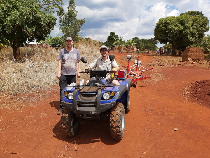
The Aarhus University team in Africa using the tTEM geophysical survey instrument (credit: Aarhus GeoSoftware).
The surveys found that most of Denmark’s groundwater was in very good condition. But the next step was critical: monitoring it.
“A lot of the things that we see in our groundwater boreholes today could have started many decades ago,” says Toke.
“And you’ll see the same problems around the world with pesticides and nitrates, as well as saltwater intrusion due to sea level rise and general water scarcity.
That’s where we can apply what we’ve learned and developed from the Denmark project to help with these problems today.”
Toke is now working in a project to create a new instrument for monitoring the groundwater table that can be left in remote areas for years.
“It can monitor changes in the groundwater table as it’s being used and see how during the seasons it changes,” he says.
“It’s still ongoing. There are still new technologies to be made, new ways of monitoring. Now everything can go to the cloud. It makes things easier.”
Data from these remote self-powered devices can automatically upload data to cloud-hosted data bases. Teams anywhere can access groundwater information allowing for quick decisions when changes occur.
From sky-based surveys to cloud-hosted data, the future of freshwater depends on how well we understand and manage it.