


Experience a specialist workflow in the Workbench Airborne TEM extension
From processing raw data to the final visualisation and interpretation of inversion models in one easy workflow.
Try it outTalk to usWork with a solution that is centred around Time-domain Electromagnetic (TEM) data.
One workflow to process and visualise your data
Experience a solution that integrates all the steps in the workflow from importing, processing, and visualising your data.
Workbench has dynamic processing and visualisation tools that allow you to experience a similar workflow independent of your data types.
Create industry proven inversions
The Workbench Airborne TEM extension provides industry-proven inversions that handle all the complexity of airborne surveys integrated with an intuitive GIS-based interface. Experience a solution that is purpose-built from the ground up with all aspects of the workflow centred around TEM data.
Incorporate all your data
With specific importers for different instruments, Workbench can handle data from several databases, and import data of any supported type into the same workspace to display, compare and interpret the results.
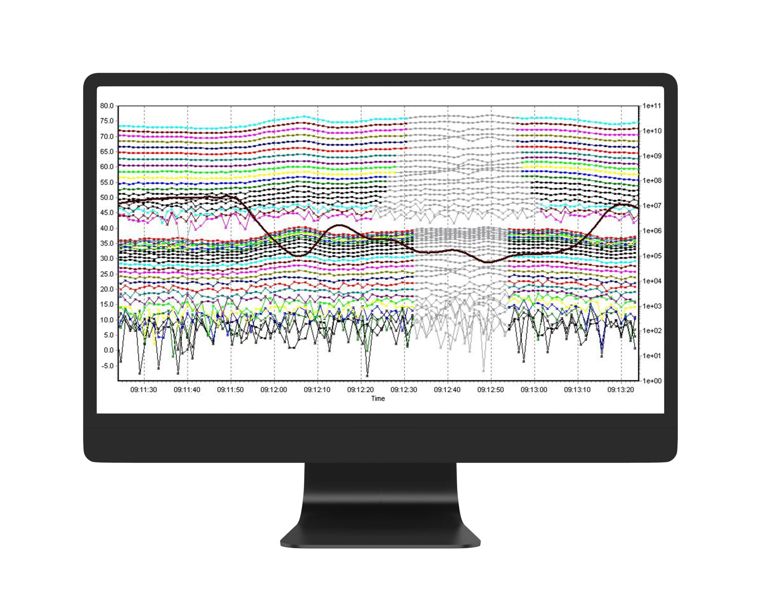
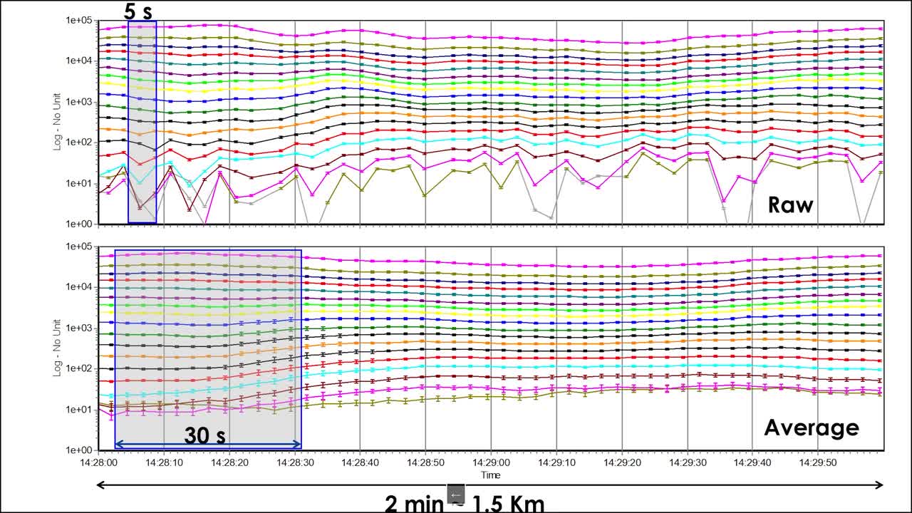
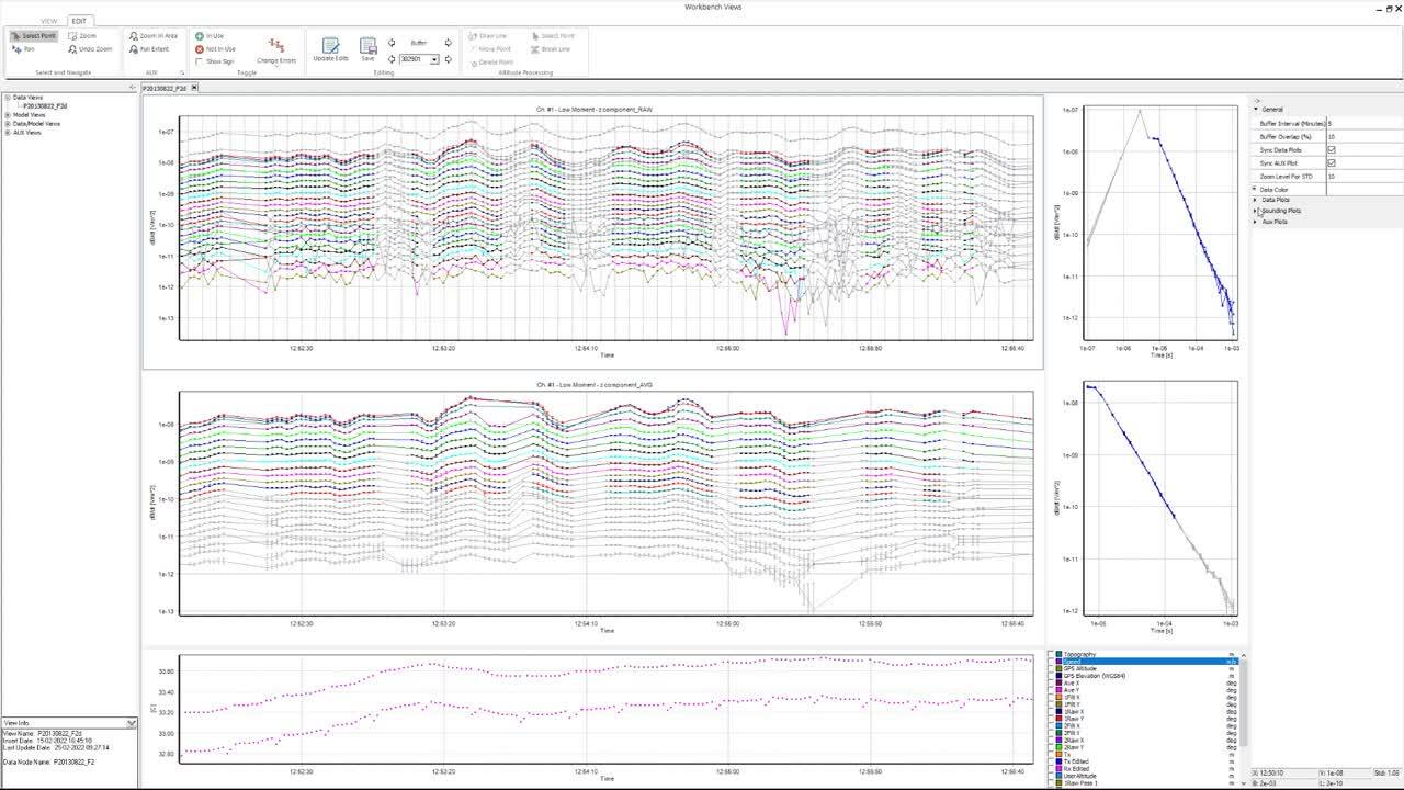
Auto process your TEM data
Suppress background noise and remove couplings – optimizing your workflow and reducing model uncertainty.
Driving decisions through data

Process big data with ease
The Airborne TEM modules support large datasets from all airborne TEM systems, such as SkyTEM, VTEM, TEMPEST, MegaTEM, NRG Excite, Spectrum, AeroTEM and more.
Advanced processing and inversion tools gives you full control of the data and model setup.
You can also bring lithology logs, geophysical logs, other EM & ERT data into one workspace for comparison, visualisation, and interpretation.

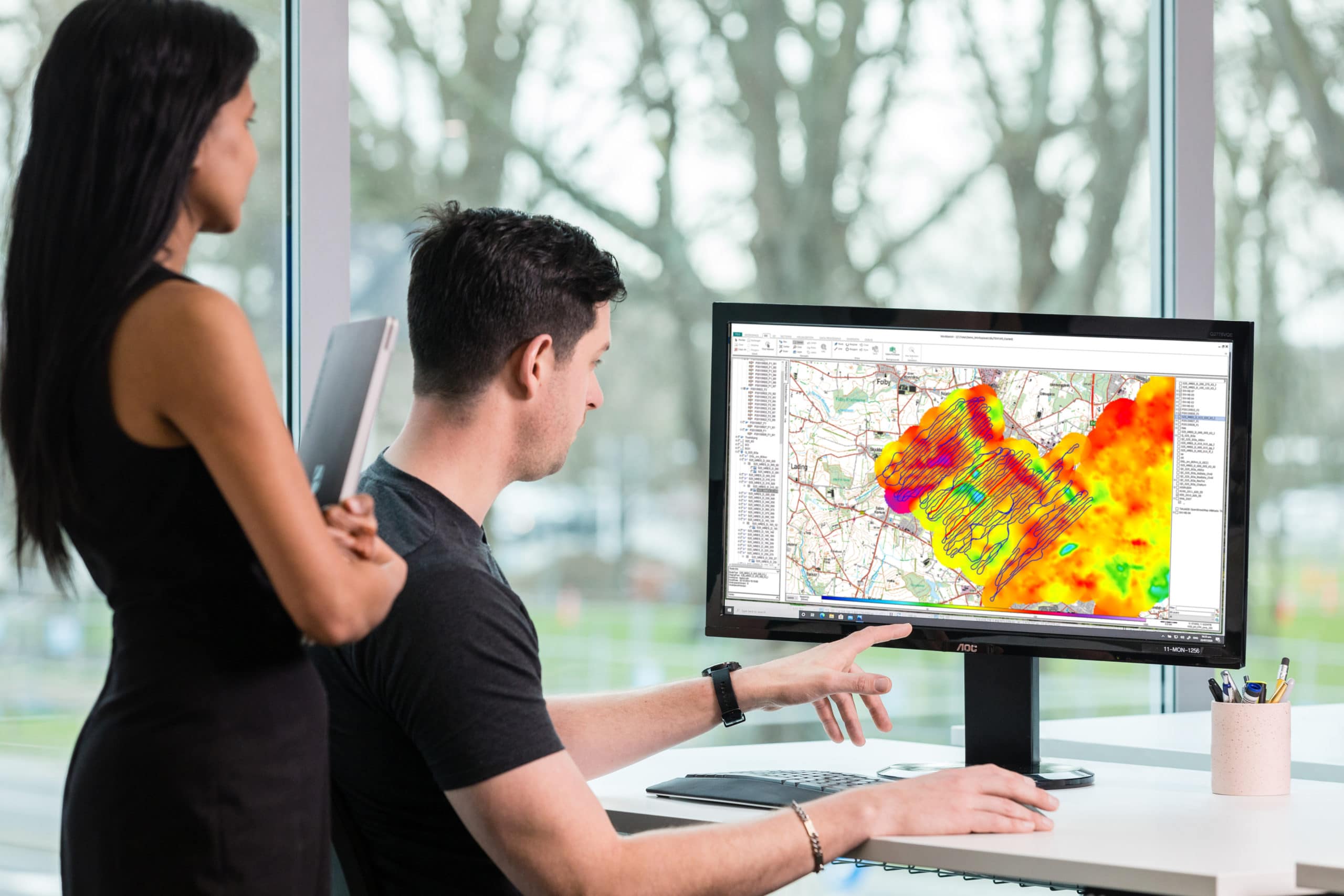
Integrated GIS Interface
All data and visualisation tools are linked directly to the GIS, so you always know where the data or models are located. The visualisation of data and models can be done in themes with many possibilities, such as resistivity depth slices, depth to layer boundaries and clay thickness.
2D sections can be drawn directly from the GIS, and resistivity models, boreholes, and more can be added to the section. You can PDF reports and create 2D and 3D gridding in the 3D viewer, and also create smooth, blocky, sharp or few-layered models to fit any need for interpretation.

Add constraints
Resistivity or layer boundary information from boreholes can be used to constrain the inversion and create models that takes existing knowledge into account, giving more reliable results.

Multiple visualisation options
Use the QC tool to create GIS themes that show you how well the models fit the data, instrument specifications, and data analysis. Create 2D and 3D gridding for 2D sections and 3D viewer. Also create high resolution PDFs with results drawn on sections or displayed in the GIS.