


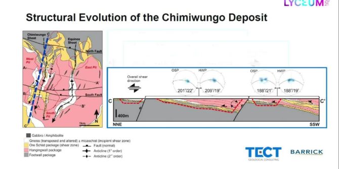
Implicit structural modelling and domaining of intensely sheared and foliated basement complex at Lumwana Mine, Zambia
Which was carefully interpreted in Leapfrog Geo to create a series of block-faulted ductile, tectono-stratigraphic domains and internal structural form interpolants that encompass an intensely
Stabilising mine production with end-to-end material tracking
Discover how to take a whole-system approach to the mine value chain and bring decision-making into focus with proactive and dynamic influence characteristics.
Net Zero by 2050: The role of geoscience and engineering in meeting decarbonisation goals
This panel will discuss how geoscientists and engineers support many decarbonization initiatives and the broad range of renewable energy sources (geothermal, wind turbines, solar, tidal,

Welcome address: Graham Grant | Together (with BSY) Towards Tomorrow! Greg Bentley | Keynote: Can geoscience save the world? Professor Chris Jackson
Together (with BSY) Towards Tomorrow! from Greg Bentley, CEO, Bentley Systems. Greg shares his perspective on advancing infrastructure and the importance of the subsurface through
Digital transformation in transportation infrastructure ground engineering
If you could change one thing about how the industry does something today, what would it be and why? These are just two of the
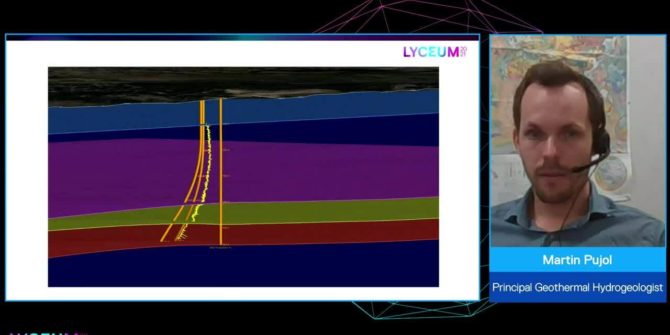
Geothermal in Australia, the hydrogeology of the popular baths at Mornington Peninsula
The baths of the Mornington Peninsula tap a low enthalpy aquifer at 47 degrees C and have grown in popularity since they opened in 2002.
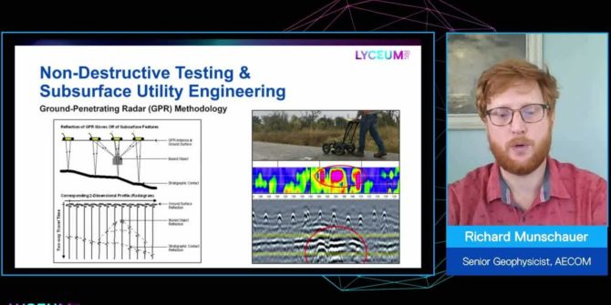
The value of adding geophysics to your infrastructure and environmental projects
It is cost effective, for the amount of data it supplies, non-intrusive and environmentally friendly, it reduces risk, and increases insight about the subsurface.
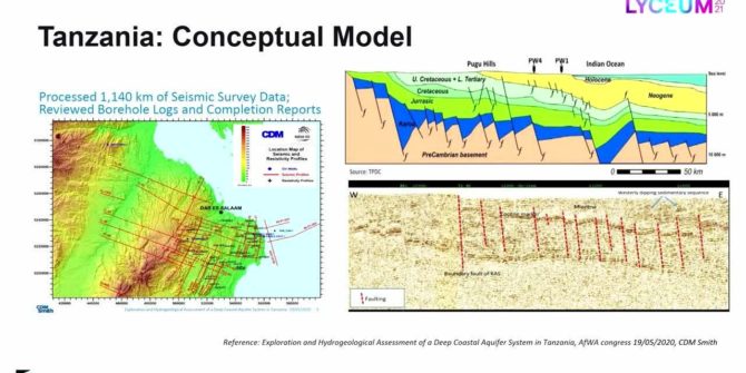
Recycling oil data to discover deep groundwater resources in water scarce countries
Ruden AS has developed an innovative method that uses existing data and technology from the oil industry, combined with applied hydrogeology to search for water