


Josh presents on UAV Magnetic dataset collected over the Crestone Crater in Colorado to show how we can quickly prepare our data for inversion using the UAV Geophysics workflow, and improve our understanding of the subsurface through Magnetization Vector Inversions (MVI) and Self Organizing Maps (SOM) to automatically classify magnetic domains and produce pseudo geology maps.
Classification of Magnetic domains using Machine learning on UAV Magnetic data collected over the Crestone Crater.
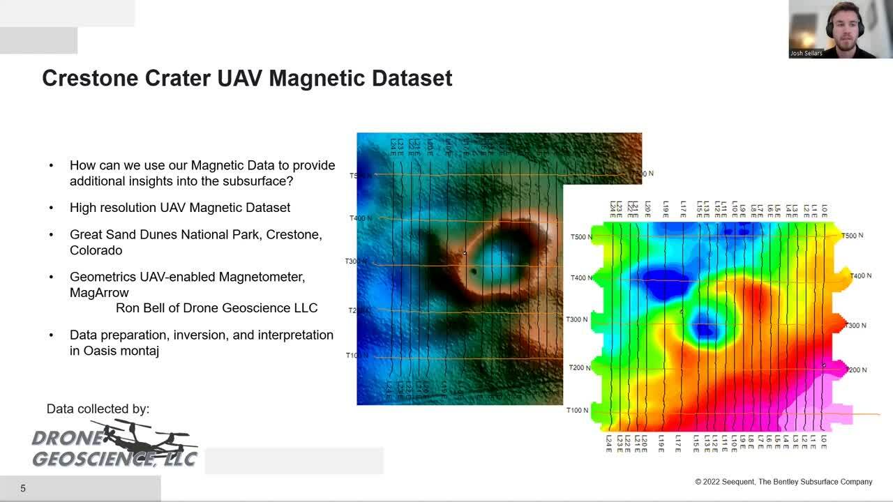
There is an increase in the collection of high-quality magnetic data from Unmanned Aerial Vehicles (UAV). This data can often be underutilized, resulting in the end user not extracting the entire value from their data.
Time consuming manual processing and quality control workflows pose a challenge for users looking to produce higher value products from their raw data. This includes geophysical inversion to create 3D representations of the subsurface, and machine learning applications to classify trends and increase confidence in their interpretations.
Seequent provides a suite of tools inside Oasis montaj that enable rapid processing and QC of the raw UAV magnetic data including planning, processing, merging sorties, tie line levelling, and more to prepare the data for advanced interpretation.
In this presentation we’ll look at a UAV Magnetic dataset collected over the Crestone Crater in Colorado to show how we can quickly prepare our data for inversion using the UAV Geophysics workflow, and improve our understanding of the subsurface through Magnetization Vector Inversions (MVI) and Self Organizing Maps (SOM) to automatically classify magnetic domains and produce pseudo geology maps.
Overview
Speakers
Josh Sellers
Duration
9 minutes
