Flexible, reliable, and risk-reducing geotechnical analysis

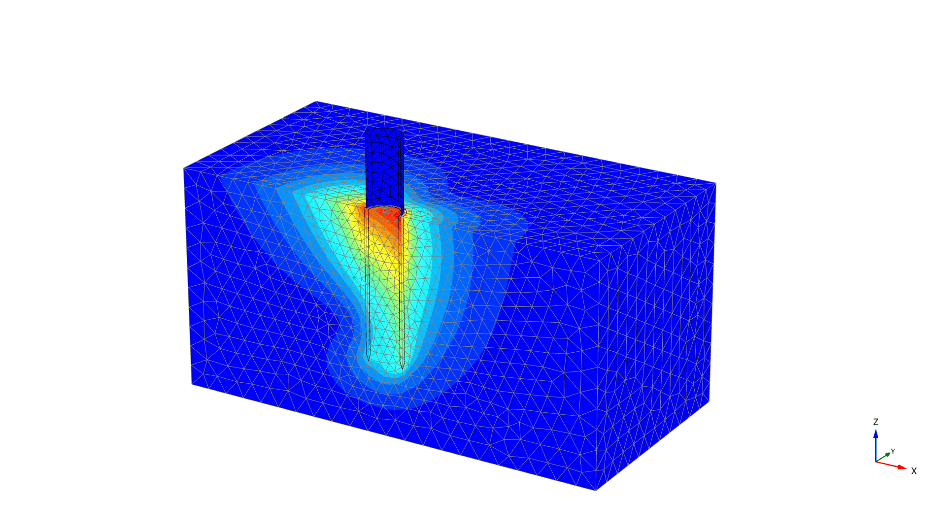
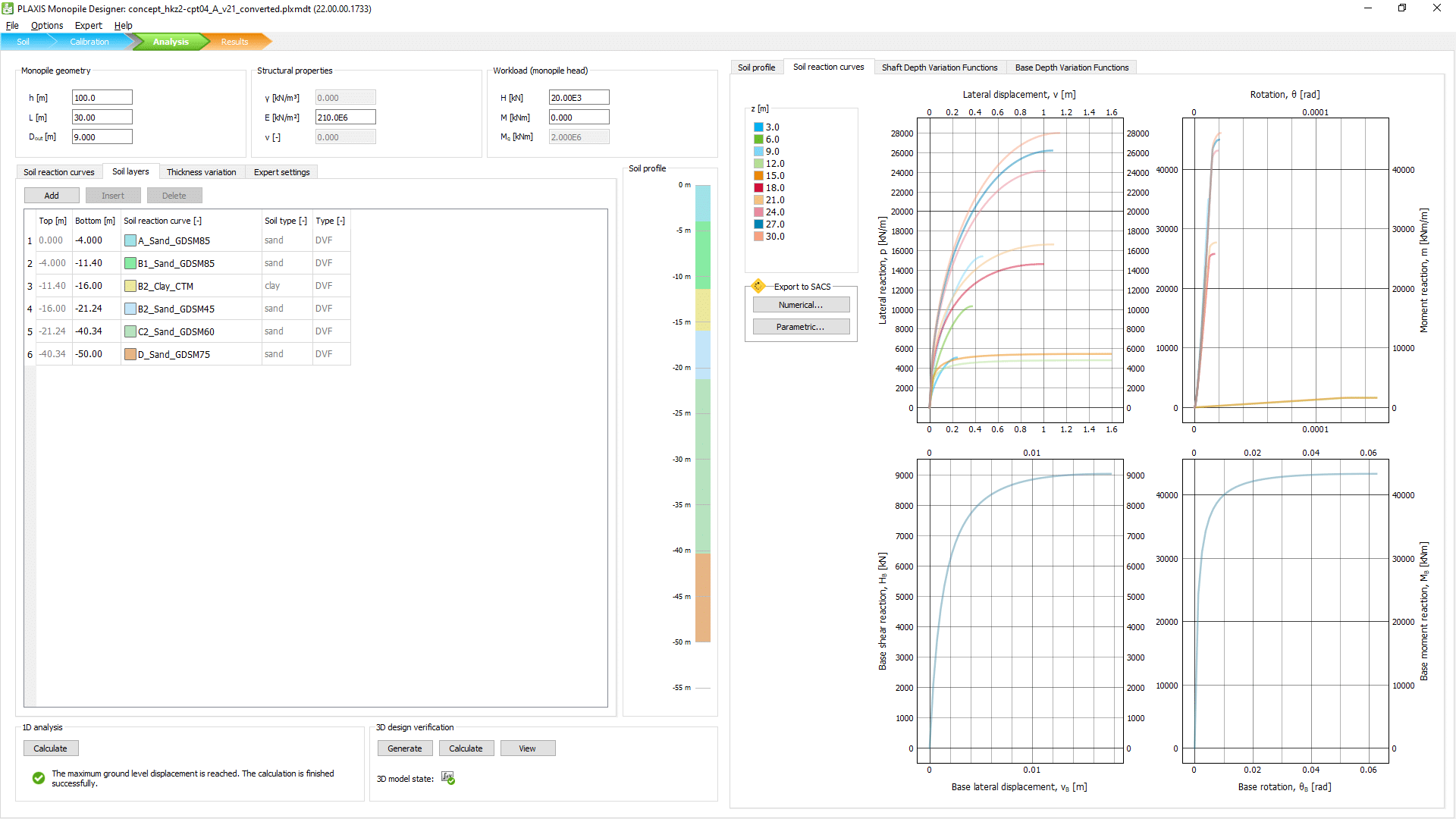
Use PLAXIS to perform advanced finite element, dynamics, earthquake, or seismic analysis of soil and rock deformation and stability, as well as soil structure interaction, groundwater, and heat flow.
Reliably solve infrastructure challenges or facilitate steady-state groundwater flow calculations, including flow-related material parameters, boundary conditions, drains, and wells.