


Expand on SLOPE/W’s practical approach to capturing slope failure mechanisms with the most up-to-date research on 3D stability analysis techniques. Import your Leapfrog geological models to quickly establish the 3D geometry and align your understanding of the subsurface with reality. Assess and compare both 2D and 3D stability to limit your risk during design and operation.
Make faster, safer decisions with SLOPE3D
Perform sophisticated 3D limit equilibrium stability analysis of soil and rock slopes
Go to storeTry it nowSLOPE3D empowers geotechnical engineers with enhanced limit equilibrium analysis for 3D slope stability problems
Increase confidence in slope stability
In some cases, 2D slope stability analysis is sufficient for geotechnical projects. But limiting yourself to cross sections that simplify complex subsurface structures and topography comes with some significant risks.
Oversimplification leads to uncertainty, conservative results, and more expensive designs. With SLOPE3D, analyse 3D stability to improve your understanding, design efficiency, and confidence.
Save time with ease
With multiple geometries and analyses in a single project file, you can quickly compare scenarios, solve multiple analyses in parallel, and represent complex chronological sequences. All in one friendly interface that brings 2D and 3D stability together.
Find key areas of concern
Use the Cuckoo search method to quickly obtain slip surfaces and identify areas of concern in large, complex systems.
SLOPE3D is part of GeoStudio integrated geo-engineering software
Learn moreMeet SLOPE3D
SLOPE3D Stories

Geoambiente: High-resolution modelling for groundwater remediation using Leapfrog
Watch: Brazilian environmental remediation experts, Geoambiente S/A, have been recognised with a prestigious 2025 Year…

Integrate, communicate, and interpret geotechnical data
with industry-leading geo-engineering numerical modelling
Try it nowKey features

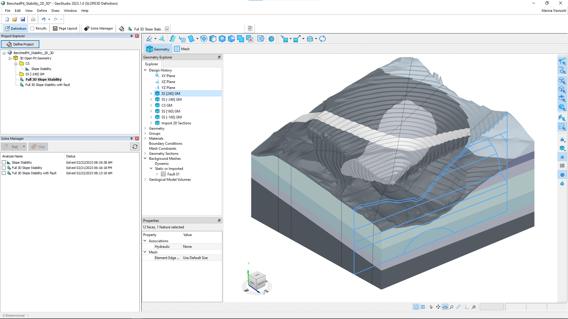
Evaluate complex 3D geological models
Create your 3D geotechnical model with different modelling strategies: direct interoperability with Leapfrog, imported background meshes, or building 3D geometry using the tools in GeoStudio.

Save time across multiple analyses
With multi-physics and multi-geometry capabilities, you can create staged construction scenarios and run several analyses in the same project file.

Choose from diverse constitutive models
Capture the behaviour of rock and soil using an extensive list of constitutive models, from anisotropic to undrained and unsaturated conditions.

Integrate pore-water pressure data
Define pore-water pressures using piezometric surfaces or pressure head spatial functions, or couple with SEEP3D. Then display values as contours on the geometry for complete clarity and easier analysis.

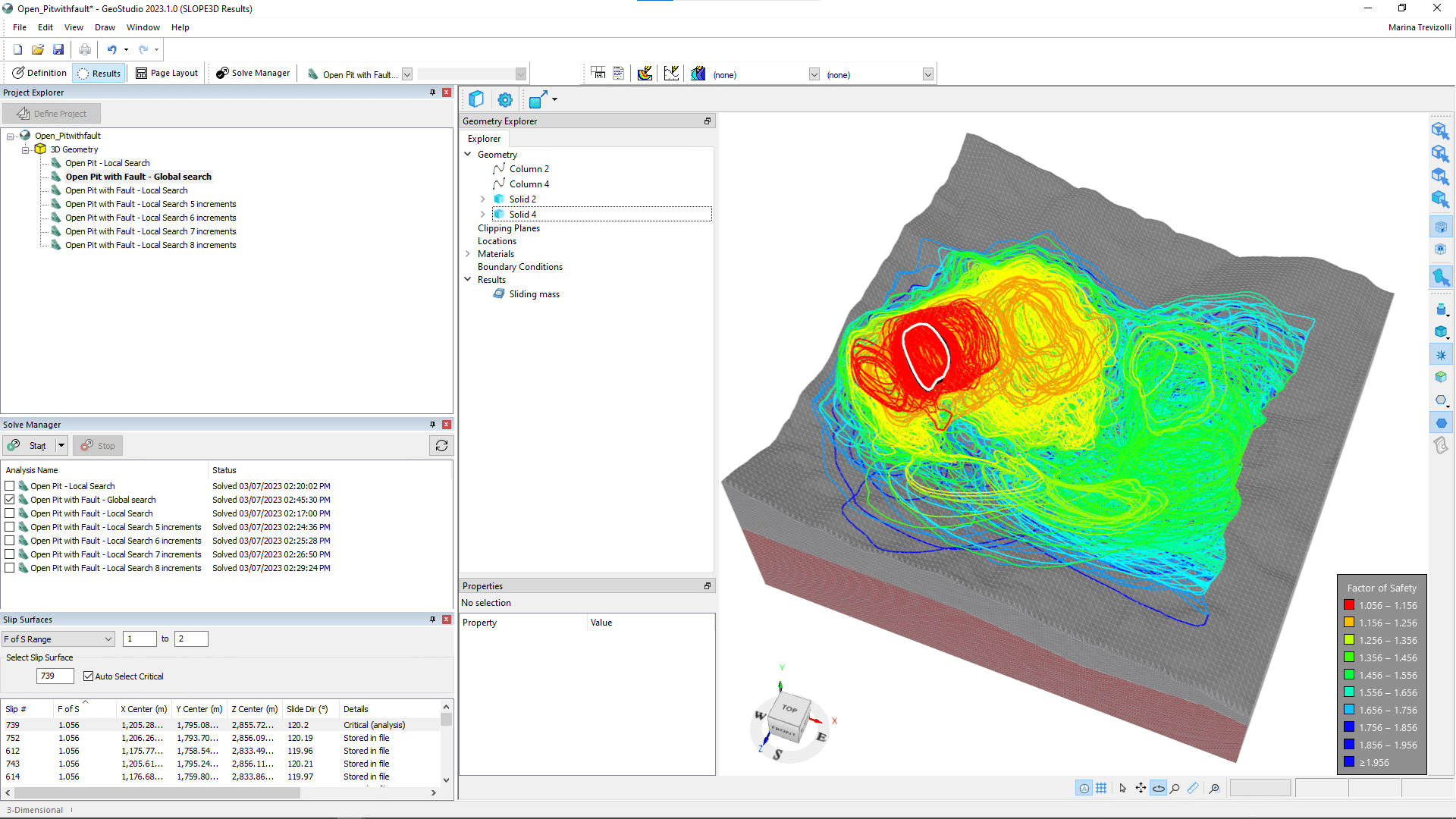
Compute the influence of weak surfaces
Investigate the influence of weak surfaces and anisotropic material properties on the 3D factor of safety and sliding mass volume.

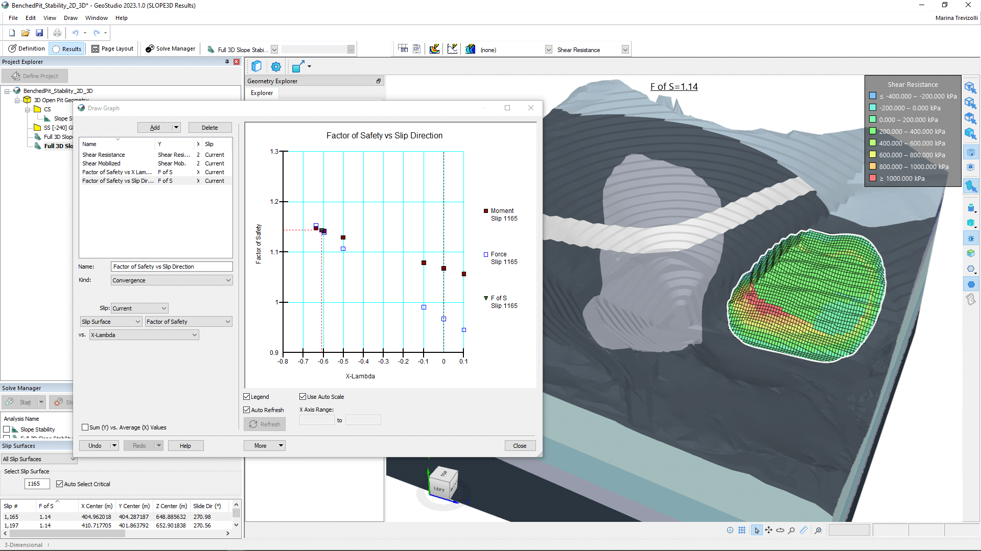
Visualise and understand your results
Turn your 3D stability results into insights with a variety of options for graphing, column information, reports, and contour visualisation.
Useful Information
Use With
Solutions For
System Requirements
We recommend you use Windows 10, with a reasonably fast processor, mid range graphics and 32GB of system memory.
Supported Data/Formats
Supported kinds of data and formats that you can use with GeoStudio