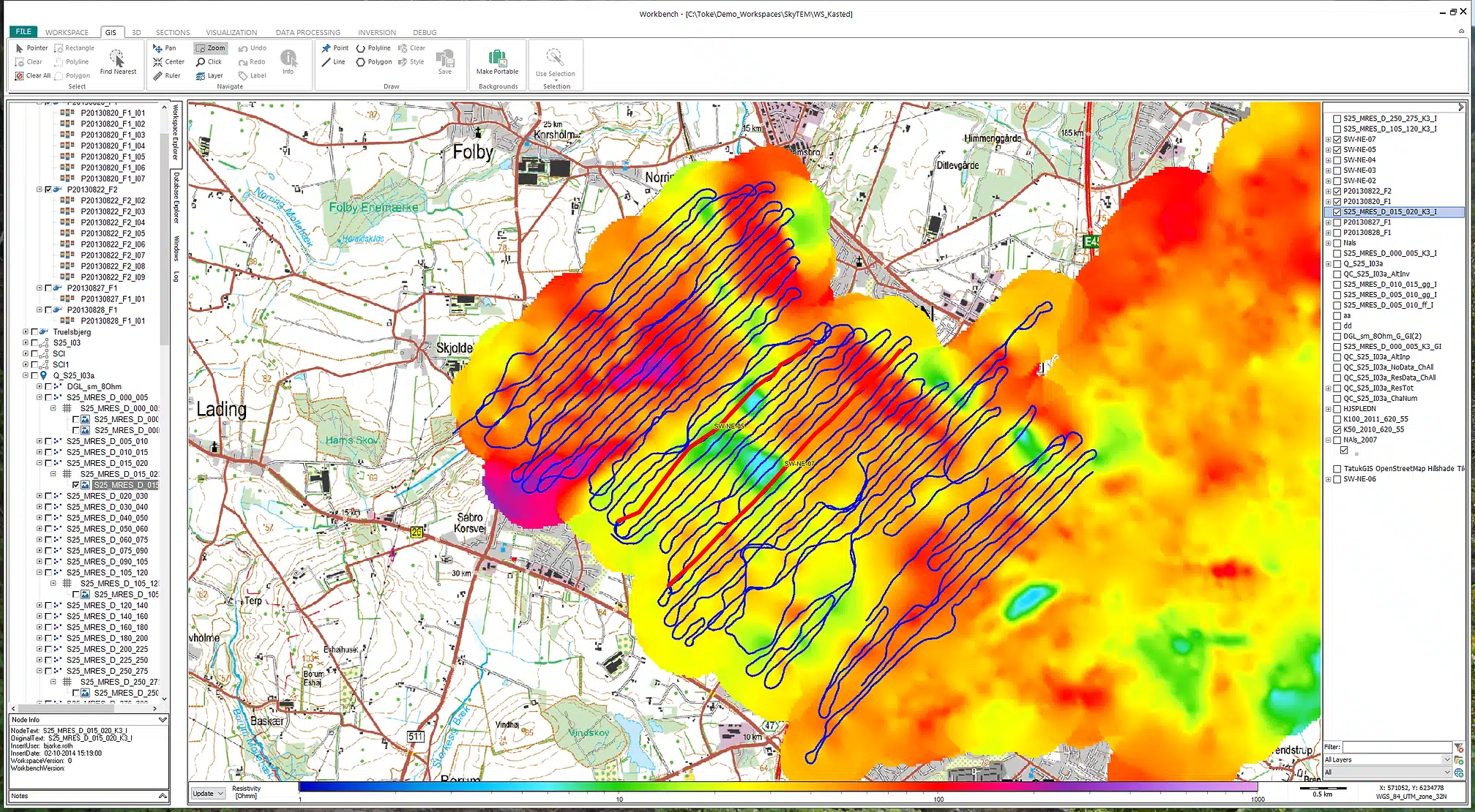
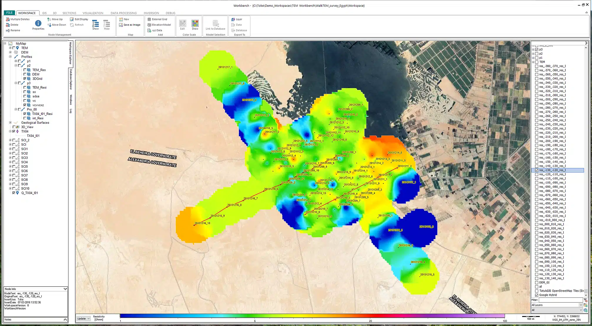
Developed around an integrated GIS platform, Workbench combines powerful processing and visualization tools, including the 3D Viewer and PDF Creator. The GIS platform is a core component of Workbench Essentials.
Key features
- Display data and model positions on a dynamic map.
- Display lithology logs and geophysical logs.
- Draw sections and add models, logs, grids, and images.
- Create and grid themes like depth/elevation slices, layer parameters, Depth Of Investigation (DOI), and more.
- Create QC point themes to evaluate inversion models and parameters.
- Add background maps, images, DEMs, shape files, and other georeferenced data.
- Select data subareas for inversion setup.
- Linked to the 3D Viewer and processing and visualization tools for locating and selecting data/models.
- Connect to a WMS, WMTS, or WFS server to add background maps via the internet.
- Support for all EPSG coordinate reference systems.
- Linked to the PDF Creator for easy PDF report creation.
- Draw points, lines, and polygons, and save them as shape files.