


See what’s new in Leapfrog 2022.1
Continual upgrades to your user experience include drillhole correlation tool improvements and the ability to visualise block model labels in 2D. You’ll experience faster workflows
Access upgrades to algorithms, performance, user experience and interoperability in Leapfrog 2022.1
This release of Leapfrog brings a suite of developments across the board to user experience, science and algorithms, performance improvements and increased interoperability. The latest
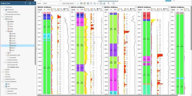
Improvements to the Drillhole Correlation Tool in Leapfrog 2022.1
Our popular drillhole correlation tool has seen major improvements to its interface to enhance its appearance and usability. Now you can add custom colourmaps and
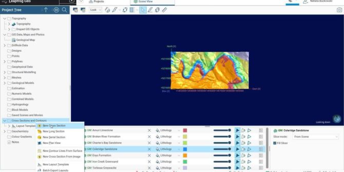
Add Plan View and Master Layout to Sections in Leapfrog 2022.1
We’ve made improvements based on customer feedback to improve workflows involving several serial sections, as well as stand-alone cross-sections. Now you can create a higher-level
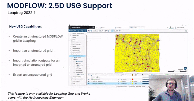
Improved Support for MODFLOW: 2.5D USG in Leapfrog 2022.1
Introducing a new, intuitive and interactive way to create quality 2.5D unstructured MODFLOW grids. Now you can define boundary conditions based on features within the
Visualising Block Model Labels in 2D in Leapfrog 2022.1
Expect significant improvements to Leapfrog’s scene visualisation technology with two important enhancements to block models - a 2D slice mode and the ability to have
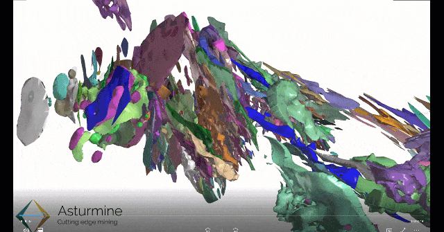
How resource estimation in Leapfrog Edge cut modelling time by 30%
Asturmine is a mining consulting company that switched from explicit modelling and manual data entry to a connected, dynamic workflow – improving sustainability and efficiency
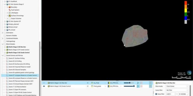
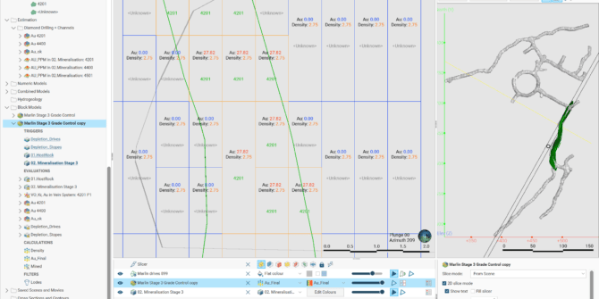
Grade control reconciliation workflows using Leapfrog Edge
Grade control is an important part of any mining operation. Seequent’s key products, such as Leapfrog Geo, Leapfrog Edge, Seequent Central, Imago and MX Deposit,