


A six-fold increase in the uranium price to more than US$60 per pound over the past three years has sparked a worldwide uranium rush. There are now an estimated 400-plus companies looking for new resources or reviving old plays that were abandoned when declining uranium prices stifled exploration in the 1980s.
The problem is, hardly anyone knows how to explore for uranium. There has been so little interest in the radioactive metal over the past few decades that a whole generation of exploration geologists has grown up without ever handling a scintillometer. The experts in the field are mostly retirement age or older.
Take Bob O’Dell, for instance. “They dug me up and put me to work,” the 80-year-old geologist told The Economist after being hired by Energy Metals, a Canadian uranium explorer, to consult on the company’s exploration projects in the U.S.
Younger geologists have a steep learning curve ahead. With that in mind, we provide a summary of the latest exploration techniques in the uranium patch.
Focus on unconformity-related deposits
The summary focuses on unconformity-related deposits, the most common of the 14 major categories of uranium deposit types. These deposits provide all of the uranium production from Canada, the world’s largest uranium producer, and comprise a major proportion of Australia’s resources.
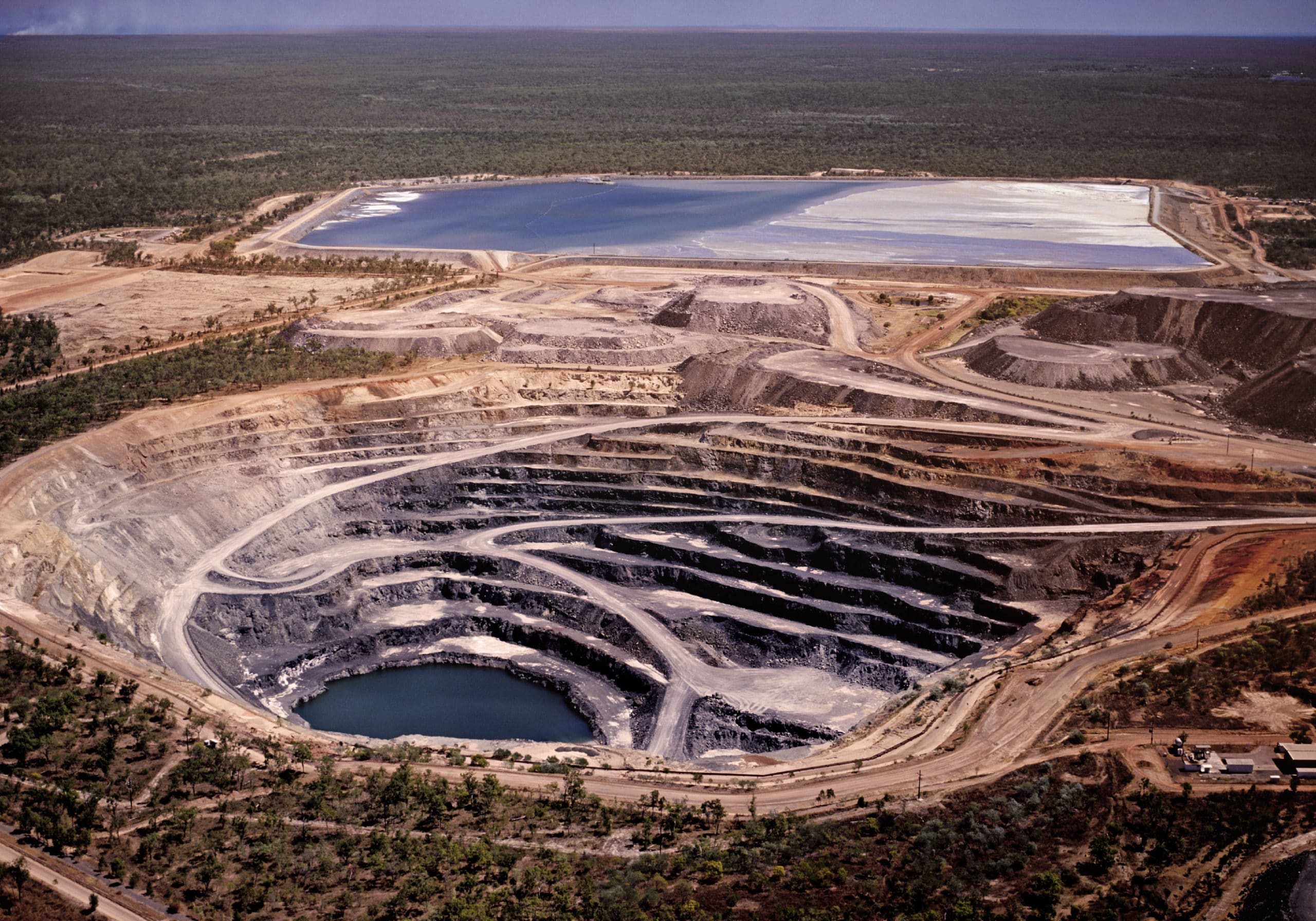
In the Athabasca Basin of northern Saskatchewan, the locus of current production and exploration, unconformity-related deposits are associated with quartz sandstones and conglomerates filling an oval-shaped basin that is about 1.5 km deep at its centre. The sedimentary rocks lie uncomformably over a basement of metasedimentary, metavolcanic and plutonic rocks.
Uranium deposits in the basin occur below, within and slightly above the unconformity and are associated with graphitic zones and major structures in the Archean basement. They tend to be extremely high-grade (more than 10% U3O8), but small, deep and difficult to find.
During the first wave of exploration in Athabasca, which was mostly surface-based, only about 20% of known uranium resources were uncovered. Finding the rest required advances in deep-penetrating geophysics and geological models. Even so, most of the finds were concentrated on the eastern rim of the basin, where the unconformity is at its shallowest.
Now, exploration is spreading throughout the 100,000-sq-km basin as a result of more sophisticated technology, even better geological understanding, higher uranium prices and recent exploration success in areas previously thought to have limited prospectivity. Uranium exploration expenditures in the province are expected to exceed $100 million in 2006 compared with $13 million just three years ago, according to Saskatchewan Industry and Resources.
Exploration Techniques
Exploration techniques currently being used in the basin are outlined below:
Area Selection.
Airborne geophysics has evolved to allow deeper imaging, opening up areas of the basin that could not be penetrated during previous waves of exploration. Modern techniques can detect targets under almost one kilometer of sandstone cover, a depth that would have been inconceivable just a few years ago. The resolution of airborne data has also improved – approaching or exceeding that of ground surveys – allowing direct drilling from airborne results.
High-resolution magnetic and electromagnetic (EM) surveys can detect basement features where they coincide with graphitic zones, the major marker for uranium deposits. For example, combined airborne GEOTEM electromagnetic and magnetic surveys over the Shea Creek area on the western rim of the basin identified several conductive zones at depths of 700 metres and greater that were successfully followed up with ground geophysics and drilling. A variation on GEOTEM, called MegaTEM, has approximately twice the output power and can detect even deeper conductors.
High-resolution gravity (e.g. FALCON by BHP) can also identify favourable structural features in conductive zones, and seismic surveys are being used to image the unconformity and related structural features.
Fugro is working on a new EM system called Tempest that has better resistivity resolution than GEOTEM and is expected to be well-suited for mapping zones of moderate resistivity with the sandstone that may indicate alteration.
Geochemical Sampling
After a prospective geological setting has been identified using geophysics to outline faulting and favourable lithologies, the area can be sampled using geochemistry on a reconnaissance scale. The background geochemical composition of the Athabasca Basin is low, so even subtle enrichments of key elements can be detected. The suite of pathfinder minerals includes U, B, Pb, Ni, Cu, As, Co, Mo, Zn, V and the rare earth elements.
However, the use of geochemistry is limited by the fact that unconformity-related deposits have a small footprint and usually occur at significant depths. The Athabasca area has less than 1% outcrop exposure and is covered by a layer of glacial drift up to 100 metres deep.
Because glacial overburden is so predominant, sandstone boulder sampling has evolved to detect distinct geochemical signatures, or alteration halos, associated with uranium mineralization. Studies of hydrothermal alteration around uranium deposits shows that these halos can extend upward into subcrop, sometimes through hundreds of metres of sandstone and, by extension, into the glacial till that overlies the uranium deposits.
As a result, boulder sampling has emerged as an effective means of finding alteration halos since lithogeochemical anomalies found in the boulders are almost as strong as those found in the subcrop, according to a paper on glacier boulder lithogeochemistry published in the proceedings of a symposium held in Regina in November 1989 (see references). Even when the signature is weak, improved analytical techniques with lower detection limits for uranium, boron and lead can be used to detect alteration.
According to Ken Wasyliuk of JNR Resources, a composite of sandstone boulders consisting of 5–10 of the largest, most angular boulders available at each sample station should be collected at regularly spaced intervals. The source of the anomalous boulders can then be traced back to the subcrop. The relative speed and economy of boulder sampling compared with other exploration methods make it a popular choice for defining the limits of alteration halos.
Drill core can also be sampled using a collection of 1–4 cm wafers at the end of each row in a core box and compositing them over a regular interval of 10 metres or so. This way, the average geochemical values for specific elements can be compared on a hole-to-hole basis to pinpoint areas of alteration.
Wasyliuk says the future of geochemical exploration in the Athabasca Basin lies in the development of surface sampling techniques that can detect mineralization directly. He adds that the programs will only be effective if combined with consistent sampling, analytical and QA/QC procedures, as well as adequate documentation and a better understanding of element movement and distribution in the near surface.
Ground Geophysics
Whereas ground EM surveys were once used routinely to follow-up airborne surveys with deeper penetration through the sandstone, they are now more often used to provide detailed assessments of targets of interest. Time domain systems such as the Crone, Geonics and UTEM EM systems are the most popular, while frequency domain systems such as Zonge and Phoenix are also in use. Both types are capable of deep penetration under conductive cover.
At Shea Creek, UTEM III moving loop array surveys identified a strong conductor. The subsequent drill hole in 1992, the third of the project, intersected a uranium-bearing shear zone at a depth of 705 m with a grade of 0.62% U3O8 over 0.7 m. Follow-up moving loop array surveys were instrumental in extending the conductor to more than 30 km and selecting drill targets. The Shea Creek’s Anne deposit is currently estimated to contain 47 million lbs. U3O8 at an average grade of 3% U3O8 and remains open-ended, while drilling continues to find new zones of mineralization.
New developments include array style EM systems such as Quantec’s Titan that are much more advanced in terms of data acquisition and subsequent processing. For instance, Titan can acquire magnetotelluric (MT) and induced polarization (IP) data concurrently, reducing acquisition costs on a per station basis.
Drilling
After targets have been identified by a combination of favourable geophysical and geochemical results, the next stage of exploration is core drilling. Targets are drilled until a deposit is located or the anomaly has been explained. Most of the alteration halos in the Athabasca Basin are, in fact, barren.
One of the most significant changes in technique as exploration pushes deeper into the basin is the use of directional drilling. Pioneered by Cogema at the Shea Creek deposit, the technique allows several intersections to be made from a single pilot hole, reducing drilling costs and improving target precision considerably. Core orientation methods are also used at Shea Creek and other exploration projects to better understand the geology and structural controls on mineralization.
Data Management
Exploring for uranium requires more data collection from drill core than any other commodity because the alteration halos around deposits can be so extensive, even if the target mineralization is elusive. Geoscientists must collect and interpret reams of structural, stratigraphic, petrographic, chemical, and spectral data from the core in order to determine if further exploration is warranted. This requires a sophisticated data management system.
“Most drill jobs have two geologists and a geotechnician, and the downstream work in managing and interpreting the data has to be within a software environment that is easy to use and flexible from project to project,” says William Kerr, vice-president of exploration and development for Denison Mines Corp., who uses Geosoft’s Target™ to simplify borehole data processing. “We use Geosoft to plot our compiled data at various scales for interpretation and presentation by the geologists.”
References:
Glacial boulder lithogeochemistry: An effective new uranium exploration technique in the Athabasca Basin, Saskatchewan; S. Earle, B. McGill, and J. Murphy, p94-114 from Modern Exploration Techniques; Proceedings of a Symposium Held in Regina, November 20 and 21, 1989: Saskatchewan Geological Society Special Publication No.10 Edited by L.S. Beck and C.T. Harper (1990).
MinExpo ’96 Symposium – Advances in Saskatchewan Geology and Mineral Exploration; Edited by K.E. Ashton and C.T. Harper; Saskatchewan Geological Society Special Publication No.14, Proceedings of a symposium held in Saskatoon November 21 and 22, 1996 (1999): Shea Creek – A Deep Geophysical Exploration Discovery; Rodney R. Koch and Frank Dalidowicz, p96-108 & Advances in the Genetic Model and Exploration Techniques for Unconformity-type Uranium Deposits in the Athabasca Basin: K. Wheatley, J. Murphy, M. Leppin, C. Cutts, and J.A. Climie, p126-138.
2006 CIM Uranium Field Conference: Athabasca Basin & Analogues: Geochemical methods in the Athabasca Basin – Past, present, and future. Ken Wasyliuk (JNR Resources Inc.). The author would also like to thank David MacDougall and Colin Card of Saskatchewan Industry and Resources.