


By Jocelyn Brown – Senior Marketing Manager, Environmental
Manufactured Gas Plants (MGPs) have left a legacy of coal tar contamination. A recent Illinois remediation project showed how 3D modelling with Leapfrog and OpenGround enabled faster, clearer, and more cost-effective site characterisation and planning.
Once symbols of progress in towns across the United States from the early 1800s to the mid-1900s, of an estimated 50,000 MGPs that once operated, many have left behind a challenging environmental legacy.
Built to produce gas for cooking, light, and heat by heating coal, a key byproduct of their operation was coal tar. Coal tar’s appearance belies the pungent, telltale smell of mothballs. It was often stored in underground brick tanks and, over time, leaked into the soil and groundwater. Today it is increasingly recognised as a mixture of compounds that may cause environmental issues.
The site: An old problem with modern risks
The main categories of contaminants associated with MGP operations are volatile organic compounds, such as benzene, a known human carcinogen with strong evidence linking it to an increased risk of leukaemia, and semi-volatile organic compounds, such as polycyclic aromatic hydrocarbons (PAHs) that make up tars and asphalt.
The result is a modern-day environmental problem born from a bygone era migrating through soil and groundwater, crossing property boundaries, and potentially threatening residential areas.
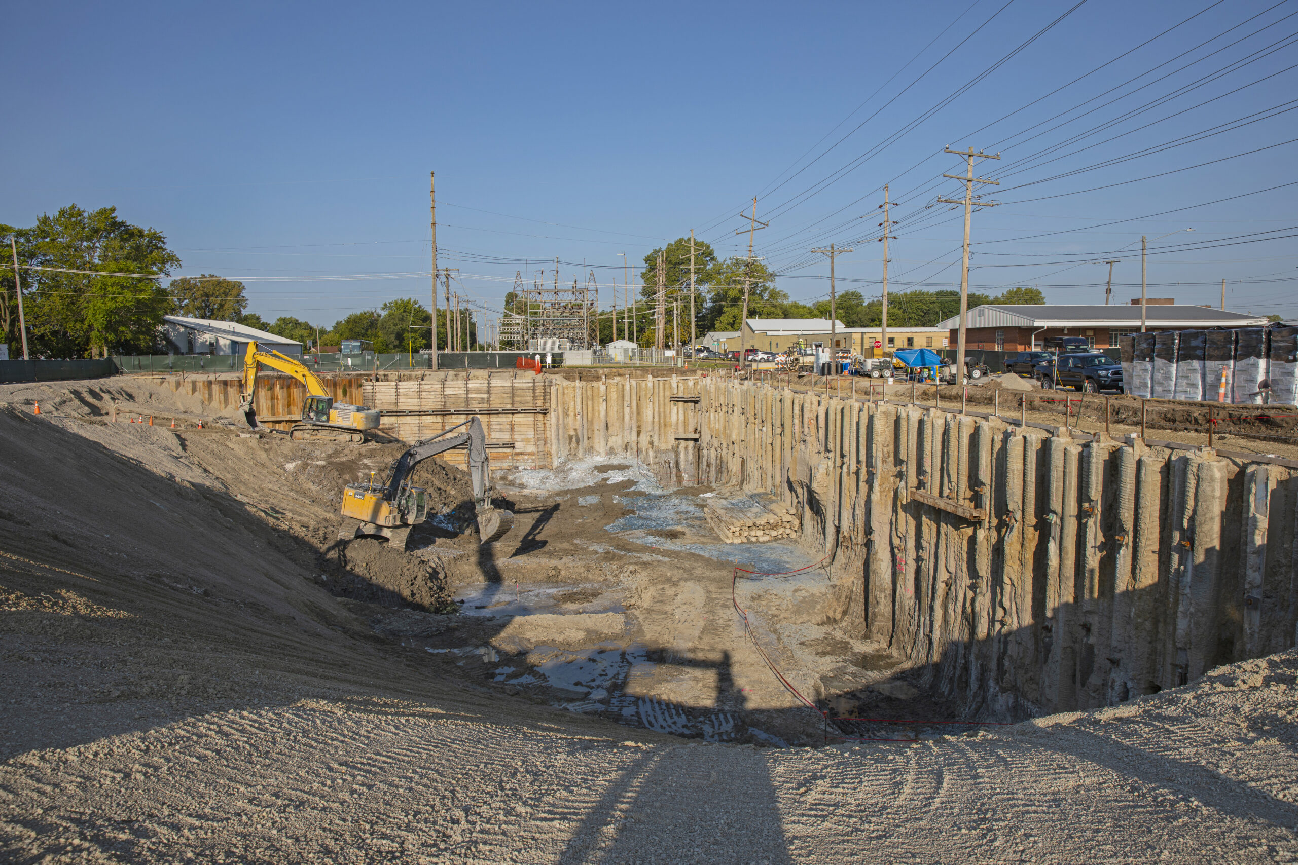
For one such site in a small Illinois town, the journey to remediation began when the property owner needed to perform an investigation and remediation before repurposing the land. The Environmental Services team at Burns & McDonnell were contracted to do the work. They knew the site’s history, but as Ben Lockwood, one of the project’s geologists, noted, ‘with these MGP sites, it’s challenging to know the extent. Some are more limited, and some are truly extensive.’
This one, it turned out, was closer to extensive.
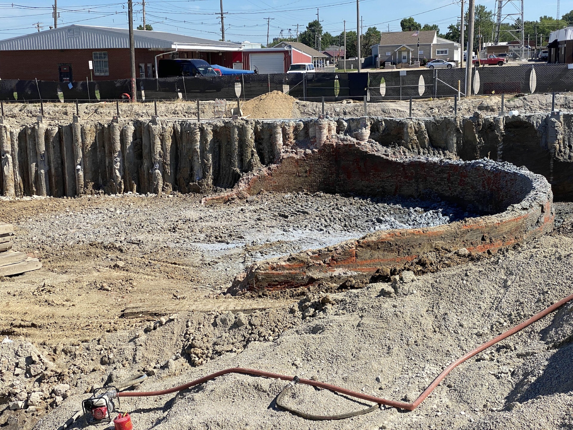
Figure 1: Early excavation gas holder in place
The challenge: A mountain of data and hours of waiting
Investigations and interim remedies completed in the 1990s and early 2000s by previous consultants confirmed the presence of coal tar contamination in the soil and groundwater. The team at Burns & McDonnell was brought in and tasked with conducting a comprehensive site characterisation and designing a remediation strategy.
The primary challenge was not a lack of data, but an overabundance of it. Over the span of the project life more than 360 investigation locations were completed to delineate impacts, remediate the site and confirm cleanup requirements.
‘Once we started modelling, it became apparent we had a lot of data and many different data types. We had soil borings everywhere,’ said Lockwood.
Using their previous modelling software, the process was painfully slow and inefficient. Data lived in various spreadsheets, requiring the team to consolidate data before manually filtering data to build the required model datasets. These datasets could change if a different subset of boring locations were to be modelled, or a different suite of analytes. The 3D modelling software was so resource-intensive that it would lock up the geologist’s computer for hours.
‘I had to generate data subsets and rerun models that took hours… I’d plan my day around it and run models overnight. If it failed, I would have to start the process again.’
This cumbersome workflow stifled iteration and made it difficult to gain a clear, confident understanding of the subsurface. The team needed a way to manage the massive datasets efficiently and visualise the complex interplay of contaminant migration pathways within the site’s stratigraphy.
The solution: A faster, more intuitive workflow with Leapfrog and OpenGround
Burns & McDonnell started to implement OpenGround, a cloud-based geotechnical data management solution and realised that Leapfrog, a 3D geological modelling tool, integrated with OpenGround data natively. The first step was centralising all the disparate data—including a vast amount from a high-resolution investigative method, TarGOST, that collects data every tenth of an inch down to whatever depth —into OpenGround. In total, the team had approximately 135,000 rows of data consolidated into OpenGround and available for modelling in Leapfrog. This immediately created a single source of data truth.
‘I enjoy having all the data in one place. The OpenGround integration with Leapfrog is fantastic,’ said Lockwood.
With the data connected, they began building a 3D model in Leapfrog, starting simply with the site’s geology. The tool’s intuitive interface made the process fast and engaging. ‘The interface is great,’ he noted. ‘There aren’t a lot of deep menus to dive through, which is really nice.’
As more data was added—soil borings, monitoring wells, and electrical conductivity data—the model came to life. The different datasets aligned perfectly, revealing a clear picture of the subsurface.
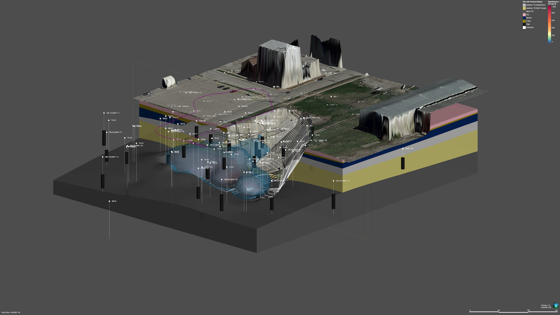
Figure 2: Excavation and in situ treatment areas with pre-treatment Napth plume in Leapfrog
In the model, the team could see the interaction between impacts and coarser grained ablation tills and how a tight, compact, clay-rich basal till unit acted as a groundwater barrier preventing further downward migration. This gave them immense confidence in their conceptual site model.
‘When we added extraction wells later, we were able to use this information to target their placement to maximise contaminant mass removal.’
The results: Unprecedented speed and cost savings
The impact of the new workflow was immediate and dramatic. The ability to rapidly process information and iterate on the model transformed the project.
‘With Leapfrog, I can pull in new data and rerun a model in about 30 seconds. I can iterate much faster and get to the right result sooner. It’s night and day different. It’s wonderful,’ said Lockwood.
This incredible gain in speed translated to significant cost savings. In environmental consulting, where time is money, the efficiency of the Leapfrog and OpenGround workflow delivered immense value.
‘Cost savings is the big one. What used to take six to eight hours now takes minutes of iterative modelling. That has significantly reduced costs.’
While the final report for the client still required 2D images, the underlying 3D model provided the team with unparalleled insight, allowing them to deliver high-quality results with a new level of confidence, speed, and cost-effectiveness.
A new standard for environmental remediation
This project proved to be a turning point for Burns & McDonnell. It demonstrated that 3D modelling was no longer a cost-prohibitive luxury but an essential, accessible tool for modern environmental remediation.
‘At Burns and McDonnell, we’ve always understood the value of 3D models, but they were perceived as cost-prohibitive in many scenarios… Now, having these products and workflows, they’re viable for more projects,’ said Lockwood.
By combining the data management power of OpenGround with the rapid visualisation and modelling capabilities of Leapfrog, the team turned a complex, data-heavy challenge into a clear, actionable plan.