


By Jocelyn Brown – Segment Marketing Manager, Environment and Energy
Why environmental and geotechnical teams must unite data and work as one to better manage risks in brownfield projects.
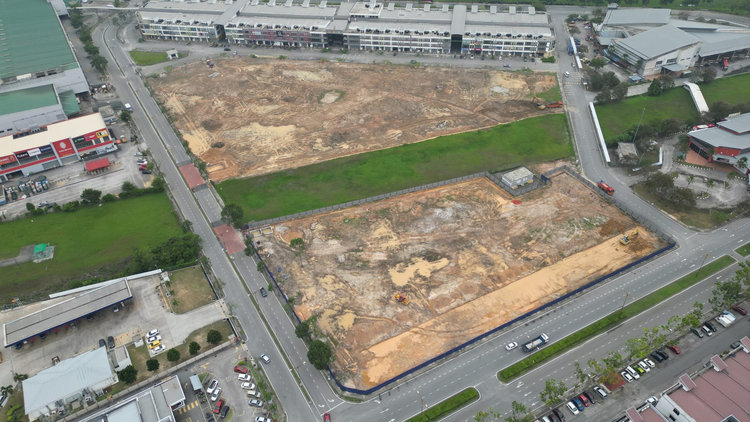
In the world of infrastructure, the most significant risks often lie hidden below the surface. Globally, the number one cause of budget overruns, project delays, and costly construction claims isn’t a flaw in design or a mistake in project management: it’s the unexpected discovery of adverse ground conditions.
This often happens on sites where both environmental and geotechnical teams have worked—sometimes years apart: environmental teams first, to assess contamination as part of the impact assessment, then geotechnical teams later, when the site is to be developed.
Even when they use similar or the same datasets, they can sit in different teams and reporting lines—so silos and inefficiencies emerge. Society is grappling with increasing urbanisation, ageing infrastructure, and resiliency challenges; we are resource-constrained, and therefore, we need to be more effective.
Managing ground uncertainty: Integrating site investigations to reduce risk
The solution is a fundamental shift in perspective. Accept that ground conditions are uncertain and construct workflows to reduce that risk.
The first step is integrating geotechnical and environmental investigations into connected workstreams. This means embracing an integrated approach where both are woven into the very fabric of the project lifecycle.
Too often, ground risk escalates in the gaps between disciplines: the investigation is scoped in silos and data is interpreted in parallel, meaning critical decisions such as excavation, dewatering, foundation type and materials reuse are made without a connected, holistic picture of the subsurface.
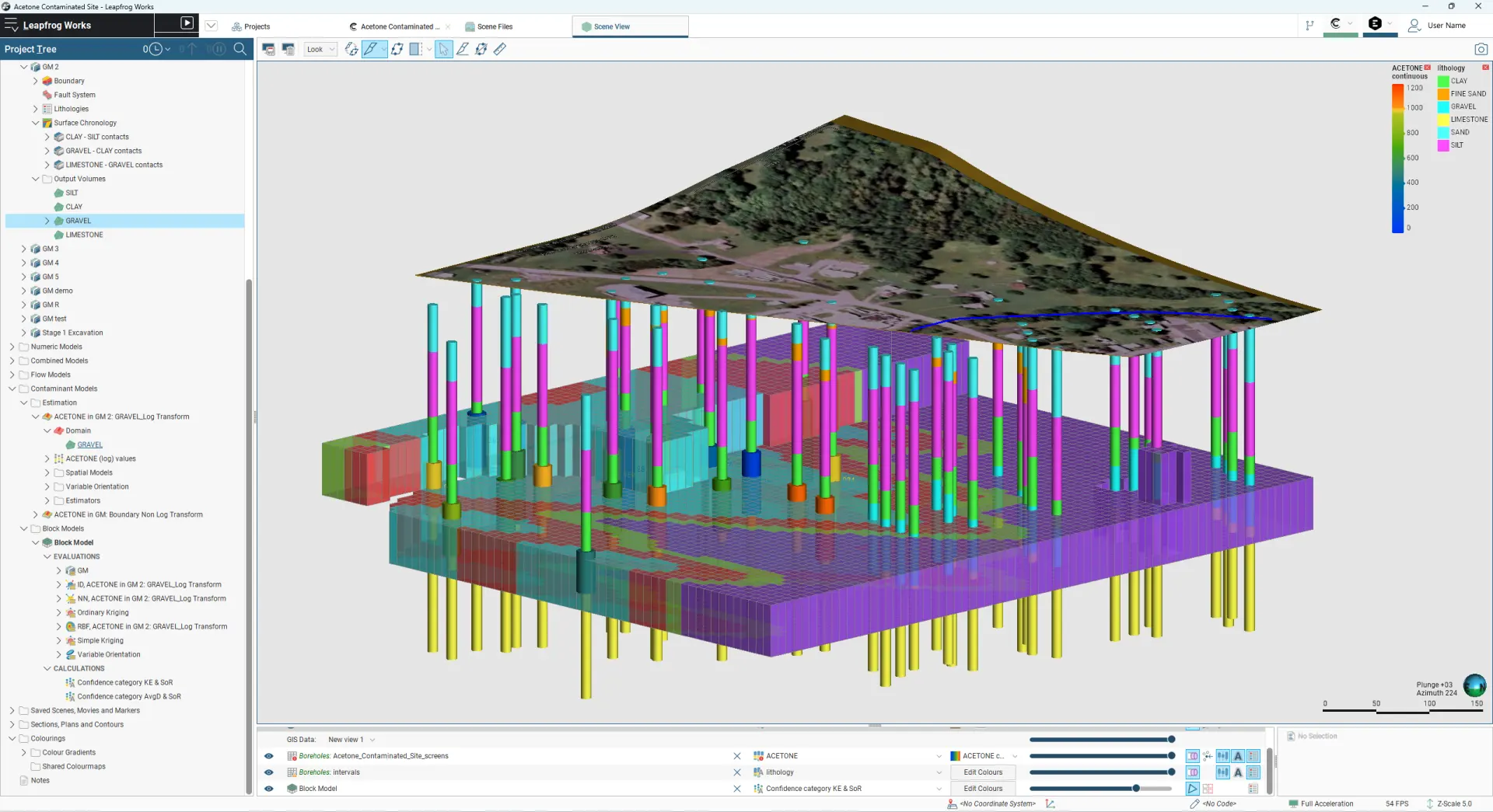
The key to an integrated workflow is a dynamic 3D model: the Conceptual Site Model (CSM). This becomes a shared understanding for environmental scientists, geotechnical engineers, designers, project managers, as well as the developer and authorities.
Additionally, it serves as an essential component within the Engineering Geological Model (EGM) framework, particularly when transforming brownfield sites for beneficial use. Thereby, bridging complex environmental, geological and geotechnical data and the need for collaborative, data-driven workflows of modern infrastructure projects.
Leapfrog Works | Contaminants Extension
Why a conceptual site model is the first, shared step in site development
Before any earth is moved, a CSM transforms uncertainty into a manageable, data-rich plan—but it works best when it is built and owned jointly by the entire project team. Services companies are increasingly realising the value of their environmental and infrastructure teams collaborating more closely to provide integrated, end-to-end services.
This holistic approach, powered by a CSM, is crucial for addressing project complexity and ensuring transparent communication with all stakeholders. Here’s why it’s indispensable.
1.Identify and manage hidden risks by further developing engineering geological models
An integrated CSM acts as a comprehensive health check, providing a worm’s eye view of the project site, providing the foundation for EGMs that reveal further critical risks that could otherwise derail a project.
Contamination: Previous industrial use, farming, or even a simple dry cleaner can leave behind harmful chemicals in soil and groundwater. A CSM helps pinpoint these contaminated “hotspots” for remediation before they pose a health risk, incur regulatory fines, or cause significant project delays.
Geotechnical Instability: Further developing the CSM into an EGM, the model clearly identifies engineering properties of different soil types, the depth to bedrock, and the location of the water table. This information is crucial for identifying ground risk, designing a stable foundation and preventing future issues like uneven settling, structural cracking, or flooding.
2.Guide smarter, more efficient design
A CSM is not just a risk management tool; it can be developed into a design tool that directly informs engineering and architectural plans, leading to more intelligent and resilient outcomes.
Design Aspect
How the integrated modelling framework helps
Example
Foundation engineering
Remediation strategy
Site layout
3.Save significant money and time
We know a 3D digital CSM has an upfront cost: our customers’ experience proves that it delivers a powerful return on investment by reducing financial and schedule overruns.
Prevents unexpected discoveries: Digging into a pocket of contaminated soil or an unknown underground stream can halt a project for months. A CSM minimises these surprises.
Reduces over-engineering: Without a clear model, engineers often must design for worst-case scenarios, which is expensive. An EGM allows for precise, efficient solutions tailored to the actual conditions.
4.Ensure compliance and build stakeholder trust
A data-driven 3D digital model is a powerful tool for communication, making complex site conditions clear for all stakeholders, and today, rigorous investigation for soil contamination is recognised as an essential prerequisite before any excavation begins.
Regulatory authorities often require a CSM as part of the permitting process, especially for former industrial (“brownfield”) sites, as formal proof of due diligence.
Furthermore, a CSM and its EGM derivative helps explain complex site conditions to stakeholders such as investors, community groups, and municipal planners, building trust and confidence in the project’s safety and viability.
The future is integrated and collaborative
The value is clear: an integrated environmental and geotechnical modelling framework alongside civil design aligns with a holistic, end-to-end workflow that clients demand.
This approach breaks down data silos, improves collaboration and adds immense value upstream in the project lifecycle—where contamination, groundwater, earthworks, and foundation design interact.
What this looks like in practice
- Integrated site investigation: collaboration on borehole/trial pit locations, sampling suite, geotechnical lab testing, and monitoring needs so that one dataset serves both risk and design.
- Build and maintain one shared data environment: updates in data stream to the models as it arrives, so there is a single source of truth.
- Interpret groundwater as a joint constraint: it affects contaminant transport, dewatering strategy, temporary works, and long-term asset performance.
- Align earthworks and materials reuse decisions: combine geotechnical suitability with contamination classification to reduce waste, cost, and programme risk.
- Connect remediation and design early: ensure foundation type, excavation support, and sequencing anticipate remediation constraints (and vice versa).
Purpose-built solutions are the best way to achieve these results.
Geology is not the built world; it is uncertain and understanding evolves as data streams into the site models.
Data-driven 3D geological modelling tools such as Seequent’s Leapfrog Works are instrumental in this process, for both environmental (contamination plume mapping, remediation and flow modelling) and geotechnical analysis (soil engineering properties and slope stability).
Seequent’s cloud-based platform OpenGround brings together all geotechnical and environmental data, connecting with Leapfrog for modelling and visualisation—creating a single source of truth that supports joint decisions, not just parallel reporting.
This single source of truth can be integrated into the design ecosystem, enabling teams with true end-to-end multidisciplinary subsurface visualisation for success—one that is secure, cost-effective, compliant, and environmentally sound.