


When Teck Cominco looked into making changes to their exploration technology, they quickly recognized that technology had already changed every aspect of how they collected, analyzed and shared their data for the purpose of exploration and making new discoveries. Everything from data collection and observations in the field to the style of notations was being dictated by how they anticipated using and integrating that data within their GIS system. And yet, like most mining companies, they didn’t have a global plan or strategy for how they used technology as part of their exploration workflow. Development of this strategy became a focal point for their newly formed Exploration Technology group established in January, 2006.
Alongside the technology revolution, was the data explosion. Millions of dollars were being spent on geophysical surveys, field mapping and drilling to support expanding projects with more drills than the company had ever had before on any one project. Much of this critical data, however, was still being used for short-term projects only, leaving its true value as a corporate resource unexplored.
Vast amounts of geological, geophysical and geochemical exploration data were shelved, or stored, in the corporate library on CDs, hard disks, maps, and old reports, some going back 50 years or more. Historical field results were often poorly indexed, and lacked the metadata required to organize them for future use. Despite a proliferation of tools, exploration data was still hard to find, use, and share between regional offices, horizontally across their operations, and vertically from exploration to resource calculation and engineering groups.
What struck Teck Cominco most, however, was not the size of the problem but the huge opportunity. As a growing company, Teck Cominco saw both the need, and potential, to establish a data foundation and collaborative platform that could provide their global teams of geoscientists with faster, better ways to process immediate prospects and develop opportunities for the future.
“With the explosion in the number of drilling projects being worked on, and the amount of data streaming through, we saw the benefit of having a global exploration technology solution that could scale to our growing data requirements, allowing us to share vast amounts of data across our company, and support our team-based approach to exploration.” Says Bob Holroyd, the director of Teck Cominco’s Global Exploration Technology Group.
The solution for Teck Cominco meant having one family of software that worked together seamlessly to capture, archive, deliver and ensure effective use of their data across the entire organization. Their newly chosen platform is based on ESRI’s ArcGIS system integrated with Geosoft’s Oasis montaj and Target to analyze borehole data and process geological, geophysical and geochemical datasets. The solution relies on Geosoft’s DAP server technology to archive data and make it accessible to geoscientists throughout Teck Cominco’s exploration offices worldwide.
“We selected Geosoft and ESRI technology because we saw a strong fit with our need to establish a solid data foundation, and company-wide standards for our exploration systems. Having worked with Geosoft for over 15 years, we had confidence in their ability to deliver a global solution” says Holroyd. “The interoperability of all our exploration software platforms is absolutely critical, and ESRI’s ArcGIS system together with Geosoft’s DAP data server technology, Target and Oasis montaj applications, gives us everything we need within one solution.”
Teck Cominco started to build its data foundation, within Geosoft DAP, three years ago, in its Vancouver headquarters, and the technology was implemented company-wide in 2006. The main considerations for deploying DAP were efficiency and time savings. While the company is still working to upload all of its data to the DAP server, their geoscientists are already saving hours, even days, by going directly to the server – instead of several different sources – to retrieve data.
The decision to standardize on ESRI’s ArcGIS system quickly followed. “Our previous GIS software was a great out-of-the box package – you could just load the software onto your computer and start working with it,” says Paul Roberts, a senior project geologist and veteran GIS user. “But it just didn’t scale to the level of our requirements for sharing data and developing teams of people working together on projects.” Roberts says the partnership between ESRI and Geosoft gave Teck Cominco the opportunity to move towards the enterprise solution the company had been looking for.
But it’s no longer just about the software, says Roberts, it’s about the workflow; understanding the way your geoscientists use the data, and how the technology fits with your global business needs. As a first step to forming Teck Cominco’s strategy, Roberts lead a company-wide assessment that looked at how they collected, used and extracted value from their data. Considerations such as what type of data should be collected and how it should be used and shared among geologists, ore reserve estimators and others was critical at this stage.
“We wanted to make sure this was the right solution for us, and we spent the better part of a year talking with geoscientists throughout the company, from field geologists to experienced GIS users, about their data needs, and how they used data as part of their jobs,” says Roberts. “Based on our understanding of how the data fits within our workflow, we see tremendous advantage in having a global solution that makes it possible for us to efficiently manage and direct the flow of data among our geologists when and where needed.”
The way forward, for Teck Cominco, has meant going back to the grassroots level. “We knew we had to change the way we plan our field programs to maximize the collection, archiving and storage of the most critical data, based on its use today and also how we anticipate using it into the future,” says Roberts.
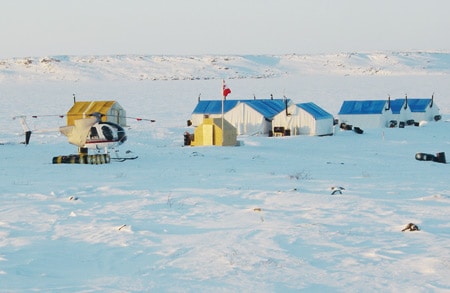
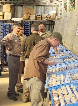
Developing and testing in-house field templates was a key building block of their global strategy. The standard global templates can be applied to any exploration project worldwide to record significant field observations such as lithology, mineralization and structural measurements, and they ensure that the right information gets into the system. “Using manually or electronically populated upload-templates has made the transition from the field to the data managers and a master database very efficient,” says David Donaldson, Leader of Geoscientific Information Services for the Exploration Technology Group. “We have used them successfully on projects in Mexico, Chile, Peru, Namibia and Canada.”
Ultimately, the company envisions growing its strategy to take full advantage of the huge innovations in technology, for workflow automation and data discovery from online sources, within a live Google Earth type internet interface such as Geosoft Dapple Globe Viewer, which was designed with geoscientists in mind.
Coming up with a roadmap to guide this new vision is a continuing challenge. The near term, especially when it comes to training and implementation, is well established, and with their new, global system in place the company will continue to work with Geosoft on their longer-term strategy.
One of the priorities is to fully populate the DAP servers so that they become the one-stop shop for exploration data they were designed to be. “Data can no longer afford to be shelved after the project. It has to remain live in a network setting on a server and be accessible for regional targeting purposes and evaluation of opportunities,” says Roberts. “That goes beyond going to the library and finding an old CD.”
Holroyd believes the resulting efficiencies and opportunities will stem from having trusted data at everyone’s fingertips. “We have no doubt that this global solution will have an impact on our business. It’s been said that our next ore body may well come from our own exploration files. The greater our ability to quickly and efficiently find and integrate that data, the better our potential for success.”
The potential benefits of having a global solution that allows data to flow seamlessly throughout the company’s regional offices are limitless. Decisions about whether to invest more in a project or leave it to rest will come much more easily. Projects in one corner of the world will benefit from tapping into data collected on comparable projects elsewhere. Geopolitical boundaries – once an obstacle to file sharing in geologically similar terrains like Chile and Argentina – will dissolve.
What does it all add up to? Much better odds of finding the Holy Grail of mineral exploration: an economic discovery.