


Oasis montaj Geology
Oasis montaj Geology extends Oasis montaj with tools for reviewing geological and chemical sampling data alongside geophysical results.
The extension allows drillhole data, chemical sampling results (geochemistry), and geological maps to be brought directly into geophysical projects. This enables geophysical interpretations to be checked against independent geological evidence, supporting interpretation validation, target review, and clear communication with geologists and decision-makers.
Oasis montaj Geology is used for contextual review and validation and does not replace dedicated geological modelling environments.
The Geology extension requires an active Oasis montaj licence and is available as a 12-month named or shared subscription.
Key Benefits
Validate geophysical interpretations using geological evidence
Oasis montaj Geology is used when geophysicists need to review geophysical interpretations against drillhole, chemical sampling, and mapped geology, without moving to a separate geological modelling environment. It provides geological context that supports interpretation confidence and decision-making.

Review geophysical results alongside geological evidence
Examine geophysical responses together with drillhole data, chemical sampling, and mapped geology within the same project.

Assess consistency with known geology or mineralisation
Check whether geophysical anomalies are consistent with observed geology, alteration, or mineralisation patterns.

Create combined geophysical and geological views
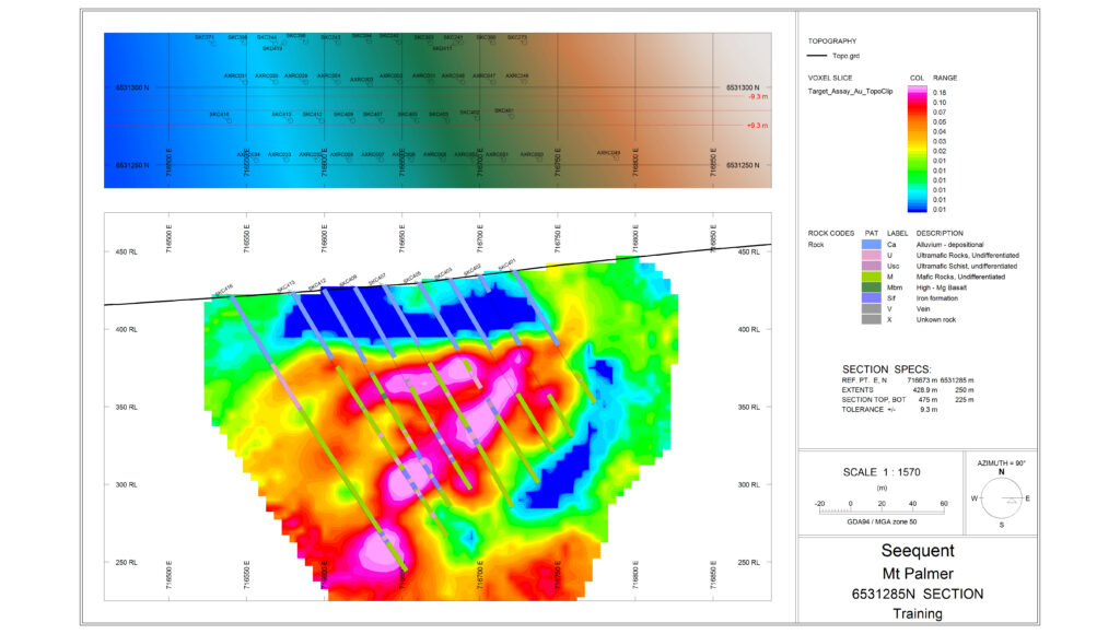
Generate integrated plan maps and cross‑sections that combine geophysical data with drillhole and geological information.

Communicate interpretations using shared geological context
Support collaboration with geologists by presenting geophysical results using familiar geological views and terminology.
Key Features
Supported methods and data types
Geophysical methods supported for contextual review:
Gravity
Magnetics
Electromagnetic (EM)
Radiometric
DC‑IP
Geological data types:
Drillhole data
Chemical sampling data (geochemistry)
Geological maps