


AarhusInv is high-performance modelling and inversion code that supports a wide range of geophysical data types, configurations, and source-receiver types. Its efficiency and precision make it ideal for modelling and inverting any airborne EM configuration, as well as ground-based TEM, GCM, ERT, MRS and TDIP configurations. Achieving high performance through efficient code parallelization, iterative sparse matrix solvers, and efficient memory handling, AarhusInv adeptly manages large airborne EM surveys in a single spatial constraint model setup (SCI) and harnesses multi-core CPUs. The AarhusInv inversion code is available through the Workbench and SPIA, but not as a standalone program.
Key features
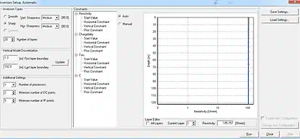
- Layer, smooth, blocky and sharp model descriptions
- Regular 3D grid model description with scatted data records
- Lateral and vertical constraints for any model parameter
- Prior constraints on any model parameters
- Joint or constrained inversion of different data types and methods
- Depth of investigation estimates (DOI)
- Cole-Cole and Maximum Phase Angle IP inversion
EM Inversion
AarhusInv uses a local 1D model description, with models laterally and spatially constrained to form pseudo-2D and 3D model spaces. The inversion code is designed to handle data from very big airborne EM surveys and supports multiple CPUs. Besides the resistivity models, the inversion code also calculates a depth of investigation value (DOI) and a data residual for each resistivity model. The inversion setups are:
- LCI-setup: Lateral constraints along flight lines for 2D model space.
- SCI-setup: The models are laterally constrained along the flight lines and across the flight lines, resulting in a 3D model space.
- TEM IP: A full Cole-Cole or Maximum Phase Angle inversion is available to model IP effects in the TEM data.
Inversion support
-
Smooth models: The resistivity model is discretized using several layers (~10-30) with fixed layer boundaries. The regularization penalizes vertical changes in resistivity using an L2 norm, resulting in a vertically smooth resistivity model.
-
Blocky models: The resistivity model is discretized using several layers (~10-30) with fixed layer boundaries. The regularization penalizes vertical changes in resistivity using an L1 norm, resulting in a vertically smooth resistivity model.
-
Sharp models: The resistivity model is discretized using several layers (~10-30) with fixed layer boundaries. The regularization penalizes certain sizes of vertical resistivity transitions, resulting in resistivity models with relatively sharp vertical resistivity transitions.
-
Layered models: The resistivity model is characterized by a small number of layers (~4-6). Both layer thickness and resistivity are model parameters.
-
Prior constraints: Customizable for any model parameter, initialized from grids, the GIS map, or specified at borehole locations with decreasing strength moving away from the borehole locations.
-
Depth of investigation (DOI): Derived from the Jacobian matrix for each model, standard and conservative DOI estimates are provided.
1D/2D ERT/IP inversion
For ERT data, a full 1D/2D Cole-Cole, Maximum Phase Angle, Constant Phase Angle, or Integrated IP inversions are available.