


Geoscience data is critical to exploration success, and yet spending more and acquiring more data have not translated into dramatically higher discovery rates. Exploration organizations are therefore seeking to maximize the value of their existing data, and technology, to prioritize opportunities and select the best drill targets.
As projects move deeper under cover, modern exploration scenarios require explorers to assess all the appropriate data on hand for the project to generate more insightful and accurate exploration models.
Real data, real solutions
Stories of data and discoveries were shared recently at the annual North American Geosoft User Group Meeting (UGM), held during the Mineral Exploration Roundup in Vancouver, B.C. “Intelligent Exploration” was the conference theme and more than 6,700 members of the global exploration community attended.
About 70 Geosoft customers gathered at the UGM to hear how fellow explorers are using technology to make the most of available data in diverse exploration situations. Examples range from visualizing diamond pipes in northern Canada to resource modelling in the Golden Triangle of British Columbia and breathing new life into historic data for a project in Cuba.
Multidisciplinary data compilation
Multidisciplinary analysis has become a hallmark of successful exploration. Discoveries become possible when large volumes of geological, geophysical and geochemical data from various sources are integrated and modelled to determine drill targets.
Tasked with managing data for Colorado Resources’ North ROK project near the Red Chris copper and gold mine in northern British Columbia, Alex Walcott, geophysicist with Peter E. Walcott & Associates, used the Geosoft platform from start to finish to integrate data and build project knowledge. The company has had Geosoft as its main exploration software since 1986.
“More than 80% of the data analysis was done using Oasis montaj and Target,” says Walcott “You can do anything with Geosoft, and then some, with a little creativity.”
In the case of North ROK, Walcott used Geosoft software during early exploration to create field maps and simple survey grids; for analysing geochemistry and geophysical modelling and processing as the project advanced; and finally for preparation of the resource model.
“Using a single software platform to integrate the North ROK project data kept the datasets consistent and updated. It meant we could reliably generate custom products for presentations, analysis and drill planning,”
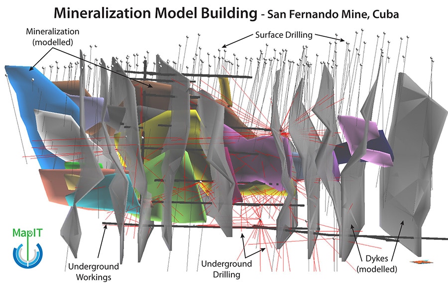
Paul Stacey, president of exploration data company MapIT, demonstrated his use of Geosoft Target to transform data dating back to the 1950’s into a reliable resource model.
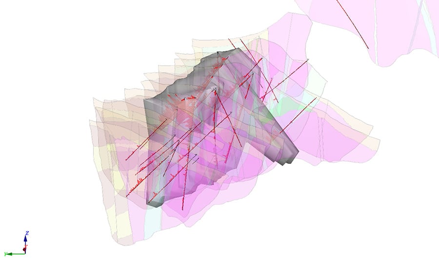
Using Target’s 3D wireframing capability, he combined drill holes, soil and stream sediment samples, geology maps, as well as historic mine plans and sections from a project near the San Fernando base metal mine in Cuba.
The wireframing enabled Stacey to apply his own expertise to the 3D models rather than rely on numbers alone. Blending old data with new, and physically connecting features and trends (joining up dykes, for example), he managed to generate a 43-101 resource estimate on a deposit that had not been mined since 1963.
“Other tools are available, but Target provides the most collaborative approach,” Stacey notes, adding that by using the free Geosoft 3D Viewer, he was also able to share information about the project with international stakeholders.
Deeper analysis
A careful, step-by-step approach to data processing can help explorers literally see deeper underground.
At Peregrine Diamonds’ Chidliak project on Baffin Island, in far northern Canada, previous exploration and modeling efforts were unable to predict the shape of a complex kimberlite body beyond 40 metres below the surface.
Peregrine turned to Campbell & Walker Geophysics Ltd. for some expert advice.
“The challenge was to produce an accurate model of a sparsely drilled kimberlite at depth for more accurate drill planning,” explains principal geophysicist Kit Campbell. “We used an iterative inversion strategy to perfect the model.”
The geophysics firm started with geologically unconstrained inversions, then used Geosoft VOXI to build constraints into the model, accounting for remanent magnetization, and adding spatial constraints and rock properties from drill data.
“The extra preparation took time but was necessary to get reliable results where previous approaches had failed,” says senior geophysicist Sean Walker, noting that “the inversions themselves took no more time than usual.”
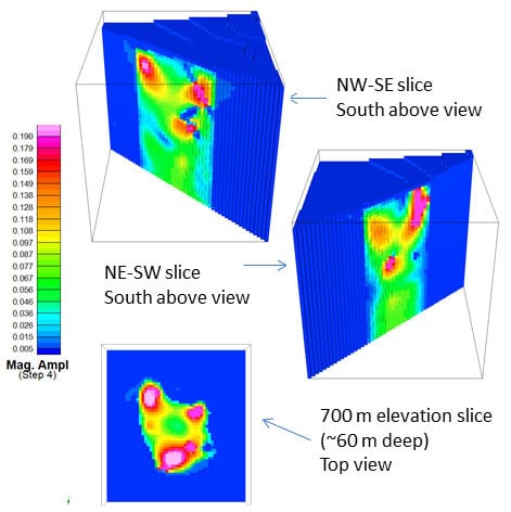
The resulting constrained Magnetization Vector Inversion (MVI) included all the available data and modelled the kimberlite bodies to 150 metres. Peregrine Diamonds is using the new models for drill planning.
Knowing what to leave out
Explorers seek to create the best models from the data available, and sometimes that means knowing what to leave out.
“The quality control tools in Geosoft help you find the problems in your data,” says Stacey, pointing out that the most challenging aspects of the San Fernando project was incorporating geochemical information from multiple sources, analysis methods, and time periods.
The robust, modern resource estimate models developed by MapIT for San Fernando have allowed exploration companies to make confident decisions about further work in the area.
A real benefit of multidisciplinary collaboration is that it brings explorers together to talk about different strategies for uncovering new mineral deposits and re-assessing old ones.
The takeaway: spend the time and effort upfront to fully explore your project data, and create the best possible exploration models. That is how modern discoveries are made.