


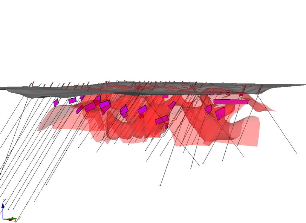
The founders of Insight Geophysics have deep roots in the past, but their approach to Induced Polarization (IP) represents the future of mineral exploration: real time interpretation of data, integration of non-geophysical information with 3D inversions, and a dynamic style of surveying that allows for tweaks on a day to day basis depending on feedback from the exploration team.
Their style is currently paying off along the Tireo volcanic belt in the Dominican Republic, where Insight has helped to pinpoint zones of gold mineralization on four separate projects, including GoldQuest Mining’s Romero deposit.
Most recently, chargeability results from a Phase 2 IP program allowed Precipitate Gold to narrow down drill targets at its Ginger Ridge project just south of the three million ounce Romero resource.
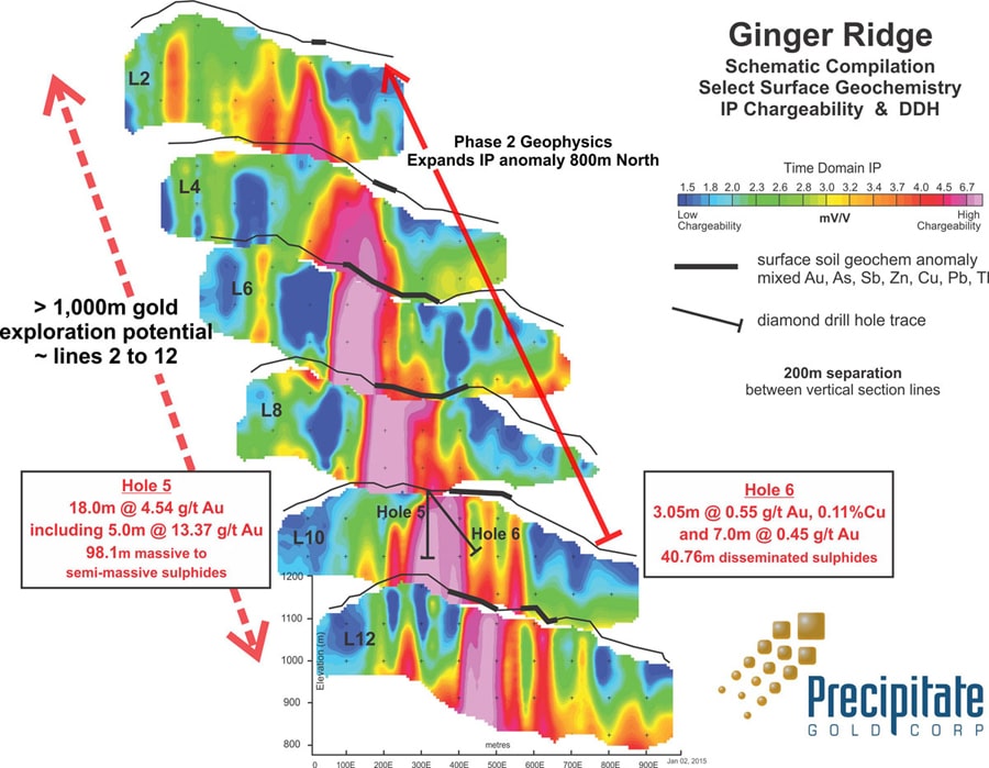
“The geophysicists working on the surface magnetics (Campbell & Walker) and IP (Insight) are using Geosoft software and providing us with high level final products that we can incorporate into all our geochemical and drilling data,” says Michael Moore, Precipitate’s VP of Exploration. “It’s all coming together, as we integrate the geophysics and geochem in preparation for more drilling.”
Insight partners Dennis Morrison, Craig Pawluk and David Dawson are former disciples of Phillip Hallof, considered the father of IP, having all worked with him at some stage of their careers. They founded Insight in 2002 partly in response to the deep discounting that was occurring in the geophysical consulting world at the time. They knew they had a unique and effective IP service they could offer clients while keeping costs affordable by using off-the-shelf technology.
Insight’s array is different from the conventional dipole-dipole array that Hallof invented because it has a higher signal strength, greater depth of penetration and can see through layers (such as water saturated clay) that can produce false anomalies in some cases.
“The only problem with Hallof is that he happened to be much smarter than the technology available at the time,” says Dawson. “When he passed away (in 1992), computers were just coming into use.”
Insight’s approach to exploration is also untraditional in that the consulting firm collaborates closely with clients, wringing information from a variety of geological, geochemical and geophysical datasets in order to find better targets.
“They used to lock the geophysicists in a room. You would stay there for 30 days to write your report, but you had no information about anything real,” recalls Dawson. “You would emerge from the room with a report that looked like a Chopin score. No one understood it or used it.”
How times have changed. For instance, during Insight’s tenure on the Detour Lake project in northern Ontario – as the gold deposit grew into a 600,000 ounce annual producer – Dawson was in constant collaboration with Detour Gold’s mine and exploration geologists. The three geoscientists worked seamlessly between Maptek’s Vulcan, MapInfo and Geosoft Target.
“It really is that fluid,” says Dawson of Target, which he has been using to produce sections since 1986. “We didn’t produce one piece of paper during that whole time.”