


Objective:
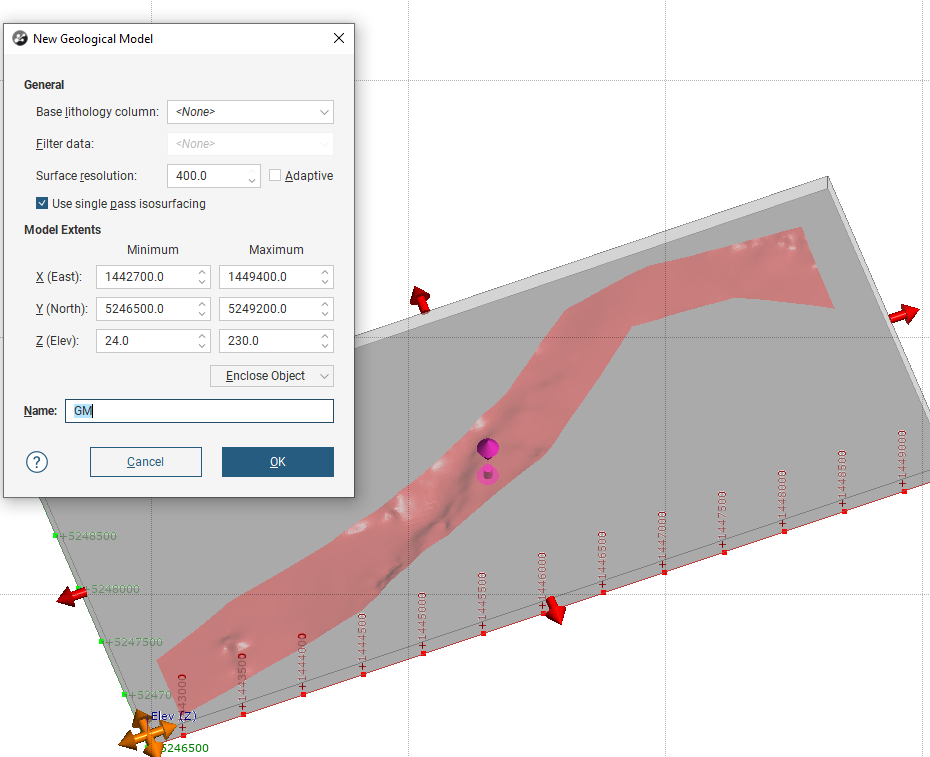
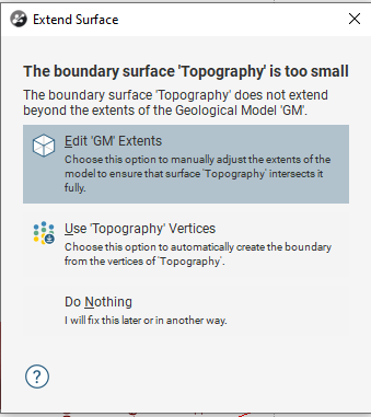
I have a topography that is to small to be used in my Geological Model and get an error when trying to use it. The Geological model is meant to be truncated against a boundary.
Resolution:
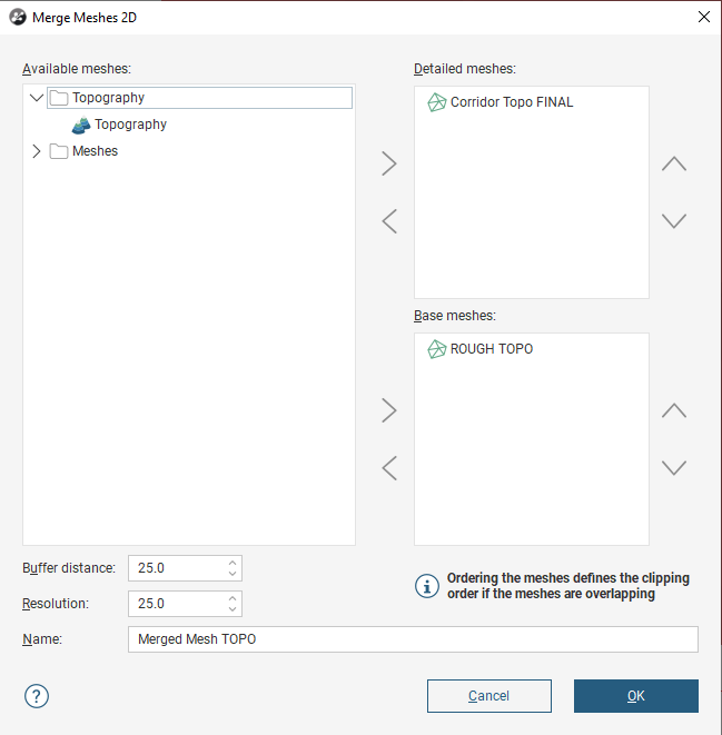
Using Merge 2D Meshes
- Create / Import a surface that is big enough to extend beyond the geological model extent.
- Depending on the topography various methods can be used. Flat surface, rough digitized shape.
- In Meshes->Mesh Operations->Merge Meshes 2D
- Select the big Mesh from step 1 as the Base (ex ROUGH TOPO)
- Select the detailed topo as detail (ex. CORRIDOR TOPO FINAL)
- If the detailed mesh has a messy edge, you might need to trim it using a clip function (Mesh Operation->Clip Mesh)
- If the detailed mesh has a messy edge, you might need to trim it using a clip function (Mesh Operation->Clip Mesh)
- Set up a reasonable buffer and resolution
- Use the new merged surface as the new Topography (or other surface)
- Apply Lateral extents as needed
Using Triangulated Meshes
- Extract Mesh vertices from the Small Topography
- Or use source material such as LIDAR points or contours.
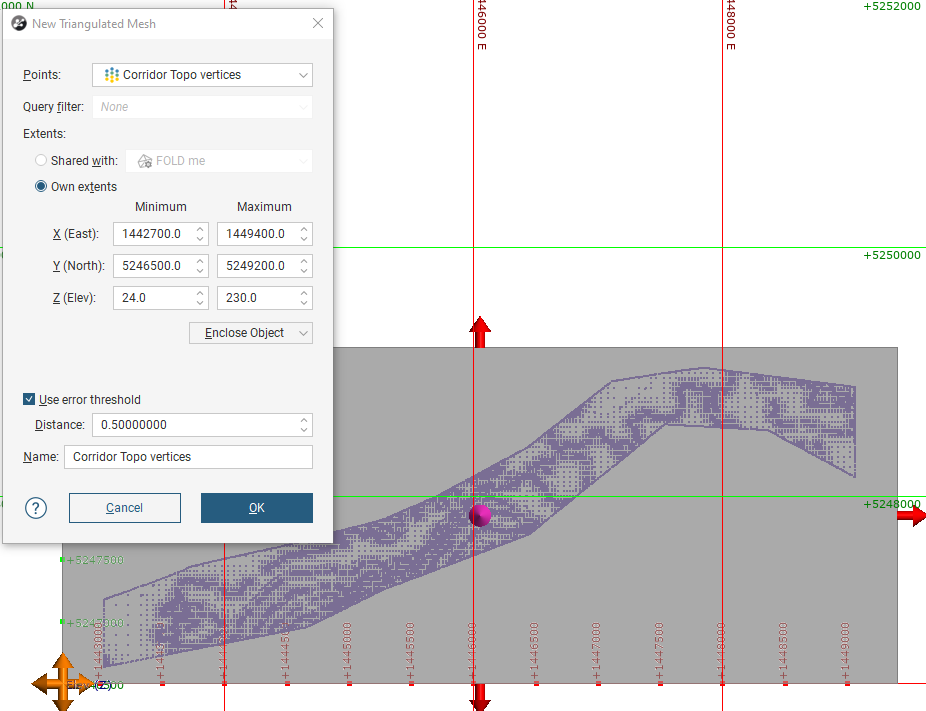
- Create a new Mesh surface, In Meshes->New Triangulate Mesh
- View the created mesh
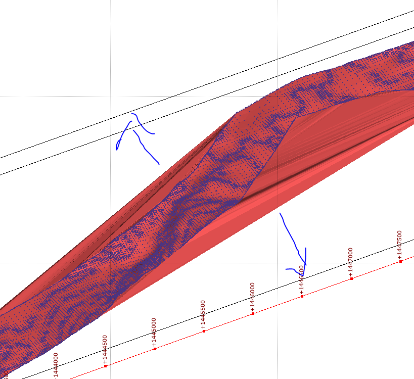
- Slice along the rough trend of the surface
- Edit Mesh (Right Click)
- Add a polyline around the extent of the geological model
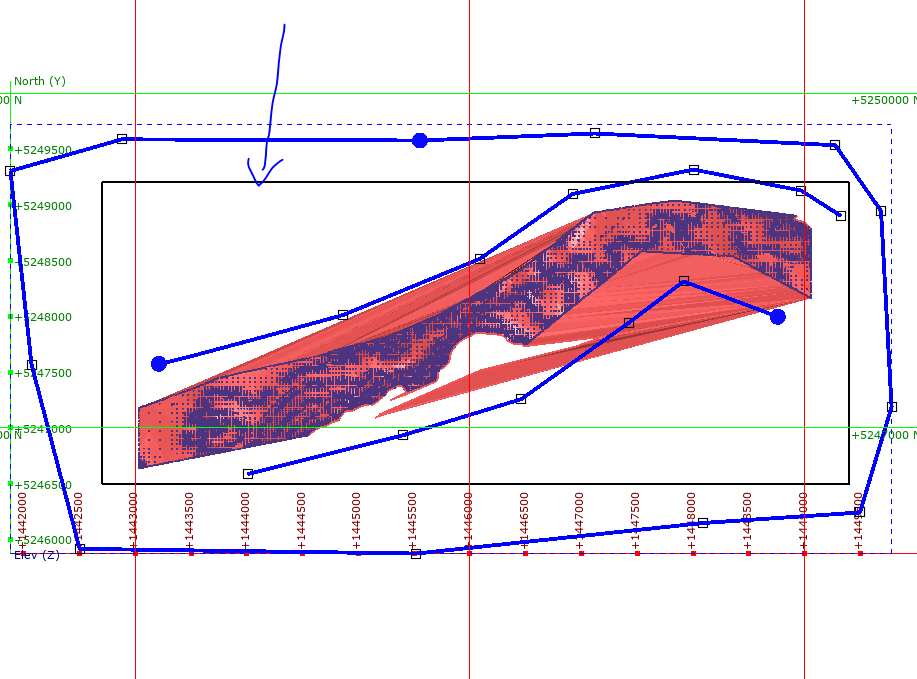
- If the terrain is varied, then multiple polylines may be better.
- Adjust the boundary of the Triangulated Mesh if needed. NOTE surface mush be bigger than the Geological Model Extent.
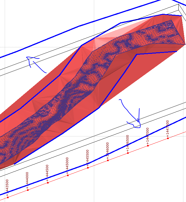
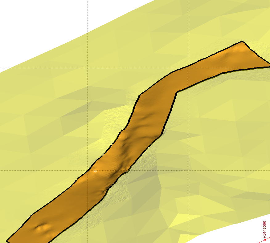
Surface is still to small. Needs to extend to the black outline.
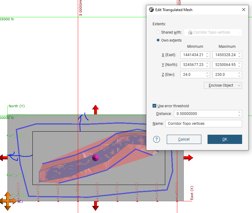
Editing boundary of Triangulated mesh
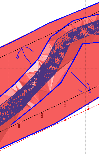
Surface is now big enough to be used in the Geological model.
Notes:
- Any static surface to be used as part of a geological model needs to be bigger (or exactly the same size) as the extent of the model it’s being used for. This applies to OPEN surface meshes. CLOSED meshes generally work if they are smaller.
- The workflow is similar if the raw data is imported.
- If you still want to use a limited topography as your topography object you can do this. Instead using the above created mesh as a lateral extent on any geological models. Removing the use of the topography.