The Pedirka Basin of central Australia remains a frontier for petroleum exploration. Straddling the border between the Northern Territory and South Australia, the basin has been explored since the 1950s, however the lack of early success combined with the high cost of mobilizing crews and equipment has hampered progress
In his paper Interpretation and modelling of the Pedirka Basin (central Australia) using magnetics, gravity, well-log and seismic data, Christopher Bishop, Senior Account Executive with Geosoft Australia, shows how low-cost gravity methods, using publicly available magnetics and regional gravity datasets, could help advance understanding of existing basin structures and uncover oil and gas potential.
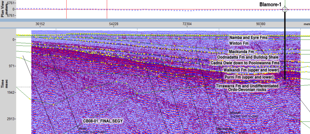
In the study, presented at the 2012 conference of the Australian Society of Exploration Geophysicists (ASEG), the use of high-resolution aeromagnetic and regional gravity datasets were integrated with sparse well-log and seismic data to achieve potential cost savings for exploration. All the potential field data and some seismic profiles collected for the project were publicly available, at no cost, from the Geophysical Archive Data Delivery System (GADDS) website of Geoscience Australia.
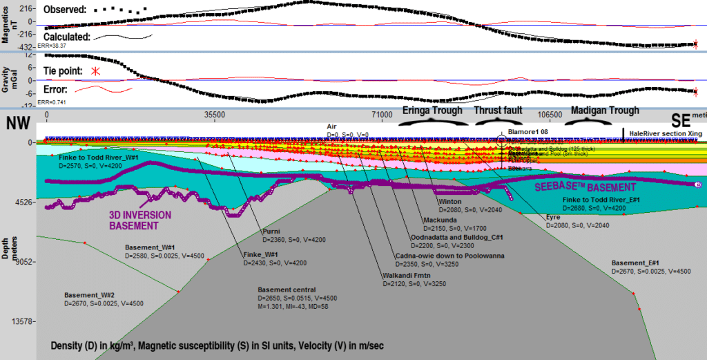
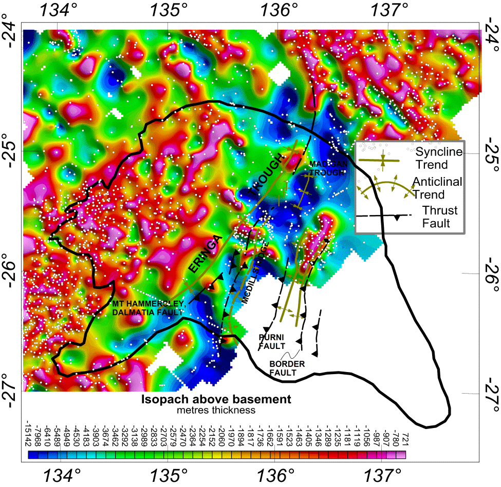
The gravity and magnetic data were jointly used to model geology sections, and estimate the total isopach thickness and depth-to-basement of the basin. The gravity data helped to propose the density of modelled sedimentary units. Total magnetic data was used in 3D inversion, generating depth-to-magnetic basement models and utilized on the 2D section to corroborate basement horizon. Key sedimentary horizons were traced using time-based 2D seismic sections and these in turn were converted to a depth section.
Methods of interpretation included the use of GM-SYS for profile modelling, Euler Deconvolution for depth to basement analysis, and VOXI Earth Modelling for geophysical inversion.
“With the potential field modelling I found the integration of differing types of data, and the multiple methods of interpretation to be extremely valuable,” says Bishop. “The most significant finding was the wide range of modelled velocities, densities and magnetic susceptibilities for the numerous sediment layers and basement units, with potentially a greater column of sediments than previously understood.”
The findings support the hydrocarbon potential of the Pedirka Basin and indicate possible sites for further investigation, while also highlighting the risks in successful detection.
The cost-effective methods used in the study provided insight into the depth-to-basement estimates of the Pedirka Basin – insight that can now be used to refine gravity-modelled sections down to depths not reached by seismic data or wells.