


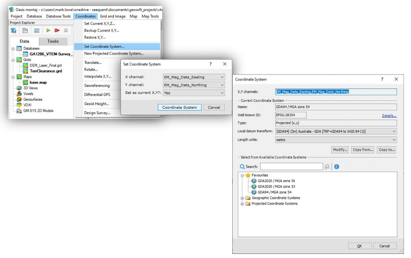
Oasis montaj’s coordinate system engine is a powerful tool that links a coordinate system to all types of data. This can be a coordinate pair on a database, a grid, a map view or a surface.
One of the key improvements in Oasis montaj and Target 9.10 is an enhanced Coordinate Systems dialogue for choosing the most accurate coordinate systems for your data. You’ll experience new coordinate systems, build you own local datum transforms, set favourites and search easily to find your datums and projections.
This blog will walk through the key advances to projections and coordinate systems – Upgrade to Oasis montaj or Target 9.10 to experience the benefit of these features yourself.
A new search tool
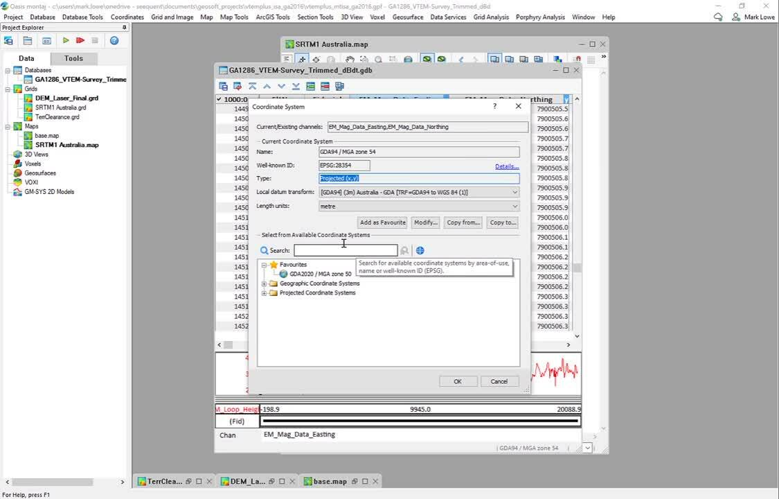
You may remember the dropdown search that was well-used in your previous workflow in Oasis montaj. As there are hundreds of supported projections in Oasis montaj this made it difficult to quickly select and choose the right projection. With this update, a 3-layered folder structure stores all the Coordinate Systems in an organised hierarchy depending on the Country location. This makes it easier to find coordinates that are unique to your part of the world.
The powerful new search tool allows you to quickly pick your coordinate system from the hierarchy. Start typing and the search will converge on the required coordinate system.
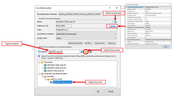
If you select the wrong system, simply choose the reset icon to go back to the starting parameters.
Favourite your frequent projections
One of our most requested customer features has been for users to be able to specify a favourite coordinate system. We are pleased to be able to save your time by easily selecting the ‘star-add’ icon to set your favourites.
More visible details
There are now more accessible coordinate system properties. If the Well-known ID (WKID) is known, it will be displayed on the Coordinate System dialogue. Choose Details… to show the expanded parameters of the selected coordinate system. This reduces ambiguity in your located datasets.
Set Your Local Datum Transforms
You can now interactively set a new projection for a local mining or infrastructure scale site. In the Modify Coordinate System menu, choose the dropdown at Local Datum transform and choose new to apply translation, rotation and scale factor.
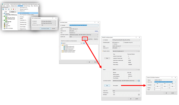
Provide your own local datum transform, Build and save local projections for sharing your projects.
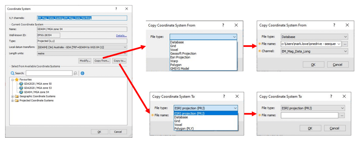
Apply details to other features from one location
Use the new Copy from… and Copy to… tools to link your coordinate system to another data type. This can include projection files but also database channels, grids, voxels and polygons. The same option can be used to set a new projection for data that is different to the current selection using the Copy to… tool, reducing duplication in your workflow.
Additional coordinate systems
You may have recently started using new projections and geographic coordinate systems that have been released by government and international bodies to reflect changes in satellite resolution and tectonic movements. These projections have been added to the new searchable hierarchy and include Australia (GDA2020), Papua New Guinea (PNG94), Global (Mercator, Cassini, Laborde Oblique, Van der Grinten, Albers), Antarctica (Polar Stereographic), Finland (EUREF FIN).
See the video below on how to use the new tools to reproject a channel in a database:
We hope that you find the new tool useful and we look forward to hearing back from our customers on how we can continue to make Oasis montaj more effective and useful in your workflows as the world’s coordinate systems continue to change and refine.