


Delhi’s Metro, one of the world’s largest, is expanding through Phase IV, an ambitious engineering project to improve transportation and reduce air pollution in India’s capital city.
By Fiona Jeffreys
New Delhi has many charms but is an incredibly challenging place to drive an underground train line through. The new corridors need to pass beneath many existing structures including key government institutions, railway alignments, and densely populated areas, making construction complex.
‘The elevated corridors also run past prominent flyovers, crowded marketplaces, and more,’ said Rongali Srinivasa Rao, Delhi Metro Rail Corporation Ltd’s Chief General Manager of the Phase IV project. Obtaining all the necessary clearances and permits was ‘challenging.’
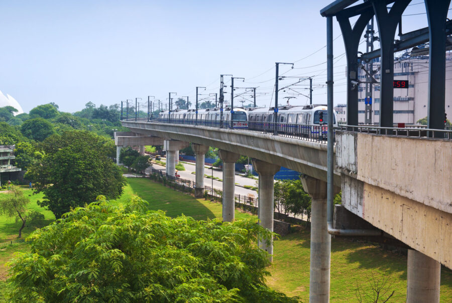
Delhi’s metro expansion aims to improve transportation and reduce air pollution by taking 180,000 vehicles off the roads per day
Source: Shutterstock
Cleaner air. Cutting travel times.
Getting cars off the road is a key pillar in the country’s determination to drive air pollution down. Extending the Metro could do that to the tune of 180,000 vehicles a day. Additionally, the project is crucial to Delhi’s economic growth, improving connectivity and cutting travel time for millions of commuters.
Vital to the success of Phase IV, which must connect to the existing Metro in multiple locations, was extensive monitoring of potentially affected structures to ensure their safety and inform decisions about the line’s design and progress.
The Delhi Metro Rail Corporate (DMRC) – a joint venture overseeing the expansion – realised that attempting to keep track of all the instrumentation data flooding in from such a large project would overwhelm traditional monitoring methods like paper, PowerPoint and email, and increase costs.
Such a fast-moving project would require effective digital project management. So, the project team decided to initiate an Integrated Project Management System.
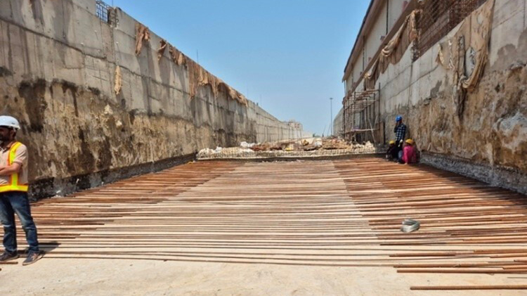
Delhi’s Phase IV Metro extension showing reinforcement work for slab concreting
Source: DMRC
Choosing the right digital solutions
‘The goal was to create a connected data environment where all project information, including schedules, 3D models, and the cost and schedule of values, could be integrated into one common platform,’ said Rongali.
They also specifically wanted a solution that could capture and connect forest clearance, utility shifting, and land acquisition issues to the schedule.
‘Given the distributed nature of the project, we wanted a solution where all stakeholders, from contractor supervisors, to design consultants, to all the DMRC stakeholders involved in planning and monitoring, up to the CXOs reviewing projects, had one platform to give and get information on,’ he said. For this purpose, the team chose Bentley’s Synchro.
Additionally, the soil analysis, critical to informing the design of the station and the viaduct components, as well as maintaining the safety of fragile structures along the route, was carried out using PLAXIS.
Seequent’s PLAXIS can be used to perform advanced 2D finite element analysis of soil and rock deformation and stability. Ground-structure interaction, groundwater flow, heat flow, or seismic activity can also be considered.
50%
Improvement in MIS reporting productivity
15%
Reduction in project co-ordination man hours
~100
People’s time and effort saved across the project
Mitigating risks and improving decision-making with PLAXIS
While tunnelling projects pose unique challenges such as unpredictable geological conditions and complex construction methods, these very factors create opportunities for innovation and advancements in risk mitigation and project optimisation.
PLAXIS uses advanced numerical methods to help design tunnels, assess risks and predict tunnel behaviour under various ground conditions.
‘This is vital in urban areas where excavation could damage nearby buildings. PLAXIS can also automate damage assessments of a building due to excavation-induced ground movement,’ said Dr. Rajendra Bisht, an Application Engineer, Geotechnical Analysis, at Bentley Systems.
‘PLAXIS accurately models tunnel lining, reinforcement, and shotcrete, simulating strength and stiffness variations. This helps design ground support systems to withstand excavation stress, minimising ground movement,’ he said.
The software also models groundwater flow, preventing erosion and tunnel instability, and allows dynamics analysis for predicting tunnel behaviour during earthquakes.
‘Detailed models and analyses from PLAXIS aid in selecting suitable construction methods, optimising tunnel design, and anticipating issues, ultimately supporting risk mitigation and decision-making,’ said Rajendra.
Benefits of Delhi’s Phase IV Metro extension
Fewer vehicles: 180,000 vehicles taken off the roads per day.
Less pollution: Around 266,000 tons of pollutants removed.
Better water security: Rainwater harvesting and IGBC green certifications for all stations (Delhi is a classed as a water-scarce region with a very low water table).
Energy contribution: 35% of energy is generated through rooftop solar installed at stations. The total expected installed capacity is 8 MW.
Greening the city: Around one million trees to be planted.