


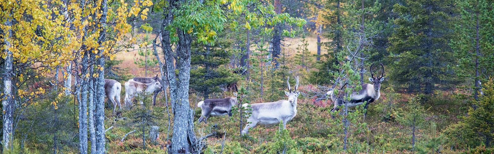
GPS points scatter as the helicopter’s hum gets closer – reindeer. Collaboration with herders may be helping shift mineral exploration in the European Union.
Recently, anti-mining protests swept the streets of Sweden and Portugal. Deep-rooted distrust of the mining industry isn’t quiet here. It’s a major reason why the EU imports nearly 100% of its critical metals.
“There are a lot of barriers to exploration, in the sense that there’s a lot of existing land use. The population density is quite high,” says Moritz Kirsch, researcher at the Helmholtz Institute Freiberg for Resource Technology in Germany.
“The cost of mineral exploration is higher. There are a lot of factors associated with that, and the public perception is not very good.”
His team is working to change that sentiment. If vital resources could be developed responsibly – both socially and environmentally – it would not only boost local economies but significantly decrease the carbon impact of importing.
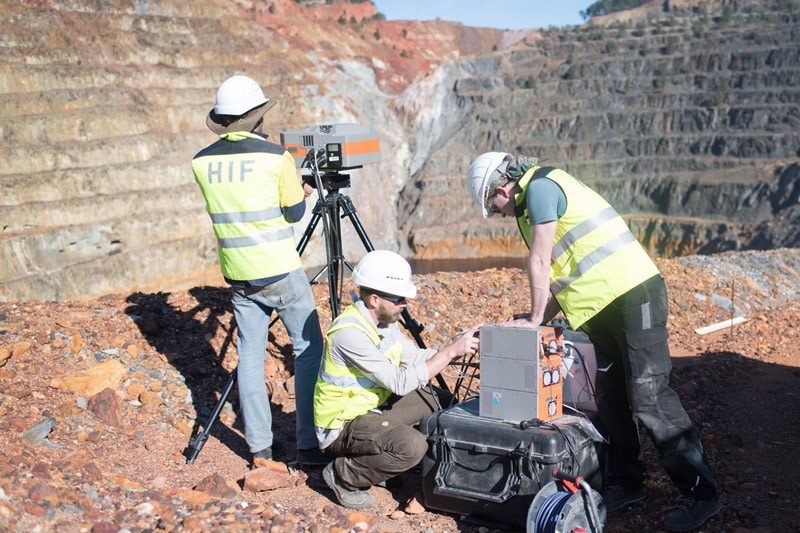
They are part of the EU-funded INFACT (Innovative, Non-Invasive, and Fully Acceptable Exploration Technologies) project. This project partners with research and industry to develop innovative, non-invasive exploration technologies and test them under realistic conditions.
Layering living data
In Finland, the airborne geophysical survey above began by consulting reindeer herders who steward the land – and the INFACT team got a surprise data set.
Reindeer are vital to the local way of life and survival. The herders’ main fear was that a helicopter would spook the animals. Luckily, the herders had their own technology.
Each animal had a GPS tracker and the INFACT team was given access to the data. Suddenly, reindeer became a data set.
By monitoring these important tiny dots, the INFACT team learned how much space to give the herd. They collected the electromagnetic data needed while minimising their impact on the herders’ way of life and the animals.
INFACT seeks to make upfront conversations like these a standard to prevent early negative experiences that can halt a project.
“People know us already. It’s good to be coming back to them, year after year, to tell them how the campaign is going and what additional data we would need to collect.”
Rebuilding bridges
“Fully Acceptable” means that local communities and stakeholders fully understand and partake in decisions that impact their environment. The long-standing distrust of mining has made investors reluctant to finance exploration in the EU.
A main INFACT objective is: “…nurturing a strong stakeholder dialog and communication throughout the project and beyond it. It aims in achieving a SLO (social licence to operate) for novel exploration techniques and consequentially their wide acceptance.”
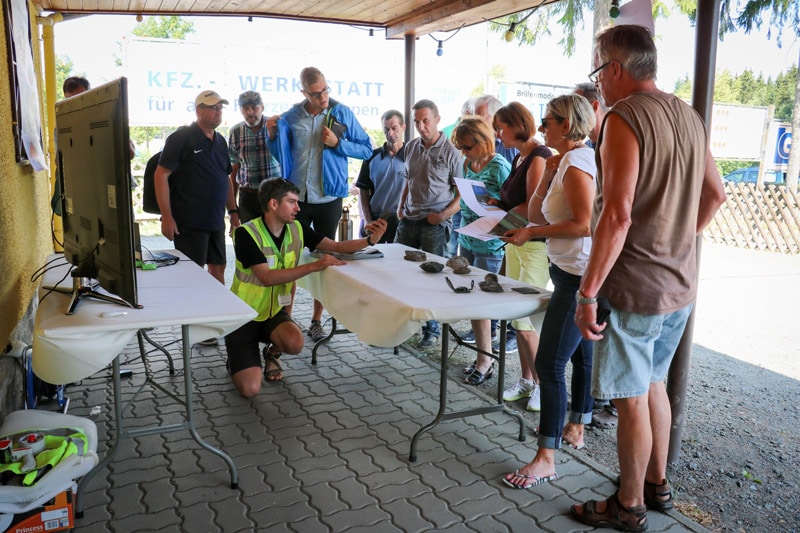
The first step is holding two-way conversations where both sides are heard and considered.
“As a researcher to be able to be in the field and talk to the local population… that what we do is sensible and in the in the long-term will benefit them,” says Moritz.
“To hear their criticism also or their concerns, and maybe being able to alleviate those concerns with facts and a bit of background has been very rewarding as a scientist.”
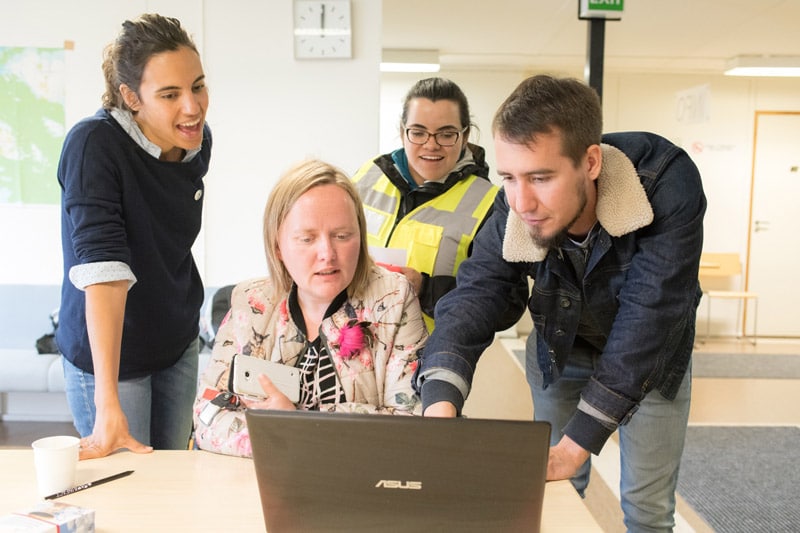
A seat at the table
In order to take part in discussions, stakeholders of all technical levels must understand the data and science behind it. Numeric tables, charts, and graphs rarely give everyone a thorough understanding of the decisions they make – or the risks.
INFACT is evaluating ways to communicate data to build community relationships and SLO.
“When we’re in the field and we’re meeting a farmer whose land we want to access… We can show them in the field: What kind of other data we have collected on the area, and how important it is that we go out and collect more high-resolution data,” says Moritz.
“We show them a 3D model using the Seequent View capabilities in a web browser to show them what’s underneath their house!”
3D geological and geophysical models get people hands-on with data. The colours and graphics bring data to life and give it real-world context – literally showing them what’s below their feet.
The INFACT team got a similar reaction when presenting their project with a group of professional engineers.
“People always go ‘Wow!’ when you when you show them a 3D model.”
Uncovering hidden minerals
INFACT is testing new technology not only to help develop resources, but to even find them at all. Most accessible deposits have already been discovered, which means future targets will be much deeper and more remote.
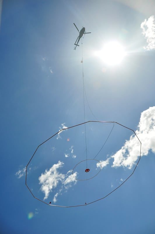
Geophysical sensor arrays strapped onto drones and aircraft have advanced non-invasive exploration techniques, and bring in valuable data from a distance. INFACT is working to refine, standardise, and optimise how this current technology is being used.
“We always use Oasis montaj, which is used by us for any pre-processing a variety of different data. And, since it is the industry-standard, it has been very easy to integrate different data coming off different sensors and from different data providers,” says Moritz.
Integrating all data and voices from multiple disciplines, builds the most complete understanding of a site – and offers new insights into where deposits are hidden.
“You can compare [geophysical survey data] to the geological model and see if any of the signals that you see correlate with alteration, with fault patterns. This is when it becomes really fun for geologists like me to actually see what it means geologically.”
The future of modelling
INFACT aims to benchmark technologies that are acceptable to society and, “that will invigorate and equip the exploration industry, and unlock unrealised potential in new and mature areas.”
For this purpose, three European reference areas were established in Germany (Geyer), Finland (Sakatti), and Spain (Minas de Ríotinto, Gerena).
“We flew a lot of reference surveys in these three sites that we call the reference areas where technology will be benchmarked in the future,” says Moritz.
“We’re also developing new processing algorithms for example, how to extract airborne induced polarity information from these airborne electromagnetic surveys.”
INFACT teams and their consultants see the power of combining data and expertise. They have built integrated geoscience models spanning disciplines and time zones using the Cloud-based technology, Seequent Central.
Tracking files, testing, and peer reviewing multiple ideas rapidly has helped them demonstrate how breaking down silos of information leads to more accurate models.
“It just made it so much easier because we could now make models that we could instantly share with our colleagues and they could have a look at it and comment on it.”
When everyone has access to the latest data, more informed decisions can be made in near real-time. As new ways to collect and analyse data hit the market, bringing it all together will be crucial to new mineral discoveries.
Community impact
Geology and data aside, the future of mineral exploration in the EU clearly depends on relationships. INFACT has knit together social scientists and technical teams to find a common language and integrate social information into their models.
“I think we’ve made progress in those two years, and it aligns our vision a little bit: trying to find best practices from a technological side but also from the side of social sciences.”
In the future, Moritz wants to make non-invasive, socially and environmentally acceptable exploration technology visible to communities and the industry.
“If we would hand out the certificates that it’s approved by INFACT. If that would gain a reputation amongst politicians and also the mining industry or the exploration industry – that would be the ultimate goal.”
INFACT hopes that positive awareness, built one community and standard at a time, will help the people and environment in the EU benefit from responsibly developed critical metals.
Header image: Reindeer in the Sodankylä area, northern Finnish Lapland. Credits: Moritz Kirsch (HZDR–HIF)