


Electromagnetic (EM) surveying is a technique that has traditionally been used to map mineral resources. However, in recent years EM has been embraced by governments and private organisations around the world as a faster and more cost-effective way of aiding groundwater mapping.
Geoff Plastow, Technical Analyst at Seequent, was involved in some of the earliest uses of EM to map aquifers in Canada and has watched its use expand rapidly.
In North America and many other parts of the world, governments, organisations or groups of local individuals may have some knowledge of the aquifers in their region, but it will be limited to what they’ve discovered by drilling into the earth.
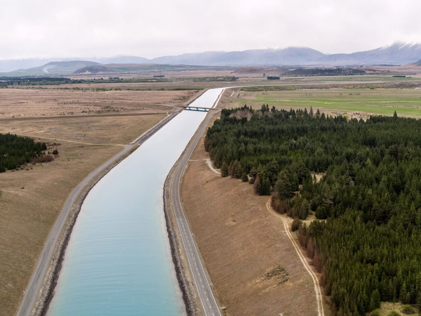
In some cases the groundwater can be at the surface, or it might be more than 100m below, but that’s about all they’ll know. They’re not aware of what else may be going on directly beneath their feet unless they actually drill there.
And drilling is challenging. It can be difficult, inconvenient, slow, expensive and comes with a number of environmental concerns. And what are you going to do to get more information? Drive every kilometre, drill a hole into the ground and analyse what you find? Across large areas, that’s simply impractical and would be enormously expensive.
So the practice of using geophysics and remote sensing to rapidly cover a survey area has considerable appeal, and its adoption has been growing significantly in recent years. EM surveys can be done from the air, cover large areas 50 or 100km (19 or 31 square miles) square in a week or two and there is absolutely no ground access required.
You can have a fast turnaround on 3D models of the subsurface, which means better-informed decisions can be made more quickly.
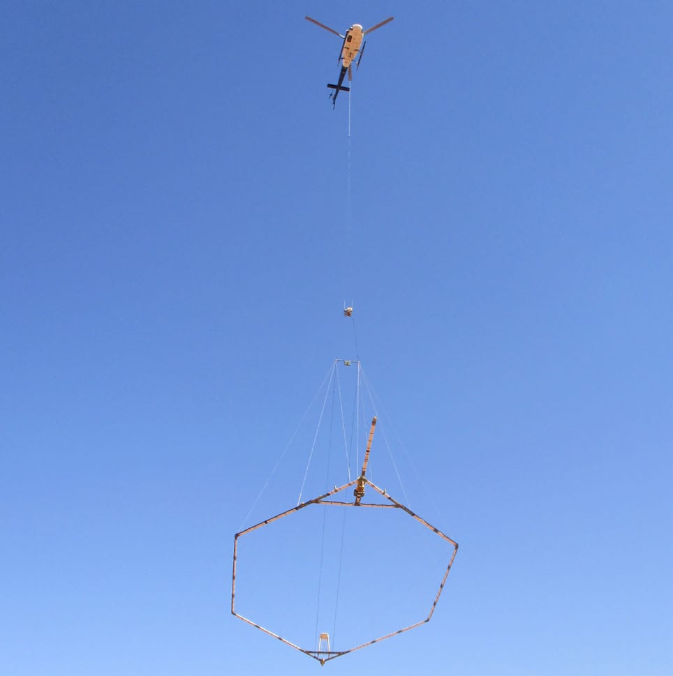
A helicopter view of the Earth’s resistance
Airborne surveys use a technology called TimeDomain Electromagnetics, which involves creating an electromagnetic signal that varies with time.
Equipment that resembles an extremely large hoola-hoop is towed under a helicopter as it flies about 100m (328 feet) above the ground. The equipment transmits an electromagnetic signal into the earth and depending on how resistive or conductive the earth is, we can use the returned signal to infer the nature of the subsurface.
Rocks will have different physical properties that will affect how the current flows, and that can tell us, for example, if there are clays or unconsolidated sediments present.
In the geophysical processing and modelling of the result we can derive a pretty realistic earth model of what is below our feet, and from that we can work with a team of geoscientists to assemble a hydrogeological model based on the resistivities and other known rock properties.
Time Domain Electromagnetic surveying (TDEM) uses induction to measure the electrical conductivity of the subsurface. The primary magnetic field created from a transmitter coil generates eddy currents in conducting bodies (including those beneath the surface). A receiver coil measures the secondary magnetic field from the subsurface, and it’s this that helps geoscientists establish the nature of the subsurface conductor.
This sort of EM survey has really become the gold standard of aquifer mapping, and the ‘deliverables’, if you like, will be a series of maps and subsurface models that infer where there are aquifer materials.
Predominantly it’s Oasis montaj that users turn to as their main geophysical processing and visualisation platform to plan, collect and do quality control on the data, then visualise it as an integrated geoscience dataset.
This incorporates geology, borehole data, geophysics and hydrological properties (the collective hydraulic characteristics of a soil or rock, such as the conductivity, permeability, water content, and pressure head, plus the interrelationships among those properties). It’s definitely a team process to build a full hydrogeological model.
“EM surveys can be done from the air, cover large areas in a week or two, there is absolutely no ground access required, and you can have a quick turnaround on 3D models of a subsurface aquifer material.”
Helping stakeholders see the water under their feet
Providing a hydrogeologist or a government or a farmer with that information is very empowering.
Some of those stakeholders will want the nuts and bolts of ohmmeters and conductivities; some will be government officials who want to be certain how far the aquifer extends under their land; but others are farmers who just want to know, do they drill 10 metres or 50 metres (33 feet or 164 feet) to get to the water they need?
And because of that survey, which may have covered thousands of kilometres in a matter of weeks, now we do know where the aquifer boundaries are, how deep it extends, whether it pinches out and is confided, whether there’s an impermeable layer and so on.
You can see the aquifer boundary under the earth, and that would never have been possible – certainly not cost-effectively – without this type of work. And while EM may initially have been used to support irrigation planning, it’s not just farmers using it today. Severe groundwater shortages in California, for example, are starting to impact people’s access to drinking water. The applications of EM surveying have grown and grown, and I think they are only going to continue.
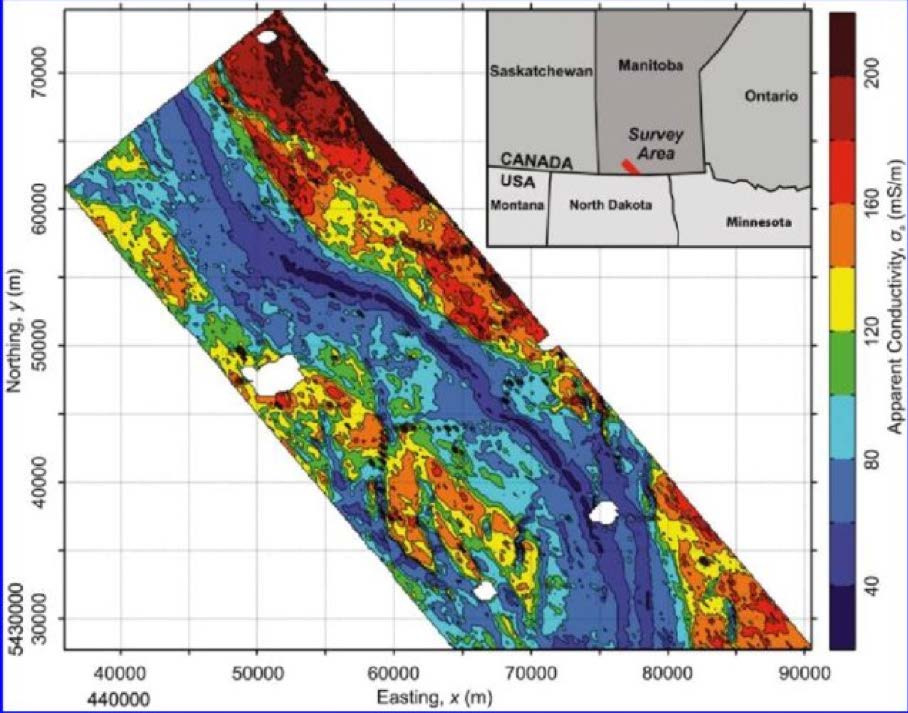
Figure 1 is from one of the first groundwater focused airborne Time Domain EM surveys done in Canada (2010). The image represents a depth slice through the earth 75m (246 feet) below the surface. The areas that are blue represent the buried valley and aquifer material. The areas that are red represent boundaries, interfluves, and nonaquifer material. Needless to say, the geophysical model is not only mapping the main extents and boundary of the Spiritwood aquifer, but all of the small deviations and interplay of the aquifer in the southern part project area. This type of detail would be impossible to achieve without aid of geophysical mapping.

Technical Analyst, Seequent.
Geoff is a Geophysicist with over 10 years of experience, in exploration and groundwater mapping, spanning five continents. Geoff focuses on delivering practical solutions to real-world Geoscience problems.