


Most visit Yellowstone to see geysers shooting into the sky, but Carol Finn PhD came to see what’s beneath them. By flying an airborne geophysical survey, her team uncovered surprises that have changed what we know about the park’s iconic thermal features.
“It’s really the most famous park in the world,” says Carol, a Research Geophysicist with the U.S. Geological Survey.
“We were flying in the off-season when there are no visitors, but the park is used to having a very, very high profile. So, we couldn’t have done this without Yellowstone National Park’s support.”
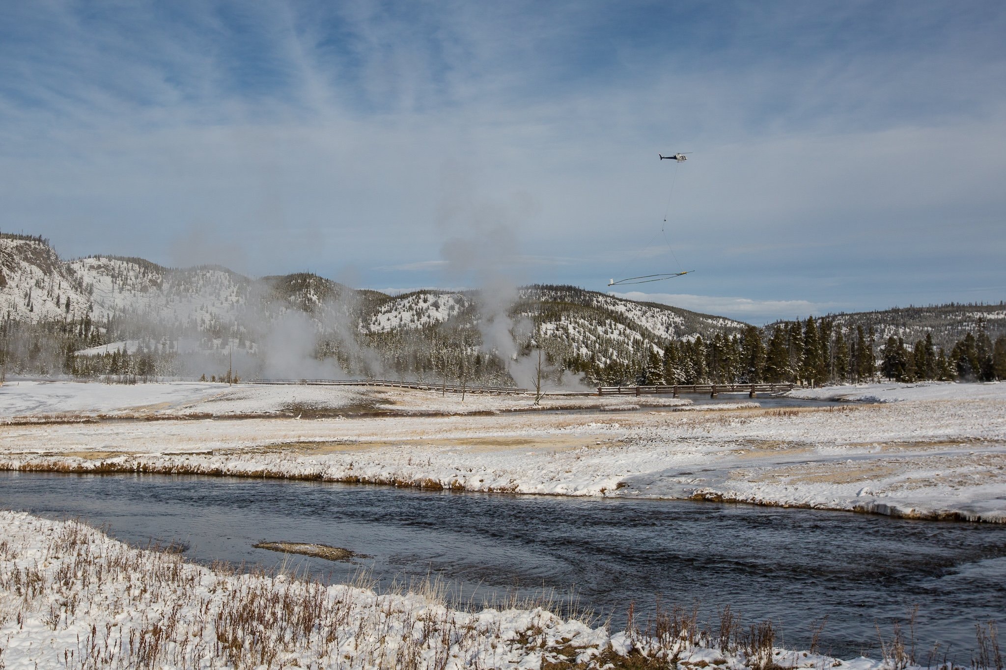
In 2016, a helicopter took off over Yellowstone with electromagnetic and magnetic survey equipment hanging below. The survey flew line by line across the park building a grid. It covered over 4,200km of line data from the air, all without touching the precious park.
“The electromagnetic instrument allows us to indirectly measure the electrical resistivity of the ground… The magnetometer measures the Earth’s magnetic field, and we can make corrections to obtain signals from the geology,” says Carol.
Their goal was to create a resistivity map of Yellowstone’s underground features. Different resistivity values help indicate different materials, primarily fluids, clays, volcanic rocks, and faults. The data would give them an idea of what was beneath Yellowstone, and where.
“The first cross-section we saw from the flights was over the Old Faithful geyser and we could see that the survey worked. We just didn’t know what the data meant.”
A helicopter flies over Yellowstone Park carrying geophysical survey equipment. Credit: Carol Finn, Ph.D.
The geysers’ water cycle
While Carol’s team hoped to gain insights into the geology of the park, no one expected the data’s revelations into the plumbing beneath its famous thermal features.
“I’m used to using the magnetic data on top of other volcanoes to identify big clay-rich areas as potential sources for landslides. So, I wasn’t thinking about them as indicators of gas and/or fluids rising from depth,” Carol explains.
“Being able to differentiate between cold groundwater and thermal fluids was a surprise. Being able to use the magnetic data to tell something about the hydrothermal system – I didn’t expect that.”
What she uncovered, now published in Nature, were the fluid pathways that drive the thermal features in Yellowstone. By comparing with data from a similar site in Taupō, New Zealand, Carol was able to interpret the new survey data.
“One of the things that I learned was to identify the fingerprints for this big hydrothermal system,” Carol says.
“There are kind of four ingredients for Yellowstone’s hot water or hydrothermal system: high precipitation, faults, magma and hot rock, and spaces between lava flows or sometimes within the lava flow itself.”
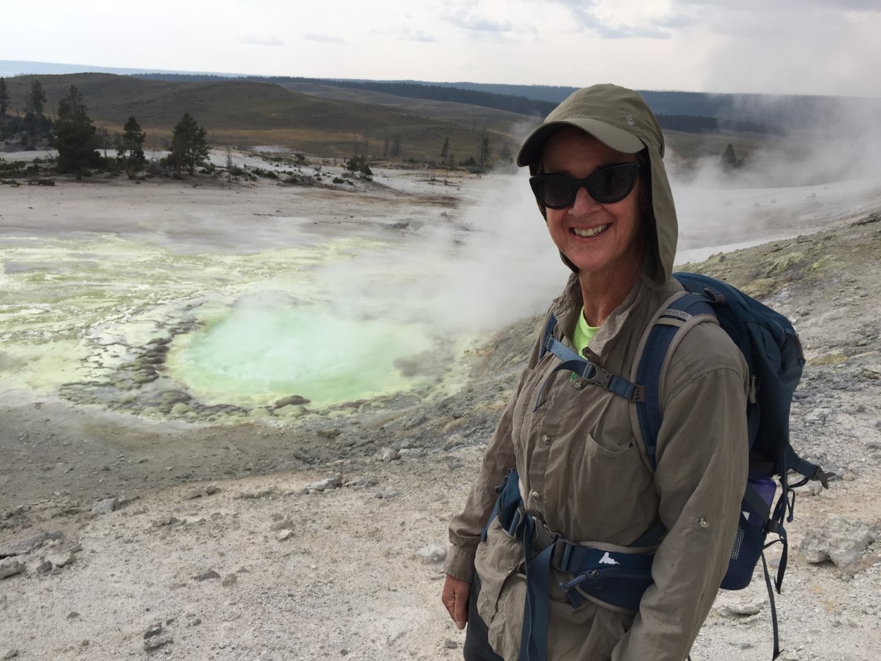
Carol at Sulphur Spring in Yellowstone, one place where the thermal waters from below break the surface. Credit: Carol Finn, Ph.D.
Yellowstone gets a lot of precipitation, which is where the system starts.
Faults (fractures) in the earth allow freshwater from the surface to go four or five kilometers deep. There, it gets heated which causes fluids to rise back up. On its way to the surface, this hot water interacts with the rocks – adding salts to the water and changing the chemistry of the rocks themselves.
The salts allowed Carol to distinguish between the freshwater and thermal fluids flowing underground.
“From our data, we can see the fingerprint of the freshwater, like snow melt, because its resistivity is higher than the thermal fluids.”
She could trace the thermal fluids as they came back up along the faults and flowed along lateral pathways before breaking the surface as thermal features in the park – like the Old Faithful Geyser or thermal ponds.
Carol’s data allowed her to see where and how the water flowed from the surface to the depths and back up again: a first for the park.
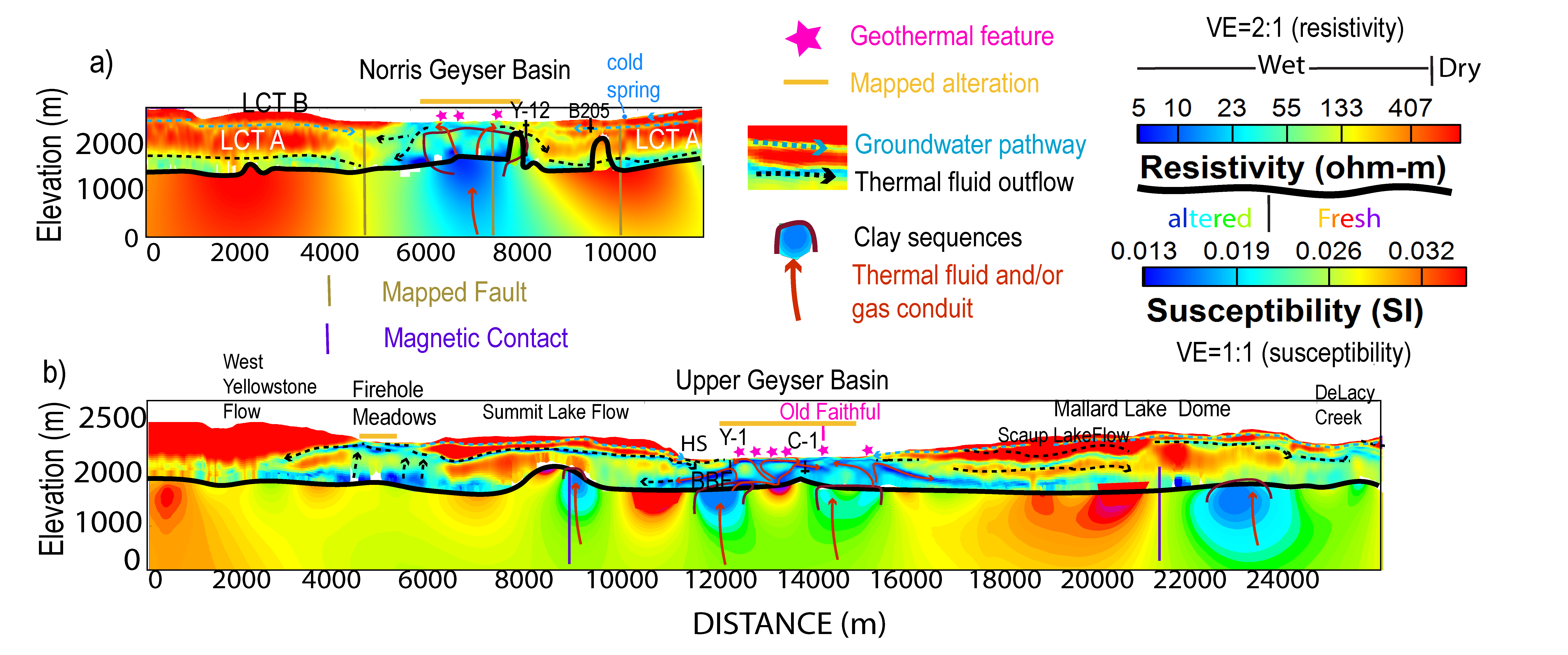
Carol's geophysical data reveals where the freshwater from above flows down into the earth, is heated, and rises back to the surface as thermal fluids. Credit: Carol Finn, Ph.D.
Faults: Where geysers get their steam
Another big surprise in the data transformed how science understood the mechanics of Yellowstone’s geysers.
Previous models suggested that while the thermal fluids did come up through faults, they were then trapped deep underground in reservoirs by younger lava flows on top. The faults never came near the surface.
Beneath these lava caps, it was thought that the hot fluids were forced to move laterally until they reached an edge of the lava flow – only then making their way to the surface.
“And it makes sense because that’s what you see. You stand at the end of the basin and you see springs. So, it’s true that that can happen,” Carol explains.
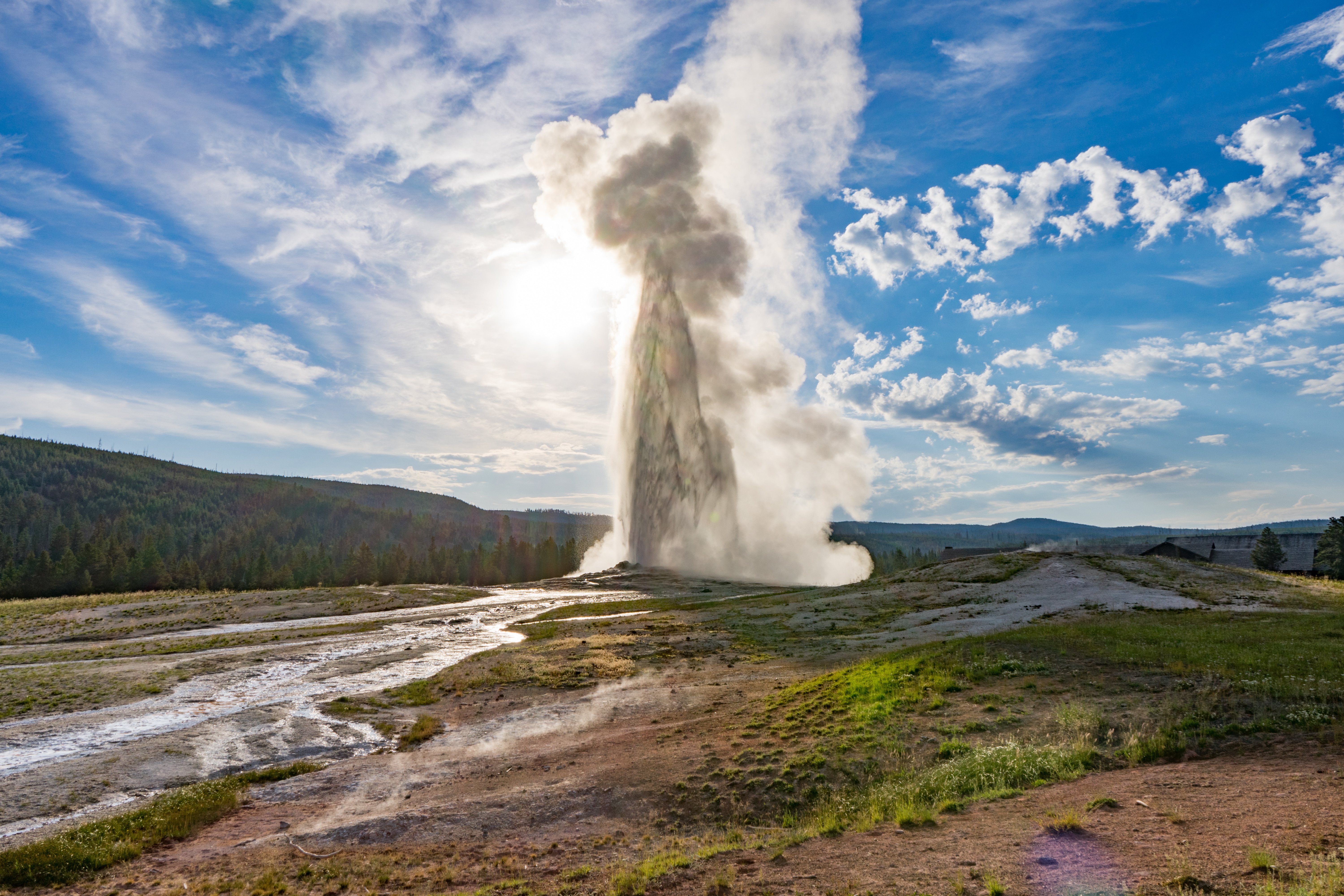
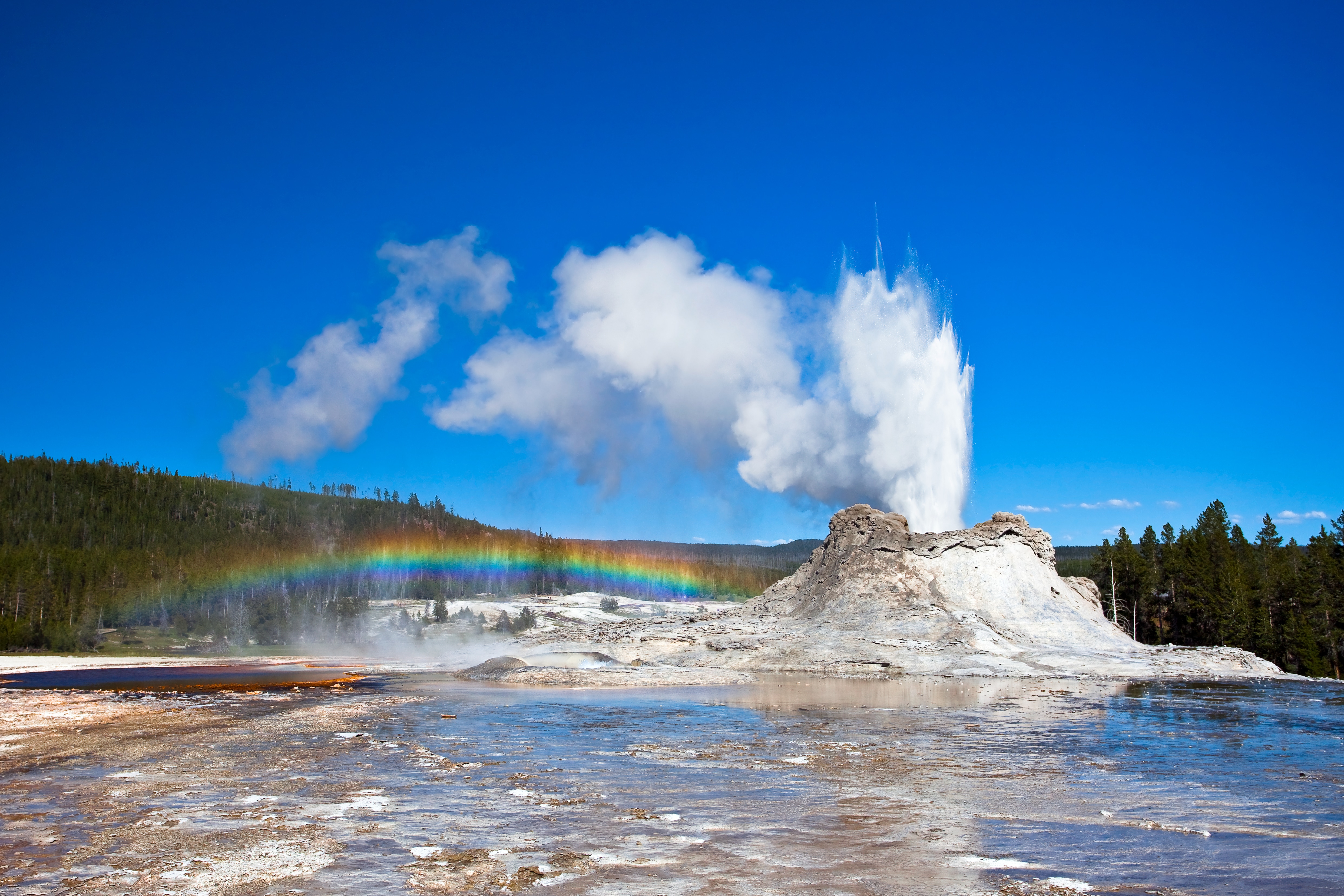
Yellowstone's famous Old Faithful Geyser gets its steam from faults that bring thermal waters up to the surface.
But, instead of finding deep fluid reservoirs capped by lava flows under Yellowstone’s thermal features, Carol’s team found faults leading up to the surface capped with clays.
“What we could see is that all the thermal areas are associated with faults, imaged as breaks in the resistivity pattern. In addition, low magnetic susceptibilities and resistivities indicate thick clays that form over faults or fractures that bring up thermal fluids and gas.”
The geophysical data showed that areas with few thermal features, such as the central caldera, are not underlain by thermal fluid pathways nor clays. In general, faults are not blocked by lava flows, but instead come near to the surface – feeding the geysers directly.
Danger zones and microbial life
With so much survey data to dig through, Carol’s team has set their sights on some of the least known and most dangerous features in the park.
“We’ll probably do some detailed work in Yellowstone Lake to see if there’s anything that the geophysical data can tell us about hydrothermal explosion craters, which are actually the biggest hazard in the park.”
Yellowstone Lake is home to the world’s largest hydrothermal explosion, which left behind a 2.6 km wide crater around 13,800 years ago. Yet, more modern events, some as recent as 1989, have hurled boulders and rocks many metres away.1
Not much is known about hydrothermal explosions, where pressurised steam and hot fluids erupt from below blasting rocks and soil into the air. They’re so far unpredictable.
Understanding how they form would help keep the famous park safe. But, outside of hydrogeology, Carol’s data is already leading to more unexpected applications.
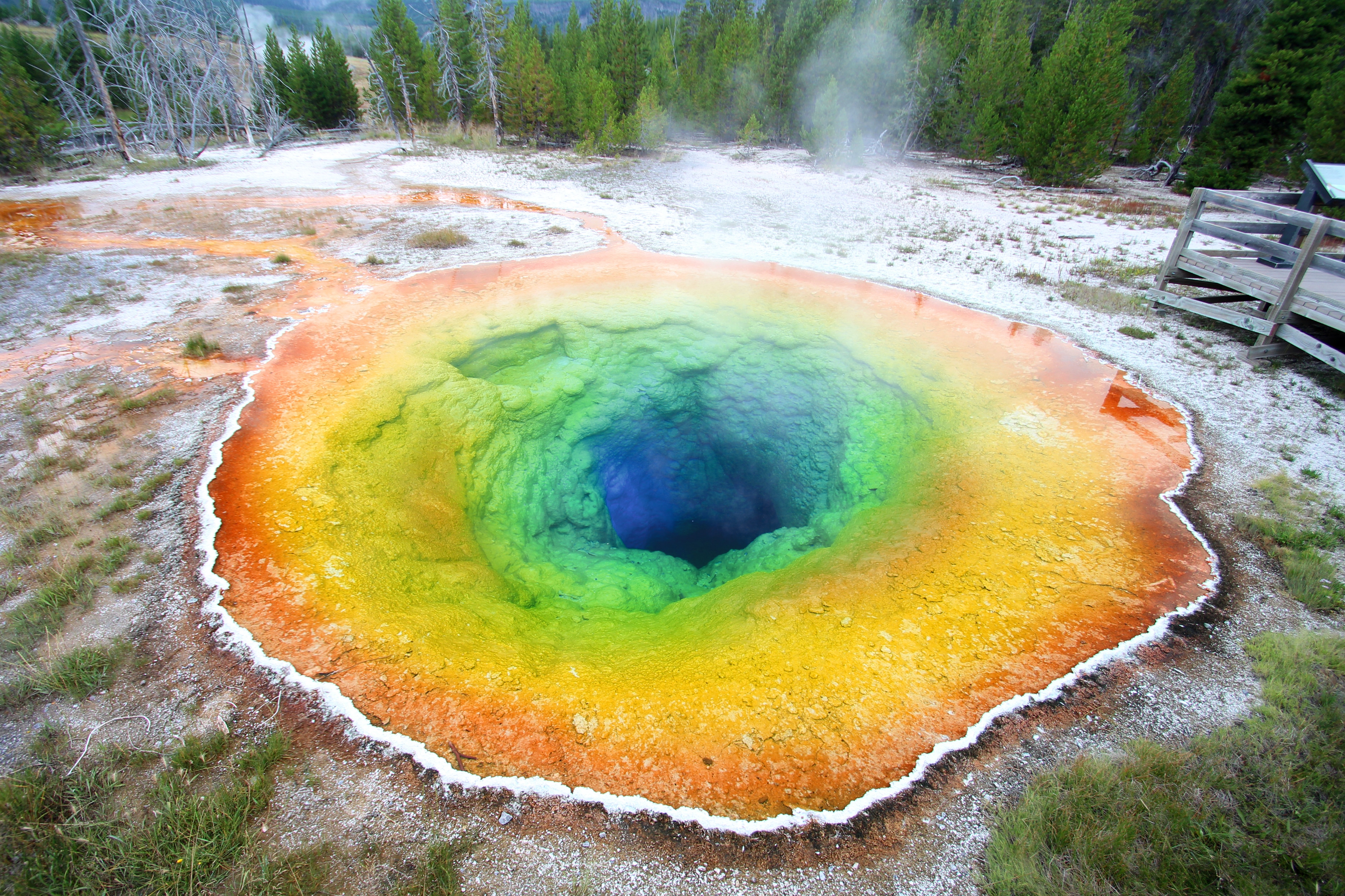
Grand Prismatic Spring in Yellowstone gets its vibrant colours from the thermal water chemistry and colonies of microbes that feed on its energy.
“A biologist told me that, ‘we knew about the geochemistry for a long time, but this is the first time I’ve been able to see the pathways of the fluids and gases and how they’re mixing and get to the surface,’” Carol says.
“That influences how the microbes show up, because it’s basically food for them.”
Carol will soon be working alongside biologists using the survey data in their research, studying microbes that feed on chemical energy in the thermal fluids.
As impressive as its geysers are from the surface, the hidden world beneath Yellowstone has astounded researchers. Time will tell what explosive results the data will continue to reveal.
1Hydrothermal explosions. (n.d.). U.S. Geological Survey. Retrieved May 30, 2022, from <https://www.usgs.gov/volcanoes/yellowstone/hydrothermal-explosions>