


Suppose you’re an energy company in search of new discoveries: Where do you look if you want to make the best use of your limited cash reserves?
The question has as many answers as there are energy companies. Some look near areas known for previous discoveries; others turn to regions where they have the strongest expertise; some may look in areas with existing high-quality survey data; while still others focus on less-rich reserves made economical by good infrastructure links.

Yet regardless of the preferred course of action, one thing virtually all explorers must face is diminishing returns on investment. It’s the harsh reality that forces them into more and more inaccessible and challenging territory.
“A lot of the low-hanging fruit is now gone,” says Dr. Mark Davies, who until 2009 was chief scientist at airborne gravity gradiometry provider ARKeX Inc. “We’ve been driven into areas where exploration is difficult, often because of extreme weather, be it cold or hot. Imaging is difficult in such conditions.”

In 2011, Davies founded the specialist geosciences company Bridgeporth Ltd. , which focuses on regions that have seen little exploration due to security and logistical concerns. The company also works in extreme climates such as Africa and Northern Canada.
“Our niche is gravity, magnetics and remote sensing. We’ve done work in minus-forty conditions and in plus thirty-five,” says Davies. “Electronics aren’t built to sustain temperatures like that, so we’ve had to modify equipment, as well as the way we acquire data, to take account of those extreme conditions.”
Bridgeporth’s technical director, Dr. Nick Harrop adds that complex projects requiring technological, instrumentation and geophysical problem-solving are par for the course for many explorers.
The bigger challenges, says Harrop, are security and logistics, and this is where Bridgeporth’s unique experience comes to play. “Other companies are perhaps less willing to specialize in this area, whereas Bridgeporth has a lot of in-house expertise for managing political, operational and security risks in complex environments.”
Condensing Timelines
Long delays are inherent in exploration work, and these delays can carry greater risk when exploring in challenging regions.
“Prior to bidding on acreage, you’re probably doing twelve months of work as part of a new venture.” explains Davies “Then, once you bid on a project and are successful, you have to do a follow-up study, including gravity, magnetics and seismic.”
In total, it may be three to five years before a block of claims begins generating revenue — a time frame that comes with a separate set of concerns if the project is in an area that’s geopolitically uncertain. The question, says Davies, then becomes: Is the region going to be politically stable long enough for the client to start producing? In short, will there be payback?
The goal is to condense what are normally three years of work into 12 months, an achievement made possible by integrating security and logistics as part of the project. Having security consultants on staff means fast results, says Davies, noting that “managing security and logistics concerns is half the headache when working in these areas.” Bridgeporth’s extensive network of security personnel means the company is able to stay abreast of any potential problems.
Another element that can shorten timelines is rapid data processing. Coarse-resolution gravity and magnetic data is available globally, allowing energy explorers to quickly and cost-effectively identify areas of interest. Once a target region has been selected, explorers can use higher-resolution airborne surveys to get more information.
Davies explains: “Everything we do is focused on acquiring data rapidly, then processing and interpreting it in real time and making decisions on-the-fly for the client. We acquire the data within a large footprint, and we process and interpret the data in real time. As we in-fill, we get a better and better picture and can continually update the client.”
Obtaining data while surveys are ongoing can help clients plan seismic programs prior to the completion of remote sensing. This is important because in most cases, clients cannot afford to shoot seismic across an entire survey area. To illustrate this point, Davies cites a recent project in East Africa: “In an area that comprised about 60,000 square kilometres, the client had a little more than 2,500 line kilometres of seismic to shoot.” Working closely with the seismic contractors, Bridgeporth was able to further expedite the process, saving time and money.
Building Relationships
Building relationships on the ground is another critical requirement when working in politically sensitive environments.
Mineral surveys tend to be “postage-stamp sized” in comparison with hydrocarbon surveys, says Davies. No matter how fast the work is performed, a survey team working on a hydrocarbon project will likely remain in the area for months at a time.
“The security and logistics experts will always tell you not to be repetitive or predictable. However, when it comes to a minerals project, we’re generally visible from the same point on the ground throughout the entire survey, so if there’s one thing we are, it’s repetitive and predictable. We have to be. As a result, we come up with more creative solutions to mitigate against that easily tracked repetitive behavior”
Hydrocarbon surveys cover a larger area, which allows the survey aircraft to vary its routine somewhat. But there is a trade-off: the large area might overlap the territory of not just one but six or seven local indigenous tribes.
In both scenarios, it’s essential to talk with local residents.
We pride ourselves on our rapport and liaison wok with local communities,” says Davies. “It’s all about getting the boots on the ground, talking to the communities, and getting them to understand that we’ll be bringing revenue into the area in the long term.”
Getting the proper rapport with the local communities makes the job easier not only for Bridgeporth, but for any seismic and mining or oil companies that follow the survey teams — a foundation of goodwill the latecomers benefit from.
Having the Right Tools
When it comes to acquisition technology, Bridgeporth strives to use the best instruments available for a given project, says Davies. “If we think a gradiometry system will work, we’ll use that; if we think a high-resolution gravity system is best, we’ll use that.” The key, he stresses, is integration. “You can acquire the best data in the world, and lots of it, but unless you integrate everything, no one piece of technology will give you a complete picture.”
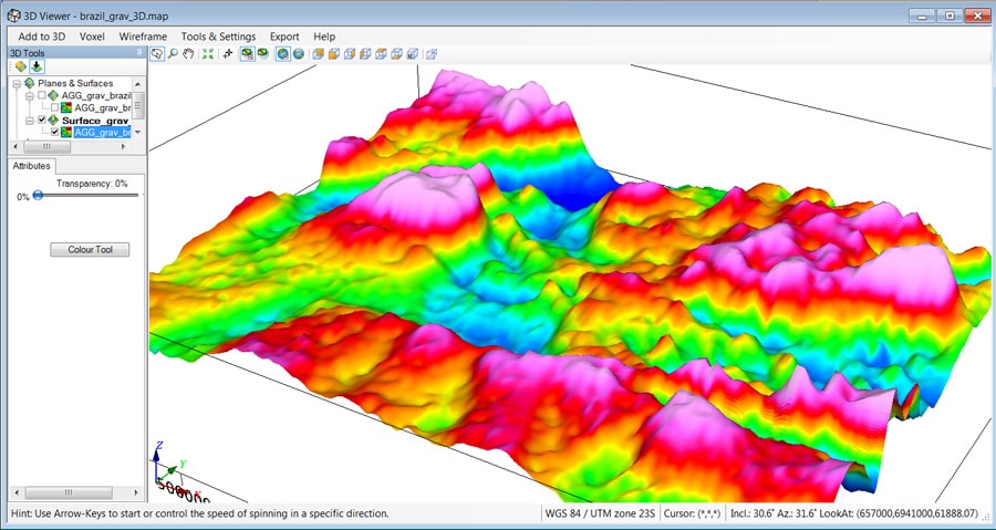
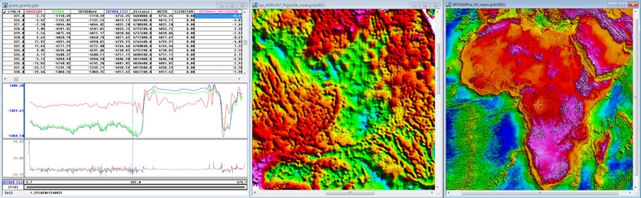
A tool that has contributed to getting the complete picture, for Bridgeporth, is Geosoft’s Oasis montaj platform. The company uses Oasis montaj and GM-SYS 3D for gravity and magnetic data processing and interpretation. Bridgeporth field crews perform quality control on the collected data before passing it on to the processing team. After the data has been cleaned and processed, it can be integrated with third-party data for the area such as 2D or 3D seismic, geological information and well information. All of these datasets are combined with the new survey data to produce as complete a picture as possible. “It truly becomes a multidisciplinary interpretation project,” says Davies.
One of the reasons Bridgeporth chose Geosoft is the ability to easily integrate proprietary algorithms and workflows developed by their Research and Development team. Davies points to Geosoft’s extensibility as a crucial benefit. “We favour a number of processing routines and a lot of the functionality of Geosoft’s processing is excellent, so why re-invent the wheel? We also write our own Geosoft Executables and then fold that into the software. That gives us the flexibility we need to tailor workflows.”
Flexibility and integration, in their skill sets as well as their technology, mean Bridgeporth can handle projects under almost any conditions. Says Harrop: “My tick boxes start with the security experts saying they can provide us with a secure camp area, and from there we have the capability to build anything. If there’s no landing strip, we can build one; if there are no accommodations, we can bring our own; if there’s no power, we can bring that too. We can handle all those things.”
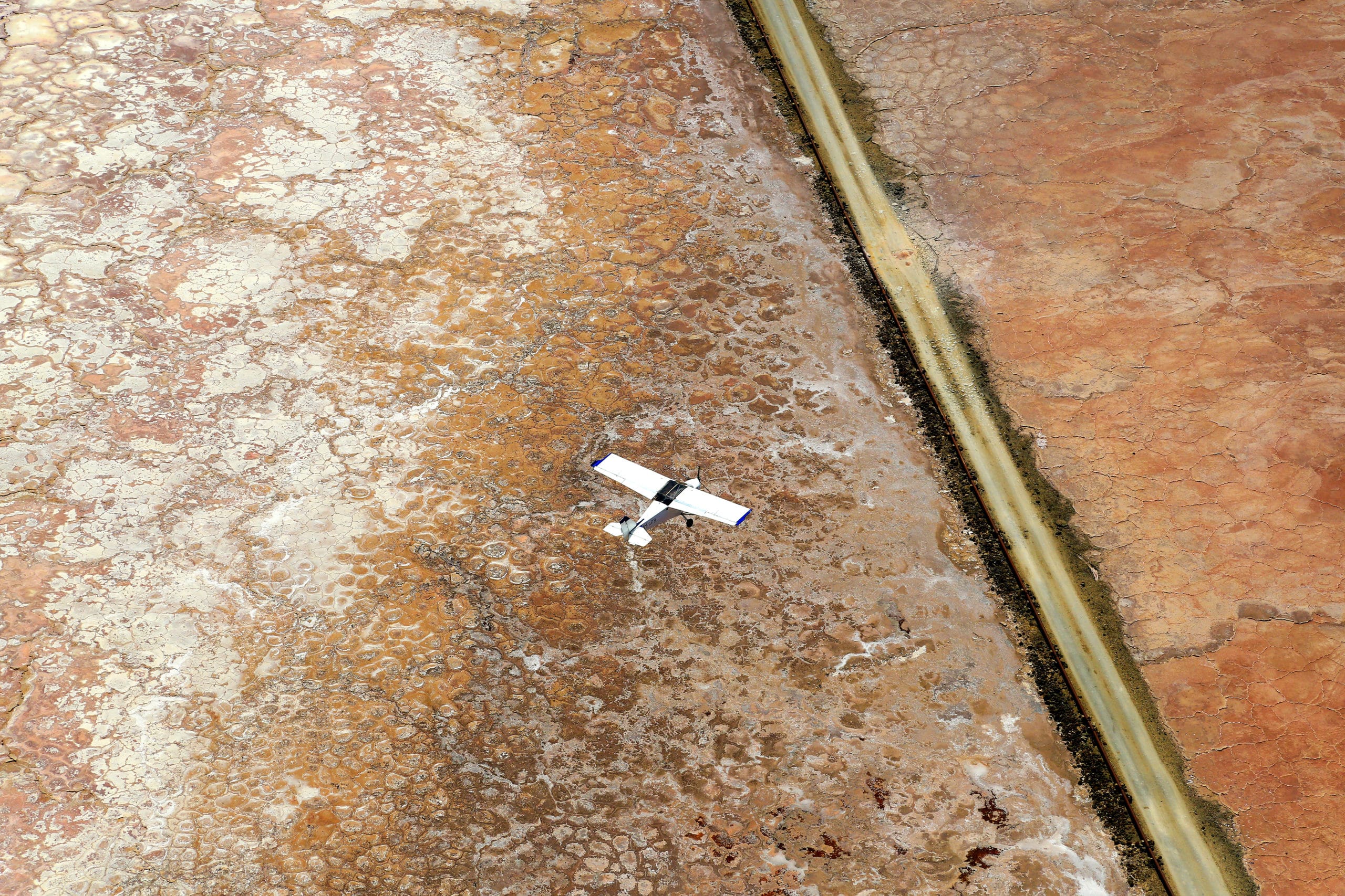
The company currently operates ground and marine teams, in addition to three aircraft: a Cessna Grand Caravan C208B, a Pilatus Porter PC-6 and a twin engine Basler. It expects to add a fourth plane and a helicopter to the fleet, in addition to having access to a range of aerial platforms via a portfolio sister company.
“The Basler in particular is a powerful tool in any arsenal. With a robust airframe, a range of special mission capabilities, low operation costs, and excellent long range capacity, it is the ideal aircraft for the kind of surveys required by the hydrocarbon and mineral industries. With marine, land, and airborne capabilities, there is no terrain or environment that is inaccessible for Bridgeporth,” says Davies.
Looking forward, Harrop predicts more and more exploration work will be done in politically sensitive areas. “There are many such regions and countries tend to experience geopolitically sensitivity in cycles,” he says. “Some countries you wouldn’t have gone to before, you would perhaps consider visiting now, and vice-versa.”