


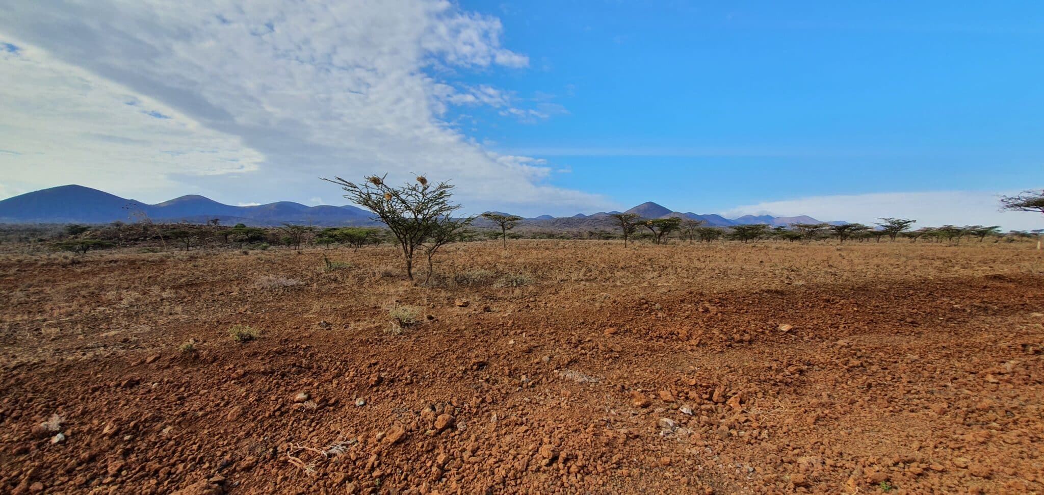
The Kenya Nationwide Airborne Geophysical Survey (KNAGS) captured over three-million-line kilometres of magnetic, radiometric and in-line high density dGPS data to cover the entire Kenyan territory. The innovative survey, together with Seequent’s Oasis montaj, has helped uncover important subsurface details regarding mineral resources, groundwater availability and geothermal potential.
Kenya is leading the way in digital transformation in Africa and ranks among the world’s top ten fastest-growing digital economies. A significant step in the country’s digital journey is the completion of the Kenya Nationwide Airborne Geophysical Survey, initiated by the Kenya Geological Survey (KGS) on behalf of the Government of Kenya.
While countrywide surveys from the 1960s only extended to smaller high-priority areas, KNAGS’s latest survey provides an extensive dataset that meets the needs of multiple end-users.
“Our goal was to accurately update and revise geological maps, publish mineral prospectivity maps, support the sustainable planning and development of infrastructure, and explore potential groundwater and geothermal resources,” says John Ogalo, Chief Superintending Geologist (KGS) and KNAGS Project Leader.
“Using Seequent’s Oasis montaj software to process our latest geophysical data has enabled us to move beyond decades-old maps to create an updated, detailed inventory of the entire country’s natural resources,” says Ogalo.
“And has supported our vision of enhancing the skills of our young Kenyan geoscientists, with innovative software that provided workflow and product flexibility across every stage of our project,” he says.
Fast Metrics:
- With Oasis montaj’s fast turnaround and quality control, the team reduced the need for data capture flights by 40%, significantly reducing the carbon impact of the project.
- The Government of Kenya will use the project to help achieve its goals of boosting mining GDP by 10% and working towards more efficient and environmentally friendly mining.
- The data can help the government responsibly tap underground aquifers for improved water access, and to explore the development of clean, renewable geothermal power.
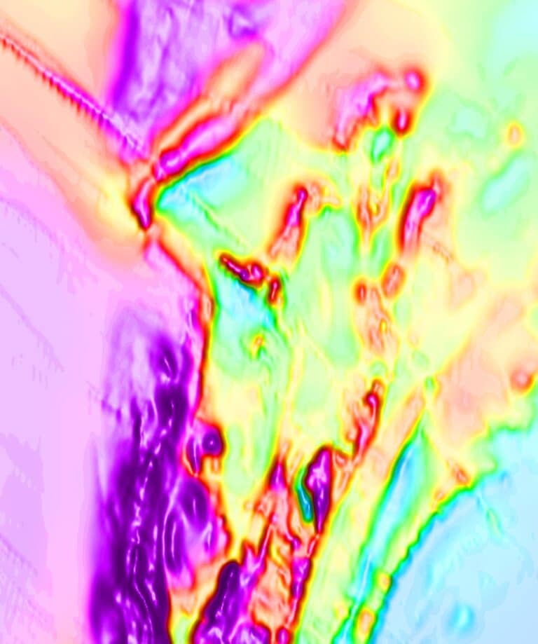
Magnetic anomaly map of a sample area shaded with a wet look. The magnetic data has revealed more detail on the sub-crop geology than shown on legacy geological reports. (Image: Kenya Geological Survey).
Managing massive volumes of data under time pressure
The comprehensive nationwide data set can help the Kenyan Government to fill knowledge gaps, better identify valuable resources, and plan for economic resilience.
It also has the potential to positively impact local companies and communities, across multiple SDGs, including the energy transition and access to clean water.
But such an ambitious project involves an enormous amount of information. KGS faced huge data management challenges and needed a platform that could prepare large databases of high-resolution survey data from design to post-acquisition.
“Processing all that data is challenging enough, but our team had to complete the project quickly to keep the data as current, accurate, and useful as possible,” says Godwin Mnyika, a KNAGS Project Geophysicist.
Oasis montaj provides a powerful and flexible toolset for visualising, analysing, and integrating geoscience data, making it invaluable across every stage of airborne geophysical survey workflows, to help successfully and efficiently deliver results.
“After each sortie, we could conduct quality control checks on the collected data to ensure quick turnarounds. And using drape analysis scenarios, we could integrate data quality effects from difficult topographical areas to support decisions such as how to best navigate using helicopters in steep areas,” says Mnyika.
“Our project participants were able to integrate data from multiple survey blocks acquired with different platforms and with multiple sensors to correctly tag data, perform quality control analysis and generate reports,” he says.
“Over time, we built very large multi-component databases, processing and tracking over three-million-line kilometres of data. All while keeping costs low, and on a tight timeframe,” Mnyika adds.
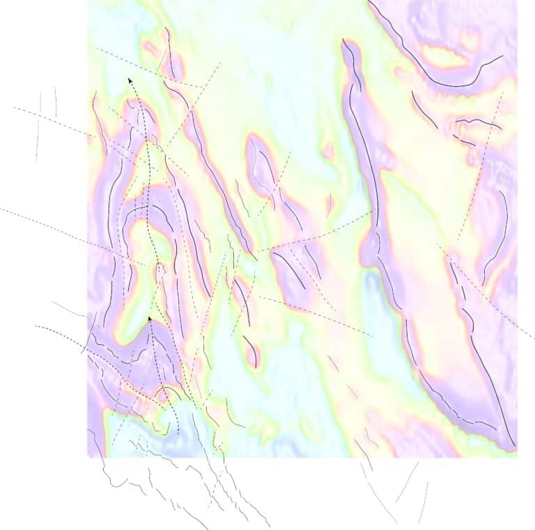
Magnetic Anomaly Map from a second sample area. Inferred structural features and continuity of geological units on legacy maps is confirmed with high resolution (Image: Kenya Geological Survey).
Organising an entire country’s data to help inform decisions.
Adopting digital technologies can greatly improve access to essential resources and services. While the effective use of subsurface resources can help support challenges associated with climate change, population growth, and community resilience.
With Seequent software, geoscience professionals can model and predict with greater accuracy and speed the location of underground mineral deposits, and the geotechnical characteristics of underground features and structures.
The software has applications throughout the mineral exploration and mining lifecycle, such as identifying prospective targets, building the geological model, and calculating the mineral resource estimates. As well as in the civil engineering, energy, and environmental industries.
“We were able to map out many potential areas for mineral resources including base metals, coal, gemstones, geothermal spots, precious metals and rare earth elements,” says Mnyika.
“Our team were able to quickly transform the massive quantities of high-resolution survey information into organised databases and could easily link our new data with legacy data,” he says.
“While the fast turnaround and quality control reduced the need for data capture flights by 40%, significantly reducing the carbon impact of the project.”
Kenya Nationwide Airborne Geophysical Survey (KNAGS) was a Founders’ Honors Recipient in Bentley’s prestigious 2023 YII Going Digital Awards in Infrastructure, in the Subsurface and Modelling category. Founders’ Honors are presented to a small number of exemplary projects, individuals, and organisations that inspire Bentley’s mission of advancing the world’s infrastructure while sustaining both the global economy and the environment.