


Objective:
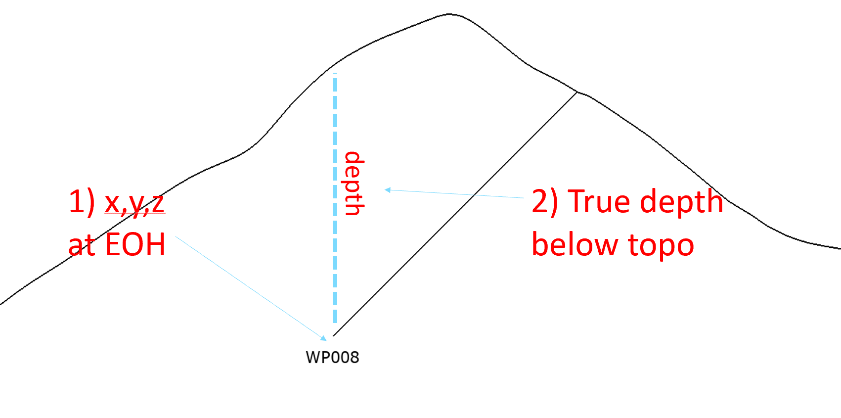
Objective 1: I have my drillholes/boreholes loaded, but I want to determine what the elevation (x,y,z coordinates) is at the bottom of the drillhole.
Objective 2: I also want to know what the real depth is (e.g. vertical depth below topography)
Resolution
Solution Summary:
- To obtain X,Y,Z:
- Backflag an empty Geological Model to create an interval table
- Export the backflagged table and include Interval End Points
- Reimport the table as Points
- To determine True Depth:
- Import the Z again as another column in the Points file
- Set the elevation to Topography
- Create a calculation of Z on Topo – original Z
Detailed Solution Workflows:
- To obtain X,Y,Z:
- Backflag an empty Geological Model to create an interval table
- Right click on Geological Models > New Geological Model, and keep the Base Lithology set to None
- Ensure the extents covers all drillholes
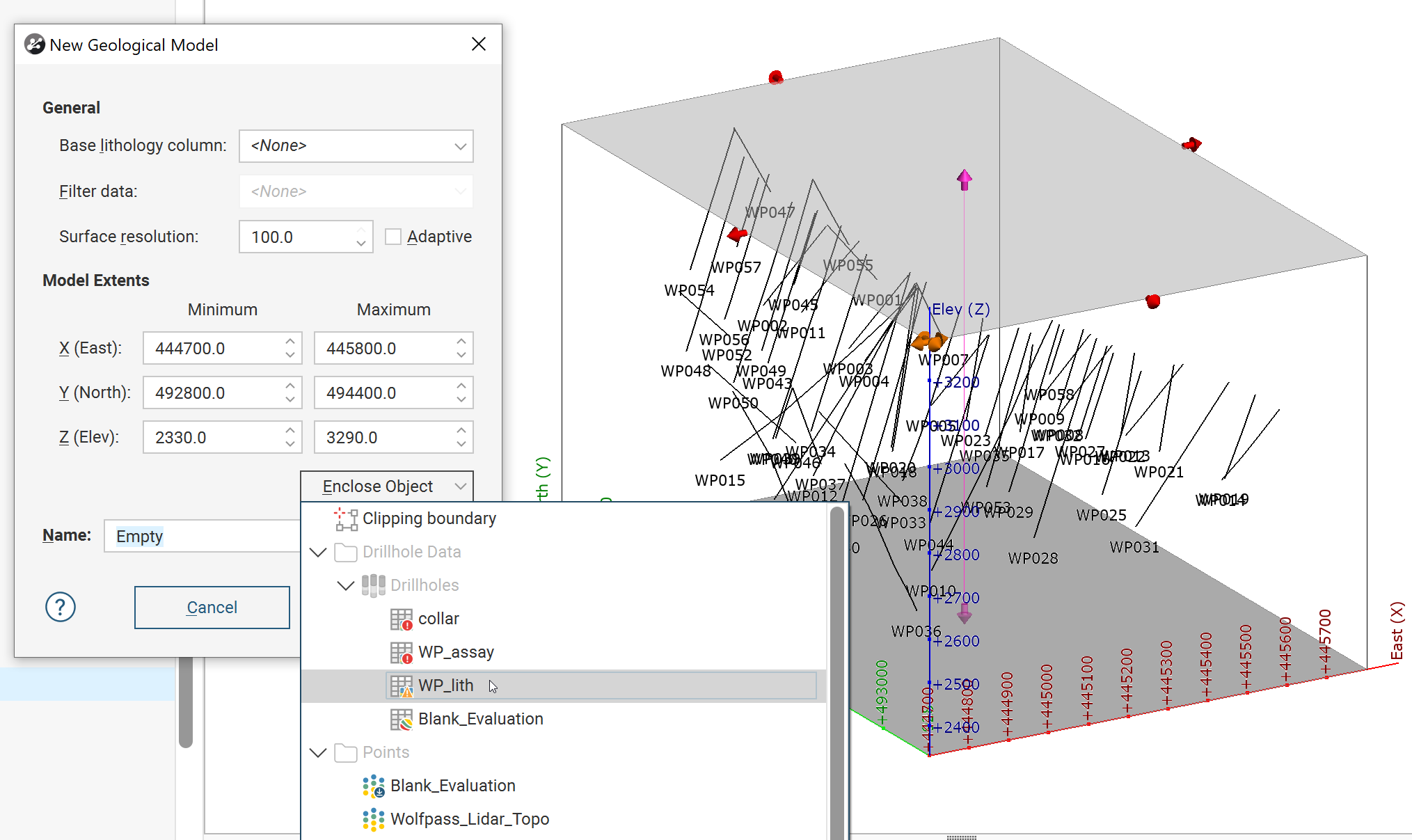
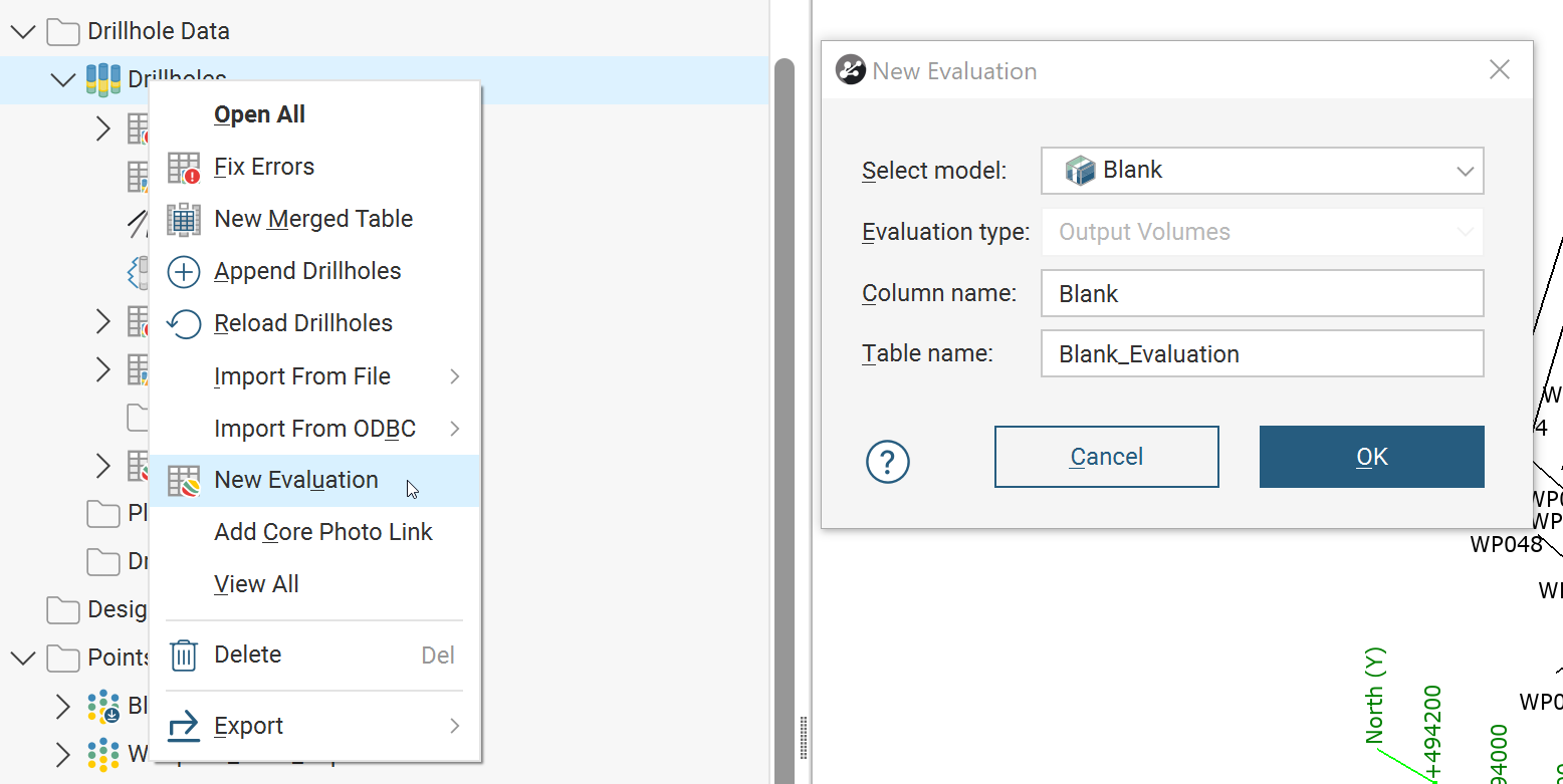
- Right click on Drillholes > New Evaluation, and choose the empty GM
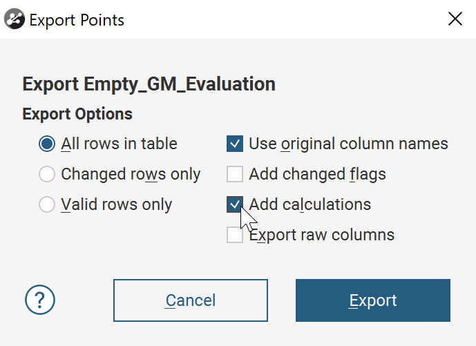
- Export the backflagged table and include Interval End Points

- Reimport the table as Points. You only need the X/Y/Z
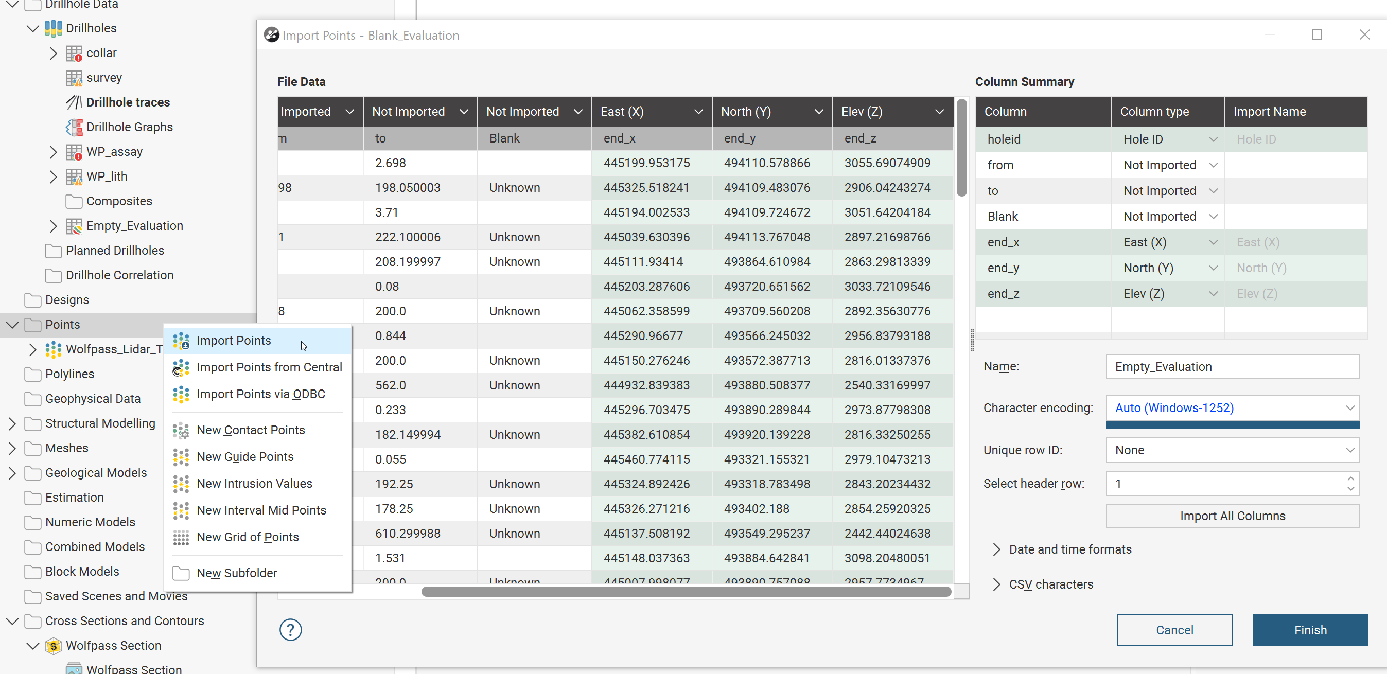
- Tada, X Y Z values for the end of hole
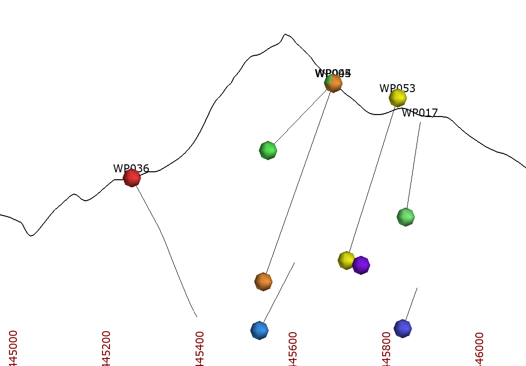
- If you want to add a label for the Z value, you will need to follow the first part of Part 2
- Backflag an empty Geological Model to create an interval table
- To determine True Depth:
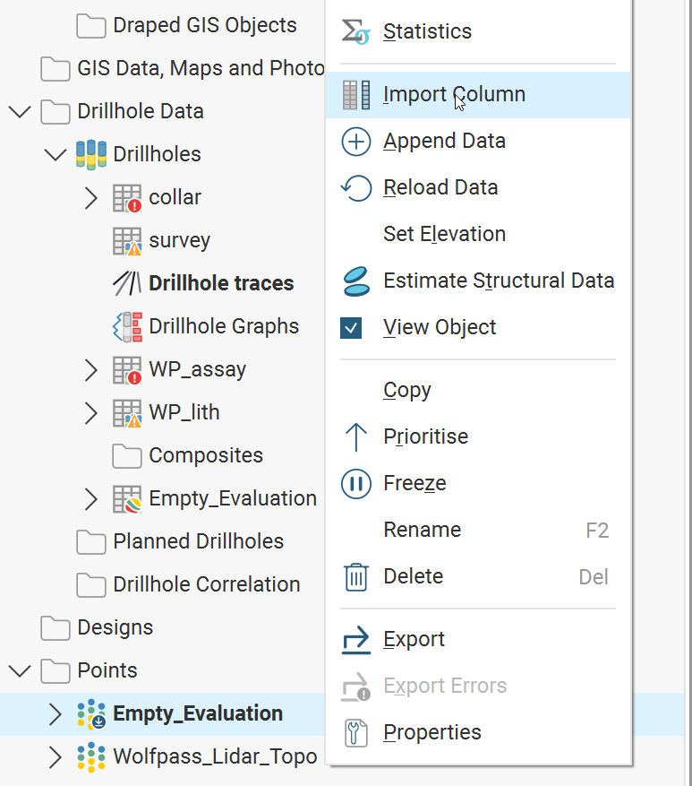
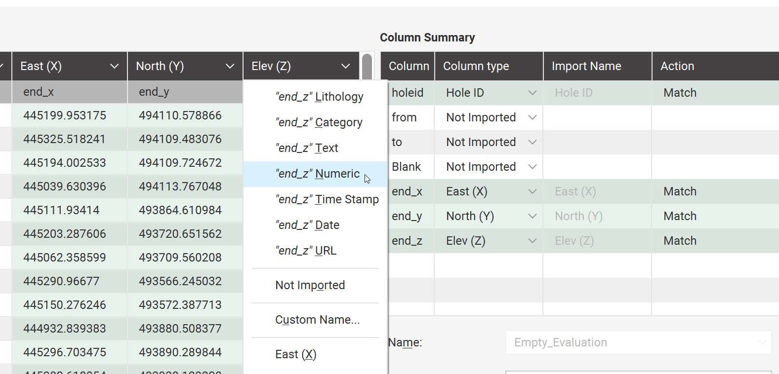
- Import the Z again as another column in the Points file by Right Clicking > Import Column and choose the same file.
- Make sure to change the data type for Z to Numeric, otherwise you won’t be able to import it
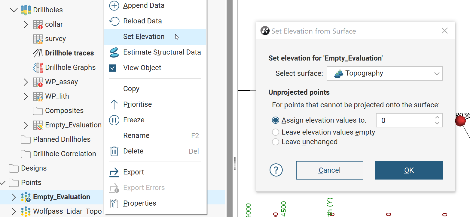
- Set the elevation of the Points file to Topography by Right Clicking > Set Elevation
- Create a calculation of Z on Topo – original Z by Right Clicking on the Points > Calculations and Filters.
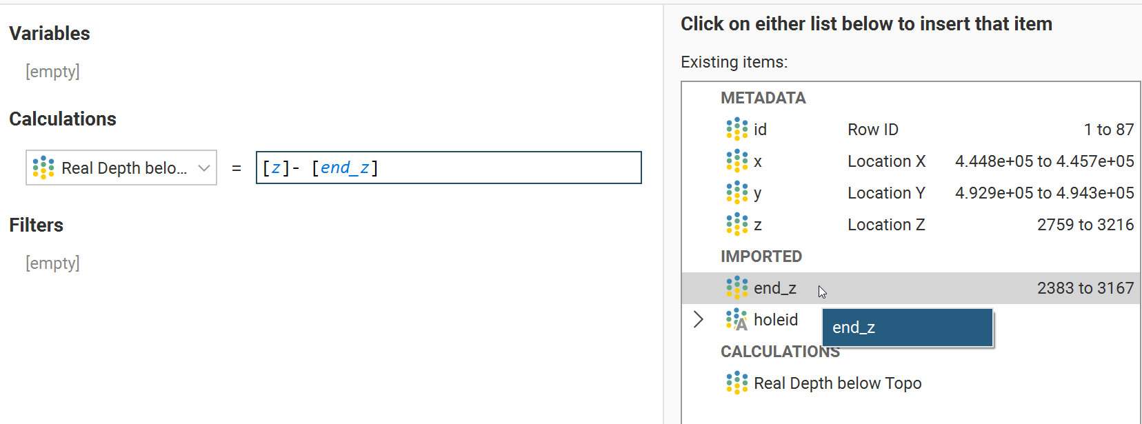
- You now have a column that represents true depth. Since this is dynamically linked to your Z value, if you want to move Z back to the EOH elevation you will need to export/reimport to remove the dynamic link.
- If you export, make sure to tick INCLUDE CALCULATIONS within the export.
- Import the Z again as another column in the Points file by Right Clicking > Import Column and choose the same file.
Please contact [email protected] for any questions with this workaround.