


Taking the time to integrate gravity and magnetics with seismic data can pay off for oil and gas explorers with limited budgets
For oil and gas explorers who want to maximize targeting effectiveness and minimize costs, Jonathan Watson has a message: Gravity and magnetics interpretation is a low-cost exploration technique that can add a lot of upfront value to your exploration program.
“It’s expensive to go in with just seismic first,” says Watson, who is interpretation manager at Bridgeporth Ltd, a geosciences company in Milton Keynes, U.K. “Using gravity and magnetics at the outset can often help you understand what’s going on with minimal costs, and it allows you to fine-tune and improve your seismic program based on what you’ve learned.”
A specialist in the integration of gravity and magnetics with seismic data, Watson shares some of his views in a webinar titled “Integrating Potential Field Data with Seismic Data and Structural Geology”, based on his presentation at last year’s conference of the European Association of Geoscientists and Engineers, held in Amsterdam.
Gravity and magnetic, or potential field data, methods have been around for some time but continue to be underused in oil and gas exploration. According to Watson, this is partly because explorers are generally under pressure to produce seismic results ahead of funding deadlines. Moreover, if potential field companies generate only geophysical models when the oil company geologist needs geological models then a disconnect can occur.
Another challenge is lack of experience with potential field data methods. “When a gravity and magnetic dataset has been interpreted outside of the oil companyby an independent expert and delivered as a package,” explains Watson, “some clients will take a look at it and not fully understand what they are looking at. It could be a perfectly good piece of work that tells them a lot, but it’s put aside because it’s not well understood.”
Knowing how to use gravity and magnetics, and at what stage in your exploration program, is key to optimizing its value. “In a frontier area, for example,” says Watson, “gravity and magnetics are the first datasets, or one of the first, that are acquired. At this stage, they can reveal a lot about basins and other geological features, which in turn can help define the seismic program.”
“This approach can be especially useful in frontier areas such as Africa. Broad areas can be covered, by acquiringlarge datasets quickly and cheaply from the air with minimal time spent on the ground,” says Watson. “That can be important from both security and environmental viewpoints.”
While there is an obvious advantage in frontier exploration, there are many other cases where integrating non-seismic data with the seismic makes sense explains Watson. “Interpreters can use gravity and magnetics to investigate problems or anomalies found in the seismic in areas already explored,” says Watson, “or marine environments where potential field data have been acquired alongside the seismic and explorers don’t have the luxury of examining it prior to seismic acquisition.”
Where oil and gas explorers do use potential field data, gravity is the more popular, he adds. “It can show a number of different geological features, be it faulting, anticlines/synclines, intrusives, basement blocks, salt domes etc.” But magnetic data are also highly relevant. They can indicate depth to sources, basement structure, and the lateral extent of volcanics, especially where there are shallow intrusions. Magnetic data are often recorded alongside gravity and so are frequently available to integrate.
Some explorers shy away from magnetic modeling, because they are not familiar with it.
“Magnetic modeling is generally more challenging than gravity modeling,” Watson observes. “Gravity is definitely easier to interpret in that if you have a gravity high, you are looking at a denser body whereas with magnetics, because of inclination, declination and remanence [residual magnetism] is not as easy to interpret.”
Still, one can learn and it’s worth the time invested. Watson cites “Aeromagnetic Surveys – Principles, Practice & Interpretation”, an eBook by Alan Reeves, as a good starting point for learning how to acquire, process and interpret magnetic data. It is available free online.
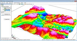
When it comes to gravity-derived structural mapping, Watson recommends having the first pass interpretation done automatically. “Automatic mapping is useful as it can be completed quickly, especially over a large, detailed area and supplied as an initial interpretation.” A manual interpretation follow-up, with classification and more constraints, can then add to the interpreter’s knowledge, resulting in a more complete structural map.
Such a process can help gravity’s differentiation between basement rocks and highly compact sediments, provided there is sufficient density contrast. Density contrast is key. “Salt domes are, with the correct acquisition parameters, usually well-imaged by gravity data, as a large density contrast can exist,” says Watson. “Gravity data are extensively used in areas of salt due to the likely low-density contrast with surrounding sediments.” Offshore areas where this process has proved successful include Brazil, West Africa, the North Sea; onshore areas include Gabon, US and Poland.
Integration of other data types can help complete the picture; a good example being geochemical data. Watson says although it is often not available for frontier areas, surface geochemical data can indicate a working petroleum system, though it usually reveals little about its size or extent. “Geochemical and other data can give you an indication of vegetation, for example, and the composition of the soil,” he notes, “and there are ways of using that to indicate the possibility of oil and gas. But what those techniques can’t tell you is what’s happening deep under the ground.”
Integration of additional potential field techniques such as MT (magnetotellurics) can be considered, along with well-logging data. Generally, the greater the integration with other datasets the better, says Watson, conceding that the limiting factors are always time management and cost. “You can’t always turn things into an academic project, much as you might want to.”
Time and cost aside, for the best overall results, integration of the datasets is key. “A combination of potential field data, seismic and geochemical can produce an integrated model,” says Watson, and in frontier areas, that can be crucial. “The establishment of a working system is key for companies to assist with exploration funding, farm-ins, et cetera,” he explains in the web-based seminar. “It builds a strong case for a potential exploration target.”
Watson’s technology toolkit includes Geosoft, which offers several packages that are useful for creating integrated interpretation. “GM-SYS software has tools for 2D and 3D gravity modelling and the ability to integrate with seismic and well data to produce depth surfaces that are key to seismic interpretation,” says Watson. “It allows you to bring the seismic in and effectively visualize the gravity and seismic data within the same software. Therefore, you can use it to create a model to satisfy both datasets. GM-SYS runs on top of Oasis montaj, which is the core platform for processing and working with gravity and magnetic data before integrating them with the seismic.”
Joint inversions can also be effective, adds Watson. “Regardless of whether it is a true joint inversion or simply the results of each dataset combined to produce a balanced result, as long as the final model is constrained by all the available data, then it is an improved model. Programs such as the recently introduced VALEM (Voxel Assisted Layered Earth Modelling) could result in even more improvements. Anything that allows more than one dataset to be used is good.”
Going forward, Watson sees more potential for gravity and magnetics in the seismic arena. “There is quite a lot of R&D going on – for example, techniques that are being used in the mining industry but haven’t crossed into oil and gas.” These include different ways of acquiring and integrating data. In shale gas exploration, there are ways gravity and magnetics could assist with mapping of natural fractures—areas of weakness or areas where fracking is going to be the most successful.
With today’s focus on using integrated geophysical methods to deepen insight and achieve greater precision in targeting, it’s safe to say use of potential field data will continue to increase – and the value is being proven in the field. To fully unlock this value, Watson sees the need for broader understanding of how and when to use potential field data methods in the exploration process; and efficient workflows and software that allow integration without delaying the exploration program.
“At the end of the day,” he concludes, “gravity and magnetics can add significant uplift when integrated with seismic – and it’s something you can easily fit it into your exploration program, with the right know-how, planning and software.”