


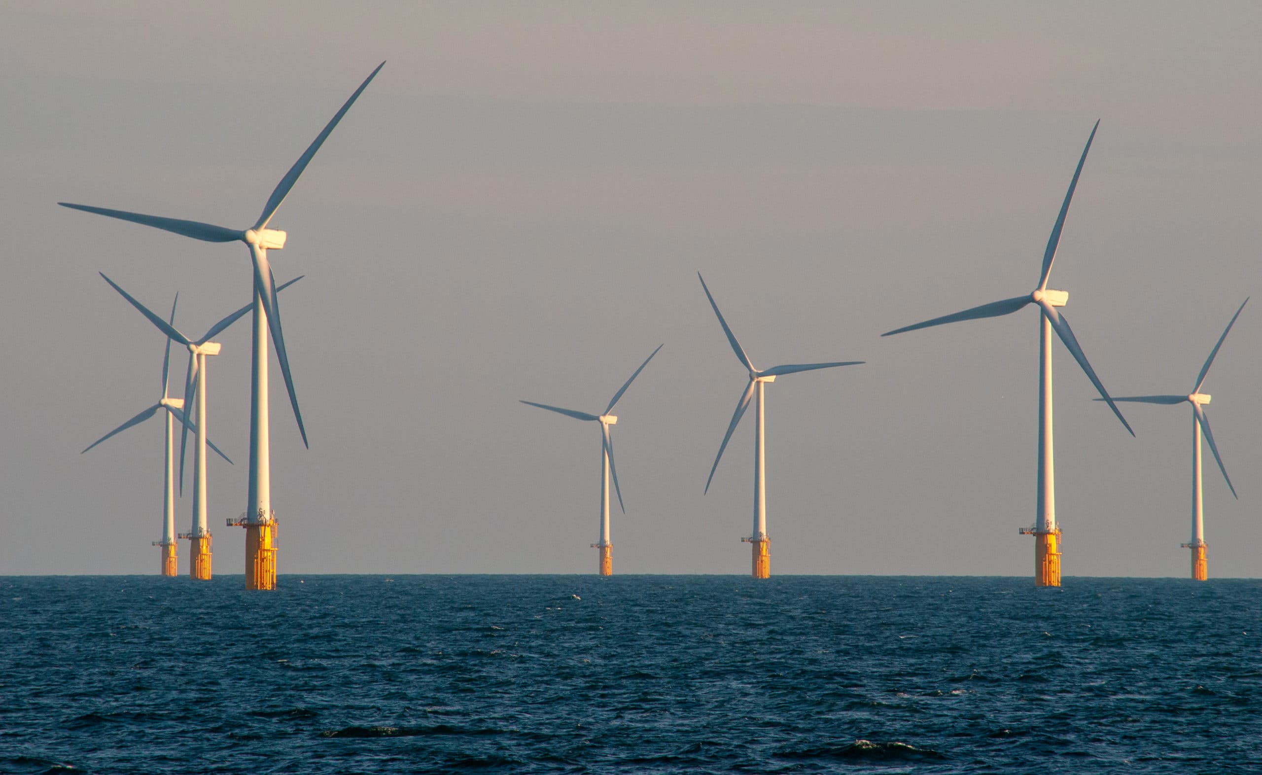
When it comes to non-conventional renewable energy, the British Isles are a world leader. Consider the current boom in offshore wind farm projects fueled by the UK’s strong coastal winds. To extract energy from the wind, enormous turbine towers are built based on a detailed understanding of the seabed at proposed sites. It’s little wonder, then, that companies like Bibby HydroMap are seeing a growth in demand for undersea surveys.
Heather Carrigher, Marketing Manager at the Wirral-based company, notes that wind farm planners require multiple surveys of a site, both before construction and then at various points afterwards. Initially a broad geophysical survey is carried out, followed by more detailed work to determine the best possible positions for turbines. In fact, the survey company is typically involved throughout the entire life of a wind farm, right up to decommissioning, says Carrigher.
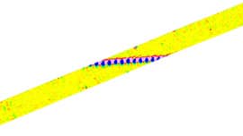
Prior to construction, however, project sites must be examined for unexploded ordnance (UXO). Even already-built facilities may require follow-up UXO surveys, as parts of the British coastline experience strong current, storms and tides that can move or uncover previously buried threats.
Some of the threats Bibby HydroMap looks for are relatively small and date back to the Second World War, such as 50-kg bombs and even 6.5-inch artillery shells. At the other end of the scale are devices that can do enormous damage: Survey vessels have found bombs as big as 1,000 pounds, which can remain hazardous even after more than 70 years in the ocean. If a piling boat were accidentally to drive a pile on top of a hidden bomb, the impact could trigger a detonation big enough to destroy the boat.
Time is money when it comes to subsea survey work as each project requires at least one specialized vessel. The size of the area to be surveyed is important, of course, but so is the level of granularity required. When a lower resolution is acceptable, the survey line spacing can be increased, lowering the overall number of line kilometres of data collected and reducing the cost to the client. The savings can be significant considering the large size of some of the sites surveyed, Carrigher points out.
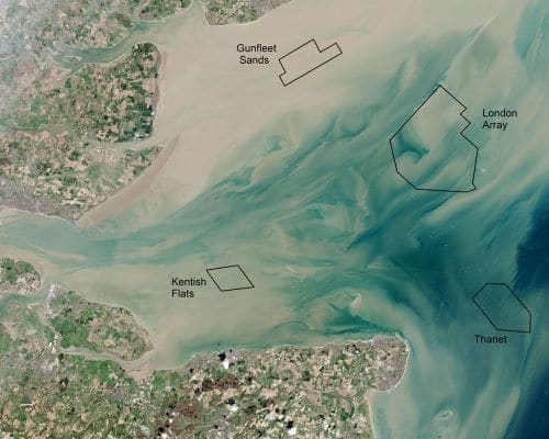
The UK is already home to the world’s biggest offshore wind farm – the 630-megawatt London Array. In the third and latest round of site allocations planning approval has been granted to projects that are much larger. The installed power of some of these sites is 2,400 MW.
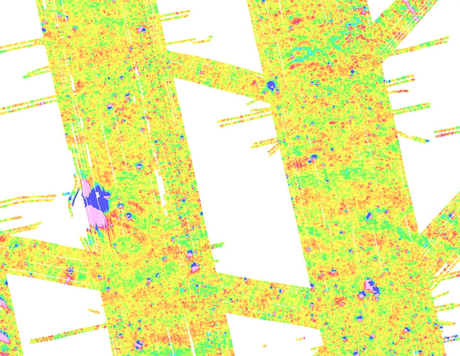
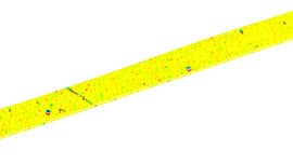
The scale of these projects will require the surveying of vast areas of ocean, and recent projects have produced 8,000 -10,000 line kilometres of magnetic survey data.
The company relied on spreadsheets and struggled with the massive volume of data before switching to Geosoft’s Oasis montaj and UXO software, recalls Caroline Tweedle, Bibby HydroMap’s senior geophysicist.
According to Tweedle, “the biggest advantage of the Geosoft software is the sheer volume of data it can handle, and how easily you’re able to process the data. It’s very fast, and you can get some nice preliminary results out very quickly.” Speed is of the essence when the on-site team is planning the next day’s work and needs to know about current survey coverage, areas that need to have additional data collected or infill, and so on.
Tweedle also notes that Bibby HydroMap has been working closely with Geosoft staff on fine-tuning the application, and the company has been quick to respond to feedback.
“Everybody has their own workflows, file types they work with and internal deliverables. Geosoft has welcomed our feedback and we’ve already seen some positive results with improvements rolled out in recent versions.”
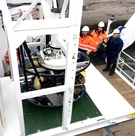
Bibby HydroMap’s workflow improvements are not limited to its use of software: Tweedle points to the d’ROP, a remotely operated vehicle (ROV) developed by the company. The d’ROP differs from other ROV designs in that it is lowered on a heave-compensated winch from a surface vessel. The ship controls the ROV’s depth and tows it forward, which leaves the onboard propellers to manage fine course corrections. The result is a platform capable of carrying a variety of sensors that can get close to the survey target (such as a pipeline) and stay on course even in difficult conditions. Also, the d’ROP was designed smaller than other ROVs since there is almost no need to expend power on propulsion.
“We can work in strong tidal conditions, shallow water, and with a much smaller boat than you’d usually have,” says Tweedle, adding that, again, the wind farm operator can save a lot of money as a result.
The d’ROP was designed to survey buried cables in shallow waters – something the previously used systems had difficulty doing. Buried cables require that the sensors are operated close to the seabed, which can be challenging for some systems in strong tidal conditions. The d’ROP will be in demand in the coming years: in Britain alone, planning permission has been granted for 15.8 gigawatts of offshore wind capacity. “Enquiries continue to grow year on year,” says Carrigher.
The work isn’t limited to British waters: Bibby HydroMap has done work in areas as far away as Sweden and Lithuania. Nor is the company’s work restricted to wind power. Surveys are under way for Port Meridian Energy, mapping out the proposed route for a natural gas pipeline between the deepwater port and the shore facilities. Other industries served include subsea telecoms and power cables, ports and harbours, marine aggregates and civil hydrography programs.
Bibby HydroMap was founded in 1997 as Osiris Projects. It was acquired by the Bibby Line Group in 2012, and has since continued to grow both its workforce and fleet, employing 115 personnel and operating 5 specialist survey vessels.
Innovations in renewable and clean energy will doubtless continue to power Europe’s demand for offshore projects. These in turn will drive innovations in everything from surveys to construction techniques. If service providers are to keep abreast of growing demand, they too will have to keep innovating and improving their offerings.
Judging by its track record, Bibby HydroMap is well positioned to do just that.