


Seequent receives Esri ‘Analytics to Insights’ award with Target for ArcGIS Pro integrating geoscience workflows to deliver new levels of insight to customers
CHRISTCHURCH, NZ – 12 March 2020 – Seequent has received a 2020 Esri Partner Award, ‘Analytics to Insights’, for its industry-first tool Target for ArcGIS Pro which enhances the integration of mining and exploration data.
GM Mining & Minerals for Seequent, Nick Fogarty, says: “We’re honoured to be recognised for our strong partnership with Esri and the value we have created for customers by focusing on improving workflows and interoperability.”
The recently released Target for ArcGIS Pro which enables the seamless integration of subsurface drilling and borehole data into ArcGIS Pro, creates world-leading solution that allows geoscientists to find what’s hidden faster.
Alex Miller, president, Esri Canada, says Seequent was recognised with the ‘Analytics to Insights’ award for “integrating mineral data from around the globe.”
Target for ArcGIS Pro is now the industry standard for importing, viewing and analyzing geological data.
Sara Deschamps, Seequent’s Product Owner, and her team created the geological software extension that enables mining and mineral exploration customers to visualize their drillhole projects in ArcGIS Pro.
“Our close working relationship with Esri meant we were able to deliver Target for ArcGIS Pro quickly and with even more flexibility and integration in the Esri environment – which is great news for customers who rely on our technologies.”
Target for ArcGIS Pro is available as a free and licensed version: Learn more.
Target for ArcGIS Pro allows users to work with drillhole, subsurface and exploration data directly in Esri’s ArcGIS Pro.
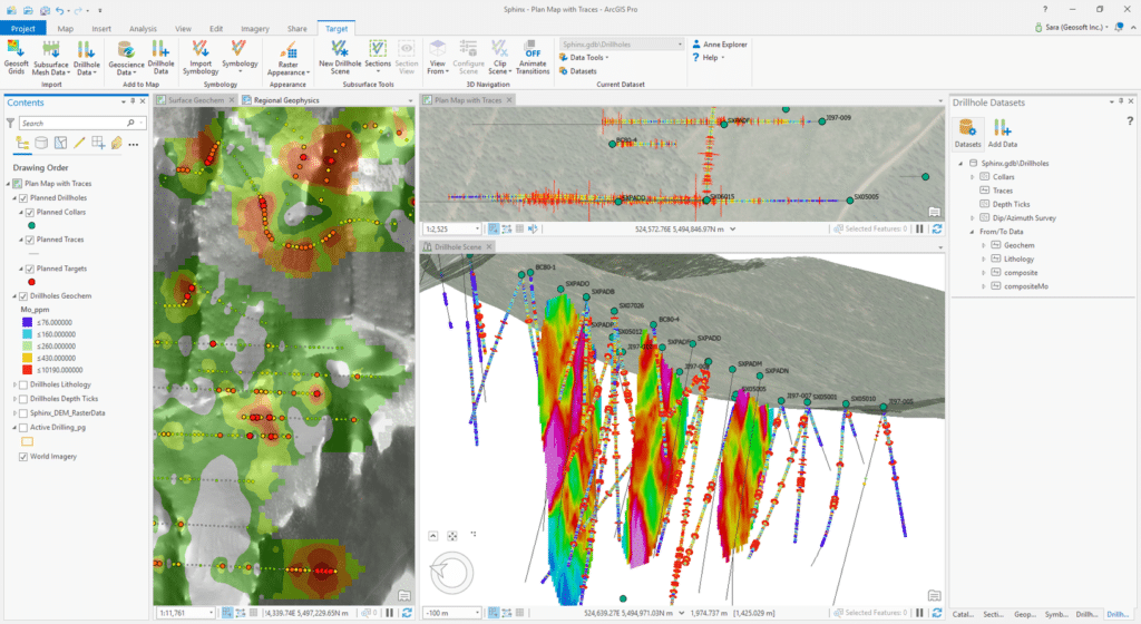
(above): Surface geochemistry data (left) is used to guide early exploration drilling (right). A plan view (top) shows downhole assay results, while viewing the same data in a 3D scene (bottom) can combine those assays along with geophysical section data.
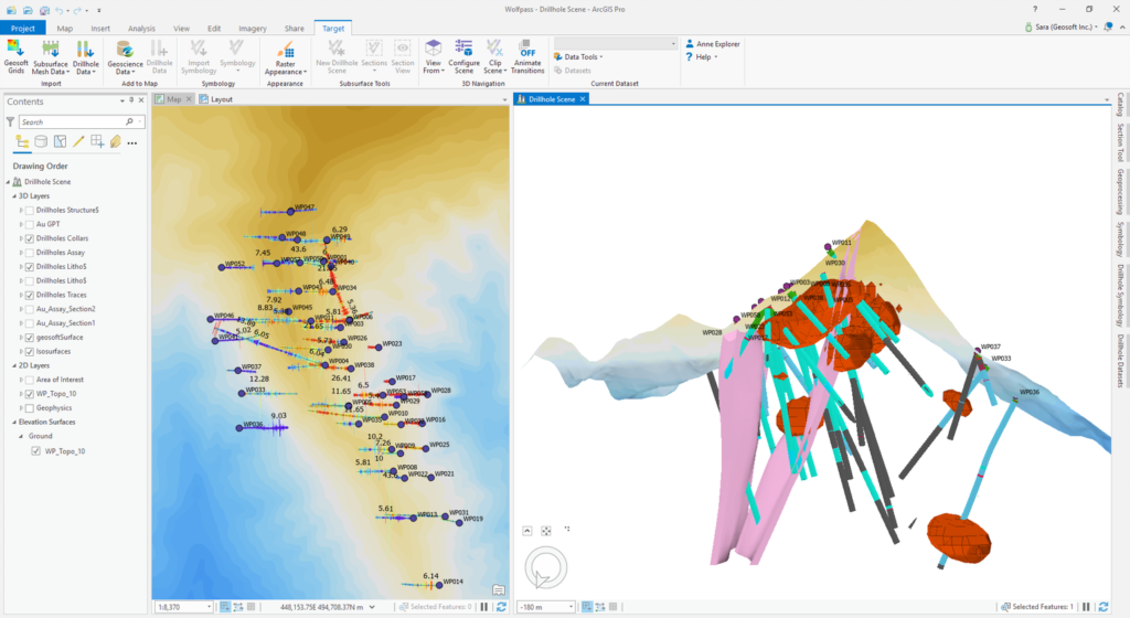
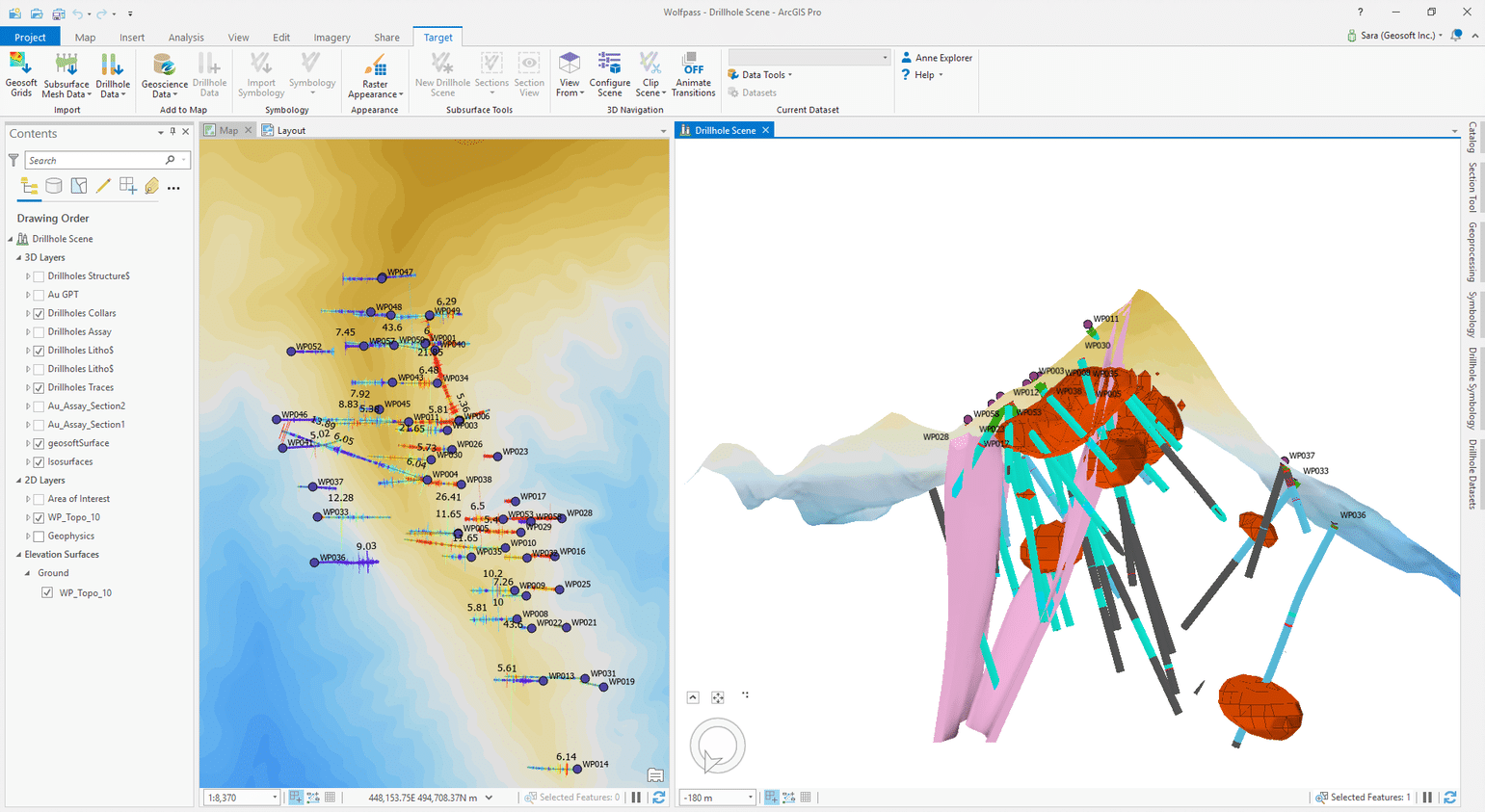
(above): Target for ArcGIS Pro enables users to visualize subsurface drilling data in 2D maps and 3D scenes, and to combine drillhole data with other exploration data such as geological models, block model slices, and surface raster data.