
Dr Jamin Greenbaum and the team are working at the front line of climate change on the coldest continent on Earth. Their research boils down to understanding what is driving Antarctic Ice Sheet melt and how to better predict global sea level rise. And according to their latest numerical model results, warm water flowing under Antarctic glaciers may be contributing to sea level rise faster than previously thought.
Fresh off the icebreaker following his 16th trip to the big fridge since 2007, aerospace engineer turned polar scientist, Dr Jamin Greenbaum, was happy to be back on terra firma, to enjoy a warm day and the prospect of burgers for dinner.
Two months earlier (28 December 2023) Dr Greenbaum departed Lyttelton Port in Christchurch, New Zealand, onboard the RV Araon – an Antarctic research ship owned by the Korea Polar Research Institute (KOPRI).
A geophysicist at the Scripps Institution of Oceanography he and the research team are looking for fresh evidence that meltwater flowing out to sea from Antarctic glacial ice shelves might be contributing to local ocean warming and accelerating ice loss.
The team’s expertise is capturing the ‘missing’ data to provide context to Antarctic subglacial changes observed from space and to more accurately test sea level rise models. And they’re prepared to traverse the frozen continent by aircraft, snowmobile or icebreaker to get it.
“It’s a tough job – both professionally and personally. We have a hectic few months of preparation. Getting there is challenging. The weather is unpredictable, lodgings are tight. I’m away from my family for months over the holiday season and always miss my wife’s birthday. That’s hard!” says Dr Greenbaum.
“But we are highly motivated to collect the data we need to better predict the timing of Antarctica’s contribution to sea level rise over the next few hundred years,” he says.
The team’s vital research is enabled with support from the National Science Foundation in the US, NASA, The Explorers Club through the generosity of Greg and Mary Moga, UC San Diego, and the G Unger Vetlesen Foundation.

Learn more about our academic licensing programme
Learn more
Plumbing the depths of Antarctic coastlines to predict subglacial melt
Antarctica from above is like nowhere else on earth, a wind-ripped white landscape. Intensely blue sky. Turquoise glaciers set against stark bare rock. Equally captivating for Dr Greenbaum and the team, is discovering more about the melting ice hidden deep beneath the continent’s ocean surface.
“Antarctic melt has the potential to raise global sea levels by about 58 metres if the entire ice cap melted into the ocean. The last time global average temperatures were similar to today, Antarctica likely contributed between 3 and 6 metres above present sea level,” says Dr Greenbaum.
To put that in perspective a 1-metre rise would directly impact more than 145 million coastal communities worldwide.
Satellites can detect where ice melt is happening by monitoring grounding lines – locations where a glacier begins to float and form an ‘ice shelf’ instead of resting on the ocean floor. When increasingly frequent intrusions of warming water melt ice along the coast, the grounding line retreats. And when the grounding line retreats, sea level rises.
“Floating ice shelves are exposed to both warming air from above and warming ocean from below, making them doubly susceptible to melting as global temperatures rise. Sea level rise is accelerating, so the problem is getting worse. And while satellites can monitor changes to the ice sheet, they can’t identify the processes driving the changes, you need aircraft or surface camps to do that,” explains Dr Greenbaum.
“Directly observing these environments is tough, expensive, and spatially limited. You can use autonomous underwater vehicles beneath some areas of ice shelves or you can set up hot water drilling camps in others. But these methods still don’t allow full exploration of the environments,” says Dr Greenbaum.
Together with a crew from Canadian Helicopters, the team instead uses the unconventional method of deploying specialist sensors from the air into small gaps in the ice.
“Our missions target areas are close to the grounding line, where fractures allow us to access the ocean if we can break through thin layers of sea ice. These spots are too far for autonomous vehicles to reach from the open ocean and where drilling camps are too risky,” he says.
“Using aircraft enables us to collect critical gravity and magnetic field data to help more accurately infer seafloor depth in these otherwise inaccessible areas.”
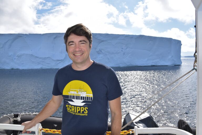
Dr Jamin Greenbaum has spent 16 Antarctic summers surveying ice to improve predictions of subglacial melt on global sea level rise (Image: Greenbaum)
An ice-locked continent swings from natural wonder to global threat
When Antarctica was first discovered over 200 years ago it was considered a natural wonder. Advancements in geophysical technology in the 1950’s and 60’s enabled the detection of huge ice sheets grounded 2.6 km below the sea in West Antarctica.
But it was the 1970’s Marine Ice Sheet Instability hypothesis that first floated the idea: ice sheets grounded below sea level could potentially destabilise in a runaway fashion.
“This was a crucial discovery for scientists. They realised areas in West Antarctica, including Thwaites Glacier, also known as the ‘Doomsday’ Glacier, could retreat unstably and increase global sea level rise,” says Dr Greenbaum.
In the 1990s, warm ocean water discovered near the glacier represented a possible trigger for runaway marine ice melt. However, within the last decade, more recent research shows the ocean on its own may not be warm enough to drive the rates of melt currently being observed.
“Our goal is to help find the missing pieces of this puzzle and try to figure out what processes are happening to explain such rapid ice melt,” says Dr Greenbaum.
The team uses Seequent’s innovative subsurface software to pull together the huge amounts of data captured across multiple geological and geophysical surveys.
“Being able to visualise, analyse and integrate all of our geoscience data with Oasis montaj has been hugely enabling for both our fieldwork and analysis. Combined with topographic maps and satellite images, we can create powerful 3D images that bring critical insights into Antarctica’s hidden ice,” he says.

Dr Jamin Greenbaum talks Seequent CEO, Graham Grant, through some of the ways they use Oasis montaj for their work and research (Image: Seequent)
The value of visualising data to understand unseen ice vulnerability
Oasis montaj is an excellent platform for contextualising and interpreting various data types, such as gravity, magnetics, and radar, as well as for magnetic depth-to-basement inversions.
“Every year we rely on the software to help plan our surveys, create maps for pilots, design flight lines and grids of deployment to maximise our exploration time over the Antarctic summer months,” says Dr Greenbaum.
“We use previously acquired data to refine surveys, repeat lines, or hone in on the best locations to sink our ocean sensors. Sometimes we’re planning on the fly, depending on weather or circumstances beyond our control, so it’s very useful to have such an agile tool on hand.”
“It’s a snappy program too, there’s no lag. And with the latest software release bringing improvements for integrating satellite imagery, I’ve been able to further streamline part of the process.”
Dr Greenbaum and the team understand that to gain a fuller picture of Antarctica’s vulnerabilities to global warming they’ll need to continue to make observations of glacial ice across the different seasons as well.
“But Antarctica’s infrastructure isn’t set up for wintertime science yet. There’s growing pressure from the science community to change that, and advancements in uncrewed aerial vehicles (UAV’s) should open up opportunities outside of summertime too,” he says.
“Our team is ramping up how to make the best use of UAV’s for our research; it’ll be great to use Oasis montaj for planning those flights as well.”
Dr Jamin Greenbaum’s story has also been published in Eco Magazine’s April 2024 edition.